© IE Online Media Services Pvt Ltd

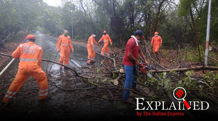 Cyclone Nisarga: Officials clear fallen trees in Alibagh, Raigad district on Wednesday. (Express photo)
As Maharashtra braces itself for the arrival of Cyclone Nisarga, which is expected to make landfall close to Alibagh in Raigad district later today, the office of Chief Minister Uddhav Thackeray has released a list of do’s and don’ts to ensure the safety of citizens. Follow Cyclone Nisarga LIVE Updates
🚨🚨
DO’s & DONT’s to stay safe! #CycloneNisarga pic.twitter.com/bLdEXUaAdb
— CMO Maharashtra (@CMOMaharashtra) June 3, 2020
According to the Indian Meteorological Department’s (IMD) latest bulletin, the cyclone lay 95 km south-southwest of Alibagh, 150 km south-southwest of Mumbai and 380 km south-southwest of Surat (Gujarat). It is expected to make landfall between 1 PM and 4 PM today. Around 15,000 people have been evacuated from Maharashtra’s Raigad district, which is just about 100 km south of Mumbai. The Indian Navy and teams of the National Disaster Response Force (NDRF) are on standby for possible rescue and relief operations.
The list, released by the CMO earlier today, urges residents to stay away from windows, avoid large roof spaces like auditoriums and malls and to keep an emergency kit ready. It also asks citizens to keep off the roads and refrain from spreading rumours. Fishermen have been instructed not to venture out in the sea during the cyclone.
Here is the full list of Do’s
Here is the full list of Don’ts
The National Disaster Response Force (NDRF), Navy, Coast Guard, District Administration and State Disaster Response Force have made pre-emptive deployment in coastal Maharashtra, especially with focus on Raigad district where Cyclone Nisarga expected to make landfall and Mumbai. Here are some of the Do’s and Don’ts as advised by NDRF officials to be followed in areas likely to be hit by the cyclonic storm.
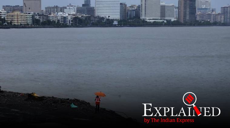 Cyclone Nisarga: Fishermen are advised against venturing into sea. (Express photo by Nirmal Harindran)
Don’ts
# Do not panic
# Do not believe, spread/forward rumours or non-authentic messages
# Do not come out of houses unless extremely necessary.
# If you leave house on foot or on vehicle do not stand near trees, poles, bridges, weak structures
# Fishermen are advised against venturing into sea
Do’s
# If you reside very close to coastline, move to the shelter homes designated by district administration or shift to relative/friends’ house for the time being. Follow social distancing norms in shelter homes.
# If possible, keep all electrical appliances off during the peak storm. Adhere to instructions by local authorities on electrical and gas appliances.
# Follow only the authentic source of information for news, weather updates.
# Keep emergency supply of dry clothes, dry food items ready. Keep important documents in waterproof bags.
# Keep update and adhere to any directions from the local administration.
– Winds raging between 90 – 110 km / hr at the time of landfall.
– Heavy to very heavy rainfall with squally winds at the time of landfall and upto two hours till the storm crosses the locality.
– Extensive damage to thatched roofed houses, homes with tinned roof and asbestos sheets.
– Dislodging of roofs and temporary shelters.
– Leaking roofs, wet walls and breaking of glass panes of windows, leading to splintering of small glass pieces.
– Inundation of low lying areas, parking spaces and fields.
– Storm surge could bring saline water to farms.
– Disruption to power and telecommunications lines due to strong winds.
– Disconnection of satellite TV, internet and cellular phone services.
– Uprooting of trees and felling of weak branches, causing road closures.
– Temporary disruption to rail and air travel.