Stay updated with the latest - Click here to follow us on Instagram
© IE Online Media Services Pvt Ltd

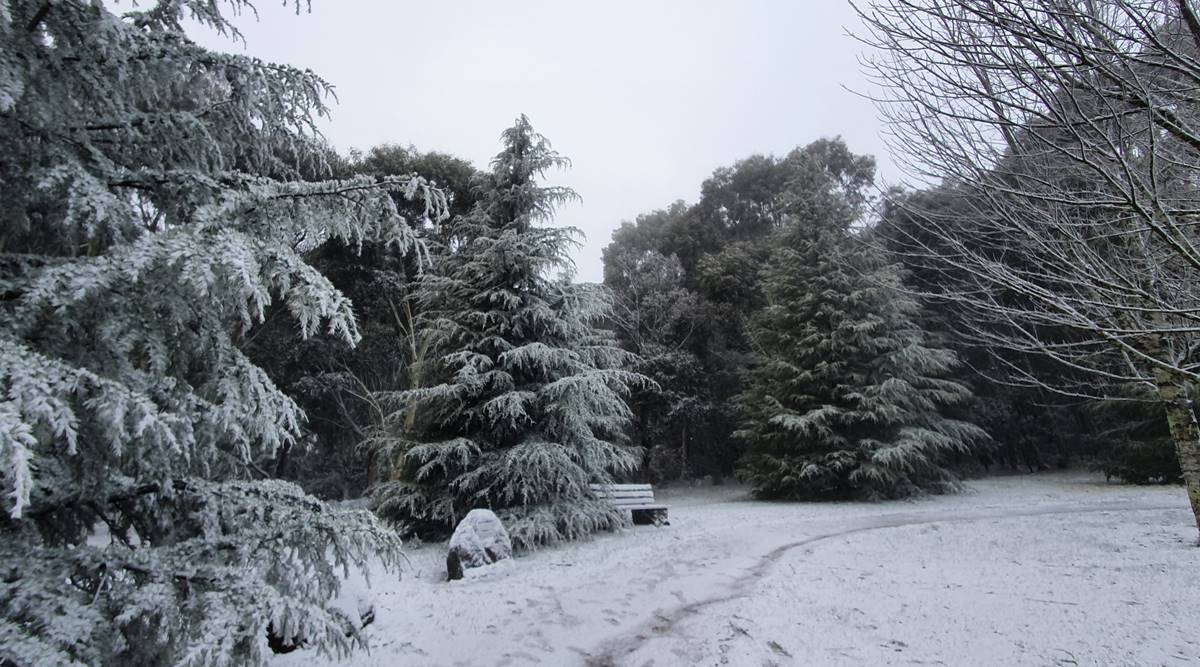 Australia polar blast: "Wintery scenes at Mt Macedon! Snow has fallen to low levels over parts of Victoria this morning," said the Bureau of Meteorology, Victoria. (Source: Bureau of Meteorology, Victoria Twitter)
A freak polar blast from the Antarctic region has sent temperatures plummeting in Australia’s east coast, leaving a blanket of snow over parts of Victoria, New South Wales (NSW), the Australia Capital Territory and Tasmania. According to the country’s Bureau of Meteorology, the early bout of chilly weather is likely to continue for the next few days.
Locals across the east coast flooded social media with pictures and videos of their towns dusted with a fresh layer of snow on Saturday. The sudden snowfall in the east coast has been caused by an ‘Antarctic blob’, a strong and powerful weather system, which has also brought icy winds, thunder and hail to elevated areas in the region.
Does it normally snow in Australia in August? Seems odd… https://t.co/EYHOqYj2kh
— Michael Moran (@TheMichaelMoran) August 22, 2020
Snow in my backyard in a capital city in Australia- and thats the ocean out there. pic.twitter.com/DLiyMhMeX8
— Lou-Smorrels (@LouSmorrels) August 22, 2020
This entire country is a lie #Australia #snow pic.twitter.com/QtgWtXdSQg
— Lauren Southern (@Lauren_Southern) August 22, 2020
In Victoria, the wintry blast caused temperatures to fall overnight to as low as 2 Degree Celsius in the city of Ballarat and 3.8 Degree Celsius in Melbourne, ABC reported. According to the NSW Bureau of Meteorology, Australia’s capital city of Canberra is set to experience its “coldest day” of the year.
#Snow has made for some beautiful scenes at #MtMacedon this morning. ❄️ These wintry conditions are set to hang around for #Vic and #NSW all weekend. Is there more snow on the way for you? You can find out by using https://t.co/CX9zhCmju3. pic.twitter.com/gmuicINPyM
— Bureau of Meteorology, Australia (@BOM_au) August 21, 2020
The blizzard-like conditions prompted local authorities to close several roads across New South Wales’ Central West and Southern Highlands, the Australian Broadcasting Corporation (ABC) reported. Thredbo and Perisher, two villages located in the Alpine region of NSW and frequented by skiers, received up to 1 metre of snow overnight.
<p “width=420″ lang=”en” dir=”ltr”>Wintery scenes at Mt Macedon! #Snow has fallen to low levels over parts of #Victoria this morning, with reports coming in from #FernyCreek, #Trentham & #Beechworth. Cold, windy conditions continue today with showers, small hail and storms forecast. https://t.co/238YsYszNZ pic.twitter.com/f3RKByPCmM— Bureau of Meteorology, Victoria (@BOM_Vic) August 22, 2020
“Depending on where you are this will be coming down on you as #snow #rain or something slushy. Widespread #snow today 10-20cm at #Oberon, same round #Orange & several cm’s at #Lithgow & #Blackheath to name a few. Some places won’t hit double digit temps,” the state’s Bureau of Meteorology tweeted earlier today.
<p “width=420″ lang=”en” dir=”ltr”>A beautiful image captured by @nampix at Clarence in the Blue Mountains this morning as snow settles across the Gospers Fireground.
It’s going to be a cold and windy day so rug up and ensure that you keep anything flammable at least a metre from the heater. #nswrfs #winter #snow pic.twitter.com/2SOtgusQLx— NSW RFS (@NSWRFS) August 21, 2020
Sydney, the capital of New South Wales, is expected to see colder nights in the next few days, the Met department has predicted.
Stay updated with the latest - Click here to follow us on Instagram