© The Indian Express Pvt Ltd

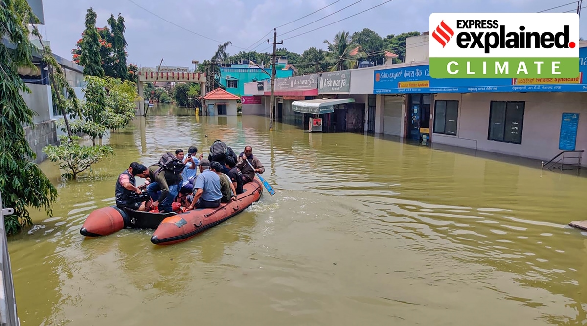 Kerala, Karnataka Rainfall: Residents use a boat to travel at the flooded Rainbow Drive locality in Bengaluru amid heavy rainfall on Tuesday. (PTI)
Kerala, Karnataka Rainfall, IMD Weather Report: Three months of the four-month-long Southwest monsoon season are over, but Kerala’s seasonal rainfall only reached the ‘normal’ mark in recent days. In contrast, Bengaluru and southern Karnataka districts have witnessed a wet season since June. Despite the large variations in the quantum of rainfall, Kerala and Karnataka have both been hit by landslides and inundated roads, with the Bengaluru-Mysuru highway submerged.
Southern Karnataka and parts of Kerala have witnessed torrential rains since the last weekend. Continuous rainfall activity has been reported particularly over Ernakulam, Bengaluru, and districts along northern Kerala — leaving roads and low-lying areas inundated, and a flood-like situation forcing closures of schools in some of these areas.
Some stations in Thrissur, Palakkad, Kasargod and Ernakulam districts in Kerala reported moderate rainfall amounting to not more than 100 mm in the 24 hours ending Wednesday evening (August 31). It is only last week that Kerala’s seasonal rainfall, 1,512 mm (-15 per cent but considered normal) as on Wednesday, crossed the ‘normal’ mark.
In recent years, Karnataka has been receiving continuous rainfall leading to destruction. This year, Karnataka has recorded 894.7 mm or 33 per cent rainfall surplus. On Tuesday, Bengaluru recorded 93.7 mm in 24 hours, marking the second wettest August day in a decade.
Districts along south-interior Karnataka have received rainfall surplus going as high as 296 mm at Mandya. Except three districts in this region, 13 have recorded significant rainfall surplus since June. These include: Chamarajanagar (179 mm), Tumkuru (176 mm), Kolar (161 mm), Chitradurga (145 mm), Bengaluru urban (142 mm), Ramanagara (140 mm), Bengaluru rural (125 mm), Chikballapura (119 mm), Davangere (94 mm) and Hassan (77 mm).
Overall, moderate to heavy rainfall was recorded at Kodaikanal DRMS (230 mm), Ernakulam south (170 mm), Neryamangalam (82.5 mm), Athirapally (72.5 mm), Dharmasthala and Kannur (70 mm), Udumbannoor (69 mm), Kadlu (67.5 mm), Aralam (66.5 mm), Vadavathoor (63.5 mm), Bableshwar (60 mm) and Kollengode (49 mm) on Wednesday.
In the absence of any synoptic systems, that is, low pressure systems or monsoon depression over the country, Kerala, Karnataka, Tamil Nadu, Nagaland, Manipur, Mizoram, Tripura, Jammu and Kashmir, and Himachal Pradesh have reported widespread rainfall this week.
At present, the monsoon currents are weak as the monsoon is in its break phase. But the India Meteorological Department (IMD) said that the monsoon was vigorous over Kerala and active over Karnataka on Wednesday. The position of monsoon trough — a major contributory factor for the rainfall — is favouring rainfall over these states.
Once the monsoon system gets established over the country by mid-July, the monsoon trough oscillates by 5 degrees, either to the north or south of its normal position. This oscillation is normally observed during July and August, the peak monsoon months over India. If this trough is located to the south of its normal position, strong monsoon conditions are observed over India. Central and northern areas of the peninsular India benefit in such an instance. When this trough shifts either to north of its normal position, runs to foothills of Himalayas or remains absent, then break-monsoon conditions are declared. During the break phase, rainfall is largely confined to the south peninsula, and east, northeast and north India — that is the ongoing spell. The monsoon season thus comprises such wet and dry periods due to the active and break phases.
Besides the trough, there is a cyclonic circulation over south Tamil Nadu, from which runs a trough till southern Madhya Pradesh.
What is the forecast?
Latest satellite images on Wednesday depicted significant cloud cover over Kerala, Tamil Nadu, Karnataka, Telangana, Uttar Pradesh, Gangetic West Bengal and Bihar.
The IMD has issued an ‘orange’ alert for Kerala and Tamil Nadu on Thursday and a ‘yellow’ alert till September 4. Heavy to very heavy (64.5 mm to 204 mm in 24 hours) will occur over Kerala, Mahe, Tamil Nadu, Karaikal, Puducherry, Madhya Pradesh, Bihar, Arunachal Pradesh, Assam, Meghalaya, Nagaland, Manipur, Mizoram, Tripura, Goa, coastal and north interior Karnataka and Lakshadweep till Sunday. Squally winds are likely off Kerala coast during the next two days.
On Monday (September 5), heavy rainfall (64.5 mm to 115.4 mm in 24 hours) and associated ‘yellow’ alert will prevail over Jammu and Kashmir, Gilgit, Baltistan, Ladakh, Muzaffarabad, Himachal Pradesh, Uttarakhand, Gangetic West Bengal.