Stay updated with the latest - Click here to follow us on Instagram
Journalism of Courage

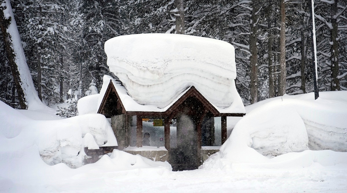 A person sits in a snow-covered bus stop Friday, Feb. 24, 2023, in Olympic Valley, California. (AP)
 Written by Eduardo Medina, Judson Jones and Vik Jolly
A powerful winter storm lashed through Southern California on Friday, blasting the mountains around Los Angeles with high winds and heavy snow, drenching the coasts with heavy rain, shutting down miles of major highways and even dusting the Hollywood Hills for the first time in decades.
In the higher elevations, forecasters said, the storm was a true blizzard, with warnings in place until late Saturday afternoon.
The storm on Thursday walloped Portland, Oregon, with snow and low temperatures that contributed to the death of a child after an ambulance was delayed in its response to a medical call because of ice on the roads, officials said.
In Southern California on Friday afternoon, the storm was raising concerns among meteorologists and officials as they assessed multiple threats that would last through the weekend: several feet of snow in the mountains, where roads are heavily travelled; pounding rain in lower elevations that could flood roadways; and thunderstorms that could produce hail and tornadoes.
“It’s a rare storm considering how cold it is — and how wet it is,” Ryan Kittell, a meteorologist with the National Weather Service in Los Angeles, said Friday. “The biggest thing is a lot of road closures.”
CALIFORNIA SNOW: Here’s our winter wonderland of a view driving up Highway 9 in Saratoga heading towards Big Basin (before we got stuck behind a pick-up truck that spun out/couldn’t make it up the hill). @abc7newsbayarea pic.twitter.com/INsFnqSTyE
— Lena Howland (@LenaHowland) February 23, 2023
While the rarity of the snowstorm prompted some anticipation among Californians unaccustomed to a phrase like “blizzard conditions,” there was still an entire weekend of dangers to look out for, including blizzard warnings for the mountains of Los Angeles, Ventura, Santa Barbara and San Bernardino counties through Saturday afternoon.
Mark Pestrella, the director of the Department of Public Works for Los Angeles County, said that beginning Friday afternoon, residents should avoid travel, especially in parts that will be pounded by the blizzard, a wintertime weather event in which winds exceed 35 mph, considerable snowfall occurs and visibility is drastically reduced.
On Friday, the blizzard conditions were brewing in elevations 4,500 feet above sea level, with strong winds intensifying up to 80 mph, reducing visibility and creating “treacherous” whiteout conditions, said Eric Boldt, a weather service meteorologist in Oxnard, California.
Up to 5 inches of rain were expected to fall along the coasts and valleys, and the heaviest snow, up to 7 feet, was forecast to accumulate in areas of high elevation. Areas between 2,500 and 4,500 feet were expected to receive up to a foot of snow, and wind gusts of 80 mph were expected.
Here’s a look at probabilities across much of northern California. Snow probabilities > 1 in and > 4 in extend all the way through the Coastal Range into the Yolo County hills with some probabilities over the hills of San Joaquin & Stanislaus Counties, as well. #CAwx pic.twitter.com/Jc5IsY80bE
— NWS Sacramento (@NWSSacramento) February 22, 2023
By late Friday afternoon, fewer than 100,000 customers in California, mostly in the northern part of the state, were without power, according to PowerOutage.us. Millions of people in the West, mainly in California and Nevada, were under winter weather alerts. Officials in Ventura County issued evacuation warnings for some inland communities, including around Ojai, through Saturday morning because of “anticipated flooding and debris flows.”
As some Californians marvelled at the unlikely white landscape, many were trying to put a name to what they were seeing: Was it rain, snow, sleet, hail or graupel? The weather service offered a vocabulary lesson for wintry mix beginners. Hail, or frozen precipitation of ice from thunderstorms, is hard and solid; graupel, or snowflakes that collect supercooled water droplets, is soft and wet.
The storm snarled major transportation arteries, causing road closures, high wind warnings and advisories for drivers to use chains on their tires Friday.
Parts of Interstate 5, a major north-south route that runs from the border with Mexico to Canada, were shut down in areas in Siskiyou and Shasta counties in the northern part of the state. The Grapevine, a 40-mile stretch of I-5 from northern Los Angeles County to Kern County, was shut down Friday morning, and authorities said there was no estimated time for when it might reopen.
 The Hollywood sign is seen through a mix of fog and dust snow during a rare cold winter storm in the Los Angeles area, in Los Angeles, California, US, February 24, 2023. (Reuters)
“This is the coldest I’ve seen in a while,” said Joe Merriam, who has lived in Corona, about 50 miles southeast of Los Angeles, for 30 years. “This is very unusual — very crazy.”
On Thursday, the storm paralyzed parts of Oregon, trapping motorists for hours while others abandoned their vehicles on the side of the road. Travel disruptions persisted into Friday, with the Oregon Department of Transportation announcing closures along at least three highways.
Rick Graves, a spokesperson for the Portland Fire Department, confirmed that a baby younger than 1 in Portland died at a hospital after firefighters responded to a medical call of a child not breathing just after 6 a.m. Thursday. The ambulance had been delayed, in part, because of poor conditions on the roads that were covered in 2 inches of “bulletproof ice,” Graves said.
The West Coast can be one of the hardest places in the country to predict weather because of the lack of observations over the Pacific Ocean, and the intensity of the storm caught many people — including forecasters — by surprise.
A person standing in downtown Los Angeles can see a 10,600-foot peak that will typically have snow on it, but by Saturday, that snow will extend much farther down the mountain, underscoring the strength of the storm, said Andrew Rorke, a forecaster for the weather service in Los Angeles.
Although the Hollywood sign was not likely to be lost in a snow-covered hillside, snow or graupel was seen falling Thursday morning near the sign, the weather service office in Los Angeles confirmed. A brief flurry was again spotted there Friday, the weather service said.
There is also a high risk for avalanches across the Sierra Nevada on Friday into Saturday morning, according to the Avalanche Forecast Center.
This will not be the last winter storm to hit the area. Forecasters from all weather service offices in California are predicting another storm at the beginning of next week.
Stay updated with the latest - Click here to follow us on Instagram