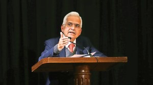
Journalism of Courage


Forecast valid until the morning of Sept 1st. Rain/thundershowers at:
East: Many places in Arunachal Pradesh, Assam, Meghalaya, Nagaland, Manipur, Mizoram, Tripura, Sub-Himalayan West Bengal, Sikkim, Gangetic West Bengal, Orissa, Jharkhand and Bihar.
North: Many places in Himachal Pradesh; a few places in Uttar Pradesh, Uttarkhand, Jammu and Kashmir and isolated places in Haryana, Punjab and Rajasthan.
Central: Many places in Vidarbha, south Chattisgarh; a few plaes in north Chattisgarh and isolated places in Madhya Pradesh.
Peninsula: Many places in north coastal Andhra Pradesh, Telangana, south Tamil Nadu, coastal and south interior Karnataka, Kerala; a few places in Konkan, Goa, Madhya Maharashtra, Marathwada, south coastal Andhra Pradesh, Rayalaseema, north Tamil Nadu, north interior Karnataka and isolated places in Gujarat state.
Islands: Many places in Andaman and Nicobar and Lakshadweep.
Temperatures recorded in four metropolitan centres were:
Kolkata max 32 n d c/ min 24 -2 d c
New Delhi max 36 2 d c/ min 27 2 d c
Chennai max 34 n d c/ min 26 n d c
Mumbai max 31 1 d c/ min 25 n d c.
The axis of the monsoon trough at sea level runs close to the foothills of the Himalayas. The cyclonic circulation over Punjab and neighbourhood persists and now extends upto 1.5 kms a.s.l.
The western disturbance as an upper air system extending upto 3.6 kms a.s.l. over north Pakistan and neighbourhood persists. The above two systems are likely to move east northeastwards. The cyclonic circulation extending upto 3.1 kms a.s.l. over south Tamil Nadu and neighbourhood has become less marked.
Total rainfall during the past 24 hours at 162 available stations in the plains, out of 291 stations, is 91 cms. Normal for the above 162 stations is 130 cms.
The southwest monsoon has been active in Assam, Meghalaya, Gangetic West Bengal and Telangana. It has been subdued in west Uttar Pradesh, Uttarkhand, Haryana, Punjab, Rajasthan, west Madhya Pradesh, Gujarat state, Konkan and Goa, Madhya Maharashtra and Rayalaseema.