
 The depression in the Arabian Sea is likely to intensify into a severe cyclone and cross the north Maharashtra and south Gujarat coasts on June 3, and will have an impact on Mumbai.
Cyclone Nisarga Tracker, Weather forecast Today highlights: Barely a fortnight since super cyclone Amphan, one of the strongest cyclones that the country has seen, hit West Bengal, Odisha and Bangladesh, a cyclonic storm has been forming in the Arabian Sea over the past 24 hours. The India Meteorological Department (IMD) officials Monday said that the low-pressure area over Southeast and adjoining East-central Arabian Sea and Lakshwadeep area has concentrated into a deep depression today and lay centred about 370 km southwest of Panjim in Goa, and 690 km south-southwest of Mumbai. The cyclonic storm, Nisarga, is likely to be formed within the next 24 hours and has a possibility of landfall on India’s western coast on June 3rd.
Follow Weather Forecast Today (June 2), Cyclone Nisarga Tracker Live News Updates
The southwest monsoon has made a timely onset over Kerala, marking the commencement of the four-month long rainfall season, the IMD said on Monday. North India is likely to get “above normal” rainfall, while Central India and the southern peninsula will receive “normal” rainfall, the IMD said.
However, east and northeast India are likely to receive less rainfall than other parts of the country “The southwest monsoon has made an onset over Kerala,” IMD director general Mrutyunjay Mohapatra said. The four-month monsoon season from June to September accounts for 75 per cent of rainfall in the country.
The depression in the Arabian Sea is likely to intensify into a severe cyclone and cross the north Maharashtra and south Gujarat coasts on June 3, and will have an impact on Mumbai, the India Meteorological Department said on Monday. It is very likely to intensify into a Deep Depression over Eastcentral and adjoining Southeast Arabian Sea during next 06 hours and intensify further into a Cyclonic Storm over Eastcentral Arabian Sea during the subsequent 24 hours. It is very likely to move nearly northwards initially till June 2 and then recurve north northeastwards and cross north Maharashtra and south Gujarat coasts between Harihareshwar (Raigad, Maharashtra) and Daman during the afternoon of 3rd June.
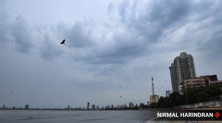
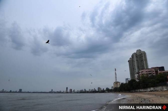 Pre-Monsoon drizzle in Mumbai. (Express photo by Nirmal Harindran)
In the wake of ‘Nisarga’ cyclone building over east-central and adjoining southeast Arabian sea, seven districts of Surat, Navsari, Valsad, Dang and Bharuch in south Gujarat, Bhavnagar and Amreli in Saurashtra in addition to Union territory of Daman have been put on high alert.
National Disaster Response Force (NDRF) has deployed 11 teams in Gujarat and one each in Daman and Diu and Dadra and Nagar Haveli along with five teams of State Disaster Response Force (SDRF). More teams that have been put on stand by in nearby areas. All the beaches have been closed to public and fishermen have been asked not to venture out into the sea.
Union Minister of Home Affairs Amit Shah assured all assistance to Gujarat over a video conference with Chief Minister Vijay Rupani on Monday. Read more here
Barely a fortnight since super cyclone Amphan, one of the strongest cyclones that the country has seen, hit West Bengal, Odisha and Bangladesh, a cyclonic storm — Nisarga — has been forming in the Arabian Sea over the past 24 hours. Indian Meteorological Department (IMD) officials Monday said the low pressure area over Southeast and adjoining East-central Arabian Sea and Lakshwadeep area has concentrated into a deep depression today and lay centred about 370 km southwest of Panjim in Goa, and 690 km south-southwest of Mumbai.
The cyclonic storm, Nisarga, is likely to be formed within the next 24 hours and has a possibility of landfall on India’s western coast on June 3.
“We are keeping a constant watch on the developing storm and will have more specific details tomorrow. We will know tomorrow where the landfall will be. But as far as we can see now, the intensity of the storm will be felt in Mumbai, Thane, Raigad, Palghar, Daman, Dadar Nagar Haveli, Valsad, Navsari, Ratnagiri and Sindhudurg areas with high windspeeds and heavy rainfall,’’ said DG, IMD, Dr M Mohapatra. Read more
As a cyclonic situation develops on the Arabian Sea, a total of nine teams of the National Disaster Response Force (NDRF) have been deployed in coastal areas of Maharashtra, including three in Mumbai. These teams are from the Pune-based 5th Battalion of NDRF. While three were already deployed in Mumbai, six more have been deployed in other coastal areas on Monday morning.
Among the six deployed on Monday, two are in Palghar district and one each in Thane, Ratnagiri, Raigad and Singhudurg districts. This deployment is being done as per the requisition of the Relief and Rehabilitation department of Maharashtra government. Each team of the NDRF comprises specialist search and rescue groups, with engineering, technical and electrical experts, along with paramedics.
A vast swathe of the country experienced below-normal temperatures on Monday as many areas received rainfall due to a cyclonic activity in the Arabian Sea and the beginning of monsoon. The southwest monsoon hit Kerala on Monday on its normal onset date, marking the commencement of the four-month-long rainfall season. Scattered rains continued in northern states such as Punjab, Haryana, Uttar Pradesh and the desert state of Rajasthan due to a western disturbance which kept the heat wave at bay.
"No heat waves are likely over the country during next 5 days, the India Meteorological Department said in a bulletin.
The national capital witnessed a partly cloudy sky and the maximum temperature settled at 35.4 degrees Celsius. Wardha (Vidarbha) recorded the highest temperature in the country at 43.4 degrees Celsius, more than a notch down since Sunday when Khargone in Madhya Pradesh recorded 44.5 degrees Celsius.
The cyclone is likely to bring heavy rainfall in its wake in parts of Maharashtra, Gujarat and Goa. The light showers/drizzle in parts of Mumbai city, its suburbs and neighbouring districts of Thane and Palghar on Monday morning brought some respite to people from the sweltering heat and humidity.
Union Home Minister Amit Shah on Monday took stock of the preparation for an impending cyclone that is likely to hit Maharashtra and Gujarat on Wednesday. The Home Ministry has deployed 23 teams of the National Disaster Response Force (NDRF) in Maharashtra, Gujarat, Daman and Diu, and Dadra and Nagar Haveli, officials said.
"Union Home Minister @AmitShah held review meeting with senior officials of NDMA, NDRF, IMD & Indian Coast Guard on preparedness for dealing with Cyclone brewing in Arabian sea which is expected to hit some parts of Maharashtra & Gujarat. MoS @nityanandraibjp was also present," Shah's office tweeted.
After rains lashed many parts of Haryana and Punjab during the past two-three days, maximum temperatures in the two states continued to hover below the normal on Monday. Chandigarh, the common capital of the two states, recorded a maximum temperature of 33.8 degrees Celsius, six notches below the normal, according to the Meteorological Department here. In Haryana, Ambala's maximum temperature settled at 32.9 degrees Celsius, seven notches below the normal, while Karnal recorded a high of 32 degrees Celsius, eight notches below the normal. Hisar's maximum temperature settled at 34.5 degrees Celsius, eight notches below the normal, while Narnaul registered a high of 35.5 degrees Celsius. Ludhiana in Punjab recorded a high of 32.9 degrees Celsius, seven notches below normal limits.
With the Southwest monsoon setting in over Kerala on Monday, several parts of the state received heavy to very heavy rains, especially Vatakarain Kozhikode, which received 15 cm of rain, following which a red alert was sounded for two days in the district. The red alert denotes likelihood of very heavy to extremely heavy rain. The monsoon has been active over Kerala with heavy to very heavy rain occurring at most places and the Union
Territory of Lakshadweep, an India MeteorologicalDepartment (IMD) bulletin said.
While Vatakara received heavy rain, Quilandy, also in the district, received nine cm of rain. Yellow alert (possibility of isolated heavy rainfall) has been issued for Monday in 10districts and for seven districts on Tuesday, the bulletin said. --PTI
Releasing the second long-range forecast for monsoon 2020, Secretary Ministry of Earth Sciences Dr.Madhavan Nair Rajeevan today announced that the monsoons have kept it’s date with Kerala, having arrived in the state today. While the IMD had forecast a June 1 arrival of the monsoons in it’s first long range forecast in April, officials had indicated that there may have been a slight four-day delay with super cyclone Amphan in Eastern India. Dr.Rajeevan further confirmed that the country will have a ``good and normal’’ monsoon this year.
``There is good news, and that is that we will have a good monsoon. The Long Period Average this year is 102 per cent across the entire country, for the period of June to September. This is two per cent more than what we expected, in April we had predicted 100 per cent LPA,’’said Dr.Rajeevan. The LPA is the average of the total rainfall received by the country during the southwest monsoons over a 50 year period. The LPA for the country from 1961-2020 is 88 cm and anything between 96 per cent to 104 per cent LPA is considered a good monsoon.
Dr.Rajeevan further added that the IMD expects a ``good spatial distribution’’ of the rainfall across the country. The North West region in India is expected to receive 107 per cent LPA, the central region 103 per cent LPA, the Southern Peninsula 102 per cent LPA and the North Eastern region (which also includes states like West Bengal and Jharkhand) will receive slightly less rainfall than the rest of the country of 96 per cent LPA.
``In July, which is a crucial month for farmers, we expect an LPA of 103 per cent across the country, which dips slightly to 97 per cent in August, which is a little less than normal. According to our data we have a high probability of a normal monsoon at 41 per cent, while the chances of a deficient monsoon are low at 5 per cent. Our data shows that this will be a good monsoon year for us. The chances of an above normal monsoon are 25 per cent and excess rainfall monsoon is 14 per cent,’’he added. ``Many atmospheric variables over the region indicate ENSO Neutral to cool ENSO neutral conditions over the region. The latest forecasts from MMCFS and other global models, as well as our own, together indicate cool ENSO neutral conditions are likely to prevail during most part of the monsoon season. However, a few other climate models indicate possibility of development of weak La Niña conditions in the later part of the season or thereafter. These also create favourable conditions for a good monsoon,’’said DG IMD Dr.M.Mohapatra.
In anticipation of a cyclonic storm making landfall on the Gujarat coast on June 3, the state government on Monday ordered the evacuation of people living in low-lying areas and deployed 10 teams of the National Disaster Response Force (NDRF) in over half a dozen districts. The India Meteorological Department (IMD) on Monday said the low-pressure area formed over the Arabian Sea has intensified into a depression and it will further intensify into a cyclonic storm in the next 36 hours.
Considering the developing cyclonic situation in Arabian Sea a total of nine teams of the National Disaster Response Force (NDRF) have been deployed in coastal areas on Maharashtra including three in Mumbai. These teams are from the Pune based 5th Battalion of NDRF. While three were already deployed in Mumbai, six more deployed in other coastal areas on Monday morning.
Among the six deployed on Monday, two are in Palghar district and one each in Thane, Ratnagiri, Raigad and Singhudurg districts of Maharashtra. This deployment is being done as per the requisition of the Relief and Rehabilitation department of Government of Maharashtra. Each team of the NDRF comprises of specialist search and rescue groups comprising of engineering, technical, electrical experts along with paramedics.
The NDRF is also in close contact with the R&R department of Maharashtra government, IMD and District administration. NDRF teams are also carrying out surveys in coastal areas of these districts along with local authorities.
1. 3 teams in Mumbai
2. 2 teams in Palghar
3. 1 team in Thane
4. 1 team in Raigad
5. 1 team in Ratnagiri
6. 1 team in Sindhudurg
The Kerala government is gearing up its machinery to tackle monsoon-related diseases with a revised fever protocol even while as it battles the COVID-19 pandemic. The onset of monsoon over Kerala marks the commencement of the four-month rainy season in the country. The country receives 75 per cent of the rainfall from June to September.
As per the latest medical report issued by the Directorate of Health Services (DHS) on its website on Sunday, at least 2,660 fever cases were reported in the state on May 30 and 65,039 fever cases in the month of May alone. The state government anticipates a rise in fever cases in the monsoon season.
Mumbaikars and people in neighbouring areas woke up to cloudy weather and light rain on Monday morning following the formation of a low-pressure area in the Arabian Sea. The depression in the Arabian Sea is likely to intensify into a severe cyclone and cross north Maharashtra and south Gujarat coasts on June 3, the India Meteorological Department (IMD) has said.
The depression over Eastcentral and adjoining Southeast Arabian Sea moved north northwestwards with a speed of 13 kmph during past 06 hours and lay centred at 1130 hours IST of today the 1st June, 2020 near latitude 13.7°N and longitude 71.2°E about 340 km southwest of Panjim (Goa), 630km south-southwest of Mumbai (Maharashtra) and 850 km south-southwest of Surat (Gujarat).
It is very likely to intensify into a Deep Depression over Eastcentral and adjoining Southeast Arabian Sea during next 06 hours and intensify further into a Cyclonic Storm over Eastcentral Arabian Sea during the subsequent 24 hours. It is very likely to move nearly northwards initially till 02nd June Morning and then recurve north northeastwards and cross north Maharashtra and south Gujarat coasts between Harihareshwar (Raigad, Maharashtra) and Daman during the afternoon of 3rd June.
Over 40 per cent probability of normal monsoon, only five per cent probability of deficient rainfall, said India Meteorological Department (IMD).
The sea condition is very likely to vary between rough and very rough over Eastcentral and adjoining Southeast Arabian Sea over the next 48 hours. It is likely to become very rough to high over EastCentral and SouthEast Arabian Sea and along and off Karnataka-Goa coasts during the next 48 hours. Fishermen are advised not to venture into southeast Arabian Sea, Lakshadweep area and along and off Kerala coast during the next 48 hours, eastcentral Arabian Sea and along and off Karnataka-Goa coasts till June 3 and eastcentral Arabian Sea along and off Maharashtra coast and northeast Arabian Sea along and off Gujarat coast from June 3 to 4.
The Southwest monsoon has hit Kerala on Monday morning, making it a timely onset over the southern State for the first time since 2013. The country receives over 70 per cent of its annual rainfall from this season between June and September. This year, the IMD has forecast a normal monsoon for the country.
Kerala, especially the southern-most districts, has been reporting continuous rainfall over the last three days, mainly associated with the depression that has formed over the southeast Arabian Sea, off Kerala coast.
With the arrival of southwest monsoon in Kerela today, the IMD said that the four-month long monsoon season from June to September accounts for 75 per cent of the rain in the country.
IMD monday said Southwest monsoon has set in over Kerala.
Due to the formation of a low pressure area in the Arabian Sea, Mumbai and some neighbouring areas experienced light rain/thunderstorm on Monday morning, PTI reported. Some parts of Maharashtra experienced rain along with thunderstorm and gusty winds on Sunday.
Around 43 people have lost their lives in rain-related incidents in Uttar Pradesh on May 30, the state government said on Sunday, PTI reported. Chief Minister Yogi Adityanath expressed grief and directed officials to provide Rs 4 lakh immediately to the families of the deceased.
Konkan-Goa, Mumbai, and parts of South Gujarat will experience heavy to very heavy rainfall over the next three days, the Indian Meteorological Department (IMD) said in its morning briefing today. This will be under the influence of a depression, that currently lay 370kms south of Panjim, 690kms south-southwest of Mumbai and 920kms south of Gujarat coast.
“The well-marked low-pressure system intensified into a depression and will further intensify into a cyclonic storm during the upcoming 24 hours,” read the bulletin issued on Monday morning. The cyclone, which is headed towards north Maharashtra and adjoining south Gujarat coast, is likely to hit land by June 3.
Welcome to The Indian Express live blog. Follow this space to get the latest weather updates.