Journalism of Courage

 Kavalappara landslide: Portions of this mighty hill came down crushing several homes. (Express Photo: Vishnu Varma)
The landslide at Kavalappara occurred a couple of hours after another in Puthumala in neighbouring Wayanad district. The two landslide sites are on either side of a section of the ecologically sensitive Western Ghats, close to Tamil Nadu’s Nilgiri district. Water coming down the hills at Puthumala becomes the Chulika stream, which meanders through gorges and valleys to emerge as the bigger Chaliyar river, which flows by Kavalappara. On August 8-9, the Chaliyar inundated several towns along its banks.
Mud, rocks, trees
The top of the hill remains inaccessible, so the height of the landslide’s crown is yet to be ascertained. A mass of mud, gravel, and boulders came sweeping down, uprooting hundreds of trees along the way.
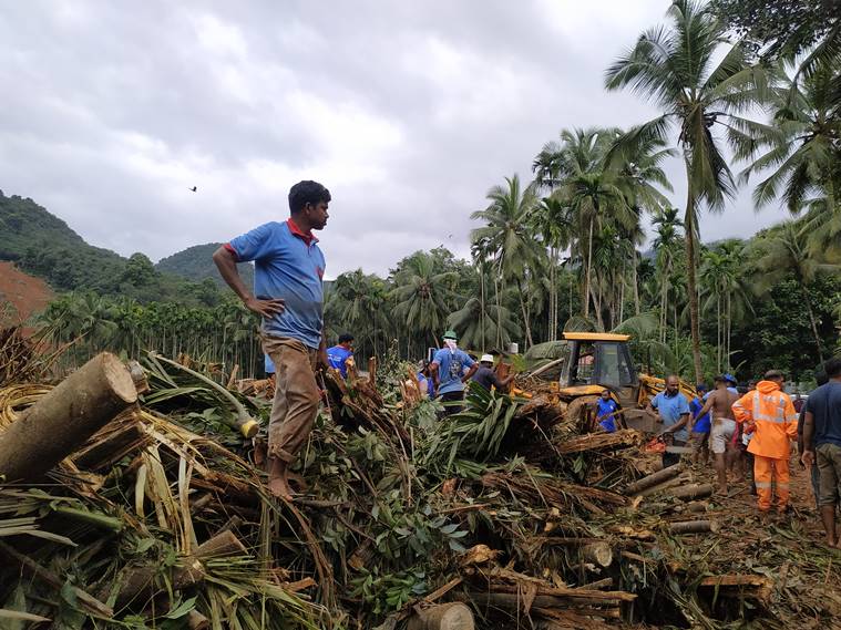 Kavalappara landslide: Local men engaged in rescue operations. (Express Photo: Vishnu Varma)
Around 7.30 pm on August 8, in pounding rain, villagers heard a deafening roar as an entire hillside at Kavalappara in Pothukal village panchayat near Bhoodanam in Kerala’s Malappuram district crumbled.
Buried 50 feet under
The hill settled on a 10-acre are coconut plantation at its base, entirely burying a few dozen homes. There is no estimate of the volume of mud that came down, but state Minister K T Jaleel has said bodies could be buried 50 feet deep.
Also read | Only house standing, but resident not sure if it’s a good thing to be alive
 Kerala weather, Kavalappara landslide: Thankamani, who miraculously survived the landslide, with her goat. While her home was spared, many houses lie in rubble now. (Express Photo: Vishnu Varma)
Raining death
Malappuram meteorological subdivision got 189.4 mm rain from August 1 to August 7, 66% more than the normal 114.3 mm. On August 8, the Nilambur rain gauge station, the one nearest to Kavalappara, recorded the highest rainfall of that day in Kerala.
Hours earlier
17 people from 7 families died after a landslide washed away 10 acres of land in a private tea estate in Puthumala in Meppadi village panchayat of Wayanad district. 53 houses, a mosque, a temple, a shop and two estate-quarters vanished under mud and rocks. The crown of the landslide was 800 ft high. Wayanad meteorological subdivision got 252.3 mm rain from August 1-7 — the most in Kerala during this period, and a 37% departure from the 184.5 mm normal.
 Kavalappara landslide: At least 59 people from 43 families are feared dead in the Kerala tragedy. (Source: IAF)
Don’t miss from Explained | Reservoir levels: West well stocked with water, South is short