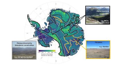
A new method using high-resolution satellite observations has allowed scientists to create a detailed map of Antarctica's subglacial terrain, uncovering over 30,000 uncharted hills and a diverse landscape. This could aid in predicting the retreat of the Antarctic ice sheet and inform climate policies, but further field surveys are needed.