© The Indian Express Pvt Ltd

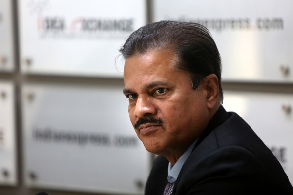
 IMD Director General Mrutyunjay Mohapatra was in conversation with Amitabh Sinha, Resident Editor, Pune (Express Photo by Gajendra Yadav)
 Amitabh Sinha: Every season we hear about this or that record getting broken. Was there anything unusual about this winter?
Every season is marked with some unique behaviour. This particular season was marked with one too. This December was the warmest December on record. There were hardly any cold-wave conditions up to the third week of December. Only in the last week of the month, we got a cold spell. So, if you compare the number of days, it was not quite high. If you compare the intensity also, it wasn’t that much. But after that in January, we had a cold spell in the first week. We should normally get two to three spells of colder conditions. But so far we’ve got only one major spell.
The warmer December is in agreement with our previous findings that under the impact of climate change, the temperature during winter months are increasing. There hasn’t been much change in the minimum temperatures, but maximum temperatures have been showing a significant rise.
 IMD Director General Mrutyunjay Mohapatra
Amitabh Sinha: Globally, the average rise in temperatures from pre-industrial times has already touched 1.2 degree Celsius. Is the warming over India of the same intensity? Or is it more moderate?
You are right. The temperature rise because of climate change is higher in the polar regions and the extra tropical regions. In tropical areas, it is relatively less. In India, average rise in temperatures have been about 0.64 degree Celsius from about 100 years ago, whereas globally it is 1.2 degree Celsius. So, in that sense, global warming over India is not that big.
The rise in average maximum temperatures over India is about one degree Celsius, while minimum temperatures have risen by about 0.26 degree Celsius. So on an average, the temperature rise has been about 0.64 degree Celsius.
Esha Roy: What are we likely to see in 2023? Is this year likely to be warmer?
There is no projection for how warm 2023 is likely to be. We provide only over the seasonal scale. But, maybe, I can give you a qualitative assessment. Last year was a La Nina year. Under La Nina conditions, there is generally a dip in temperatures. But in spite of La Nina, 2022 was one of the warmest years globally, and in India also, average temperatures were about 0.5 degree Celsius higher than normal. Now, the current La Nina conditions have already extended to about three years. It is unlikely to continue further this year. Most of the models are suggesting the possibility of El Nino this year, or at least neutral conditions will prevail. From this perspective, the coming months can be expected to be warmer.
Harish Damodaran: In 2021, India had a very wet winter. But this time it has been extremely dry. Has this been one of the driest winters on record?
Actually, so far the (winter) rainfall is normal over Jammu and Kashmir and other northern states. There was a shortfall, but the recent spell of rainfall has compensated that.
But you are right. Most of the (meteorological) subdivisions in the country are deficient. And there wasn’t much rainfall in December and January. This is mainly due to the fact that we did not have significant western disturbance events in this season. This (spell of rainfall in northern India) is the first western disturbance. Prior to this one, all the western disturbance systems had moved north of the Indian latitude.
Harish Damodaran: But 2022 was a La Nina year and La Nina is correlated with better rainfall over India. Why did we still have such a dry winter?
La Nina’s relationship with good rainfall over India is limited mainly to the monsoon season. It is not known to impact rainfall outside monsoon season in any significant manner. Even during monsoon, El Nino or La Nina conditions are not the only deciding factors. They have a big influence but there are other factors as well.
 IMD Director General Mrutyunjay Mohapatra
Harikishan Sharma: Which are the agroclimatic regions most vulnerable to extreme weather conditions in the next five to 10 years? Which crops are likely to be worst impacted?
Let us try to understand what is happening. Under climate change, the warming or rainfall activity, or extreme rainfall events, are not increasing uniformly. There are areas where extreme rainfall events are showing an increasing trend. But there are other regions, like Bihar, some parts of Jharkhand and Northeast India, where rainfall is showing a decreasing trend.
That means that the impact over the roughly 130 agroclimatic zones in the country are likely to be very different. The IMD is now providing district-level forecasts and crop-advisory services in association with Indian Council of Agricultural Research. The impact on crops in eastern India and Northeastern states is likely to be different than in other parts of the country.
The crop yields depend on a number of parameters, including rainfall, temperature, soil moisture, humidity. Some studies have tried to model the likely impact and some assessments have been made. For example, everything taken together, it is estimated that the rice yields in the country is likely to decrease with a rise in temperatures.
Mallica Joshi: We have seen a decline in the number of wet days but an increase in extreme rainfall events. As a consequence of this, what areas in the country are more prone to natural disasters?
The vulnerability of any region due to heavy rainfall events depends on several factors. One of the most important of these is physical vulnerability — whether the region is along the coast, a riverine, or hills or plains. In the coastal region, for example, the risk of flooding increases with increasing frequency or intensity of the heavy rainfall. We have seen this in the cities of Kolkata, Chennai, and Mumbai.
The hilly areas, mainly the Himalayan region and Western Ghats, are prone to cloudbursts, landslides or mudslides. So risks like these increase because of increase in rainfall events. There have been some studies that suggest that the frequency of cloudburst events have remained more or less unchanged, but that mini cloudburst events have increased significantly in these areas.
Mallica Joshi: In the last few years, there have been several instances when the withdrawal of monsoon from Northwest India has been delayed. Is that a trend that is likely to continue in future as well? Is the monsoon season getting extended?
While the onset dates for the monsoon have remained the same — June 1 over Kerala coast — the northward progression of monsoon to southern and central India has been deviating from the normal dates. In some areas, the arrival of monsoon in recent years has been 10 to 15 days later than usual. But when it reaches north India, it advances at a normal pace, and covers the entire region in roughly the same time as earlier. So the onset is happening on June 1, as earlier, and it is covering the entire country by July 15, again, very much like the earlier years. But it is in between the normal dates of arrival, in some areas, that have been messed up.
Now, when you look at the withdrawal phase, earlier we used to count it from September 1. But, in recent years, we have found that there is a delay in the withdrawal from Northwest India. So, that does indeed mean that the duration of monsoon season is getting extended in some parts of northwest India, and getting crunched in some parts of central India, but remains the same for most other parts of the country.
Esha Roy: There are ongoing efforts to prevent urban flooding in cities like Chennai and Mumbai. Are these efforts being extended to other cities as well?
More and more state governments want to make their cities safe and secure and are requesting IMD for help in flood-management plans for their cities. There have been requests from Andhra Pradesh, Tamil Nadu, Odisha, Bihar, Uttarakhand, Uttar Pradesh and others. The first part of the exercise obviously is to strengthen the observation network. The IMD doesn’t have the resources to do this on its own. That is why the initiatives of the states are welcome. We are jointly setting up automatic weather stations to increase the density of observation network.
Second, we are also improving our radar network. And third, we are increasing our capability of satellite-based monitoring. This is particularly useful for remote locations where it is difficult to install and maintain automatic weather stations.
The second part of this exercise is analysis and prediction. Our forecast capability has been improving steadily over the years. The accuracy of heavy rainfall forecasts have increased from about 60 per cent in 2016 to about 80 per cent now. We hope to do it even better in the coming years, reach at least 90 per cent accuracy levels in the next five years. We are also able to provide more localised information now.
The other part is to integrate our forecasts with geospatial information, to provide area specific warning and advisories within a city. For this, we are working with municipal corporations.
 IMD Director General Mrutyunjay Mohapatra
So, besides Chennai and Mumbai, we are already working on similar plans for Kolkata, Delhi, Guwahati, and will take up Hyderabad, Bengaluru, Bhubaneshwar, Ahmedabad and Pune next.
Harish Damodaran: All of this costs a lot of money right? Satellite, radars, automatic weather stations… how much has your budget gone up? Have you asked for more money?
You are right. Say, about 20 years ago, IMD’s budget was around Rs 20 crore or so. But now our budget is about Rs 500 crore. That includes a lot of activities of course, but the core developmental activities budget would also be around Rs 250 crore. But the budget for IMD must not be seen in isolation. The budget for the Ministry of Earth Sciences (under which the IMD operates) is about Rs 1,000 crore and most of this goes for atmospheric sciences. So the budget has gone up substantially, but there is demand for more.
With weather phenomena becoming more and more erratic, people are at a loss to understand what might be happening. There is growing tendency to blame every deviation from normal behaviour to climate change. Dr Mrutyunjay Mohapatra, the director general of Indian Meteorological Department, explains why this might not be accurate, and points to the multiplicity of causal factors at play behind most observed changes. He also talks about some of the recent trends in weather that are becoming evident over the Indian subcontinent and how they need to invest in equipment, manpower, and research facilities for increasing the accuracy of the forecasts.
For increasing the accuracy of the forecasts, and provide more services, we need to invest in equipment, manpower, research facilities. This can be done in various ways. There can be direct investment, but investment can also be made in other scientific agencies that contribute to our work. And then there is the investments being made by the state governments in collaborative efforts.
And these investments are worth every penny, because natural disasters can inflict very huge costs on us. The amount that we can save by accurate prediction and timely response to a weather event like cyclone, for example, is several times the money that is invested. It is often said that every one rupee invested in early warning systems saves at least Rs 1,000 in disasters.
Harish Damodaran: How much of competition do you face from private weather agencies?
There is no threat from others. There are several private agencies offering forecasts and weather services. Many bloggers and YouTubers have also emerged. But most of them actually rely on IMD data, most of which is available for free in public interest. Some of these agencies have also got into an understanding with IMD to use our data and produce forecasts and services.
Amitabh Sinha: Are you monetising the data and information you hold?
If the agency wants to use it for commercial purposes, then we do monetise it. But if it is meant for public service then we still provide most of the data for free. For example, the aviation sector uses our data, and that brings in about Rs 100 crore for IMD every year.
But, yes, we do realise that some private agencies are benefiting from our open access policy for data.
Anonna Dutt: How do we make ourselves, and our infrastructure, more resilient to the impacts of climate change?
There are three steps to increasing resilience. The first part involves improving and strengthening climate science. That means IMD and other scientific institutions generate and provide credible scientific information about what is happening and what is likely to happen. Ultimately, this is what is going to inform the national-level action plan or the state, or local-level action plans. It also involves improving attribution science. We have to make sure that the observed changes are being caused by climate change. Then there are projections. We need to have short-term and long-term projections of the kind of impacts that can be expected. Our capabilities in all these respects have increased significantly.
The second part is adaptation. Whether it is food security, agricultural practices, water management or other things, we will need to get used to new scenarios.
The last step is mitigation. If we want to minimise the impact of climate change, our response mechanism has to be strengthened. The response and relief measures in the case of cyclones for example has improved tremendously, as a result of which we can say, overall, we are much more resilient to cyclones now than we were about 10 years ago.
Amitabh Sinha: There is a growing tendency to attribute every unusual or extreme event to climate change. What are some of the observed changes that we are not sure could be attributed to climate change?
Yes, you are right. It is quite common to link everything to climate change. Every deviation from normal behaviour cannot be attributed to climate change. There is a whole new field of attribution science that deals with just this. It is a difficult and uncertain science. But it is making important progress.
These type of attribution studies are not very frequent in the Indian scenario, but there are already some important insights. For example, the observed increase in lightning and thunderstorms. We are not sure whether this has anything to do with the increase in concentration of greenhouse gases in the atmosphere.
Similar is the case with cyclones, for example. I was part of an international committee to look into the increase in intensity of cyclones in the Arabian Sea. And after much deliberations, we could only say that this could be attributed to global warming only with very low confidence.
Jatin Anand: Has there been any impact of the pandemic on the impacts of climate change?
There was a statement prepared by the World Meteorological Organization in this regard with inputs from all the countries. The sharp decline in activities during the pandemic has had some impacts. For example, the aerosol loading in the atmosphere was quite less because of which air quality improved. There was less fog and improved visibility. But we could not find any major influence on large-scale weather phenomena like the monsoon.
Actually, we lost an important source of data during this period. We get lot of information from aircrafts. We provide them with forecasts, and in return they collect lots of atmospheric data for us. Because the aviation sector was completely shut down for a few months, we missed out some important data points that could have thrown more light on the kind of impacts that could have been present.