© The Indian Express Pvt Ltd

 The EOS-04 satellite ready for launch. (Photo: Department of Science and Technology)
After a disappointing 2021 which saw just one successful launch, ISRO is getting back to business on Monday with the EOS-04, an earth observation satellite, that is supposed to be the beginning of a busy year for the Indian space agency.
As many as 19 launches are planned this year, including a few big-ticket ones like the Chandrayaan-3 and the uncrewed Gaganyaan mission. This makes 2022 the busiest calendar for ISRO since its inception. Hit by the Covid-19 pandemic, ISRO had made only three successful launches in the last two years, and all its major missions have been delayed by several months.
The showpiece of Monday is the EOS-04 — the fourth in a series of earth observation satellites that are being launched under a new generic name. Two years ago, ISRO had moved to a new naming system for its earth observation satellites which till then had been named thematically, according to the purpose they were meant for.
The Cartosat series of satellites were meant to provide data for land topography and mapping, while the Oceansat satellites were meant for observations over sea. Some INSAT-series, Resourcesat series, GISAT, Scatsat, and a few other earth observation satellites were named differently for the specific jobs they were assigned to do, or the different instruments that they. All these would now become part of the new EOS series of satellites. Land and forest mapping and monitoring, mapping of resources like water or minerals or fishes, weather and climate observations, soil assessment, and geospatial contour mapping are done through these satellites.
However, only the first of these newly named satellites, EOS-01, launched in November 2020, is in orbit right now. EOS-02, a micro-satellite to be flown on a new launch vehicle called SSLV (Small Satellite Launch Vehicle) is yet to be launched, while launch of EOS-03 had ended in a failure in August last year.
 The EOS-04 satellite in the making. (Photo: Department of Science and Technology)
Like EOS-01, the 1,710-kg EOS-04, which will be placed in a sun synchronous polar orbit of 529 km, is a radar-imaging satellite which would have made it a part of the RISAT series earlier. In fact, it would replace the RISAT-1 which was launched in 2012 but has been non-functional for the last few years. RISATs use synthetic aperture radars to produce high-resolution images of the land. One big advantage that radar imaging has over optical instruments is that it is unaffected by weather, cloud or fog, or the lack of sunlight. It can produce high-quality images in all conditions and at all times, making it suitable for surveillance.
ISRO said that the EOS-04 was designed to provide high-quality images for applications such as agriculture, forestry and plantations, flood mapping, soil moisture and hydrology. It will complement the data from Resourcesat, Cartosat and RISAT-2B series of satellites that are already in orbit.
Besides EOS-04, two other small satellites —INSPIREsat-1 and INS-2TD — will ride on the heaviest version of the PSLV rocket in the early hours from the Sriharikota launch range.
INSPIREsat-1 is a student satellite developed by the Thiruvananthapuram-based Indian Institute of Space Science and Technology in collaboration with the University of Colorado in the United States where it was assembled and tested. Students from Nanyang Technological University in Singapore and National Central University of Taiwan have also contributed. This satellite will study the dynamics of the upper atmosphere and carries an X-ray spectrometer for studying solar flares.
The other co-passenger, INS-2TD, is a technology demonstrator for the first India-Bhutan joint satellite that is scheduled to be launched next month. The two countries had signed a space agreement last year, and its first outcome would be the launch of BhutanSat, or INS-2B, on a PSLV rocket in March. The INS-2TD that will fly on Monday has a thermal imaging camera meant for earth observation purposes, like assessment of land and water surface temperature, and identification of forest and tree cover.
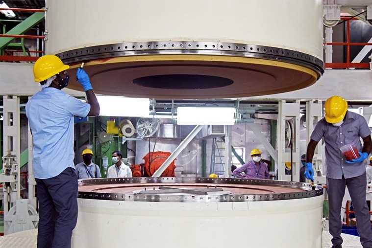 Technicians work on the EOS-04 satellite. (Photo: Department of Science and Technology)
India currently has 53 operational satellites, of which 21 are earth observation ones and another 21 are communication-based. Eight are navigation satellites, while the remaining three are science satellites, according to information provided by the government in Parliament.
Monday’s launch would be the 54th flight of the PSLV rocket, and the 23rd of its most powerful XL-version that has six strap-on boosters. The EOS-04 would be the first satellite to detach from the rocket, 18 minutes after the lift-off. The two other satellites would be released about a minute later.
Newsletter | Click to get the day’s best explainers in your inbox