© The Indian Express Pvt Ltd

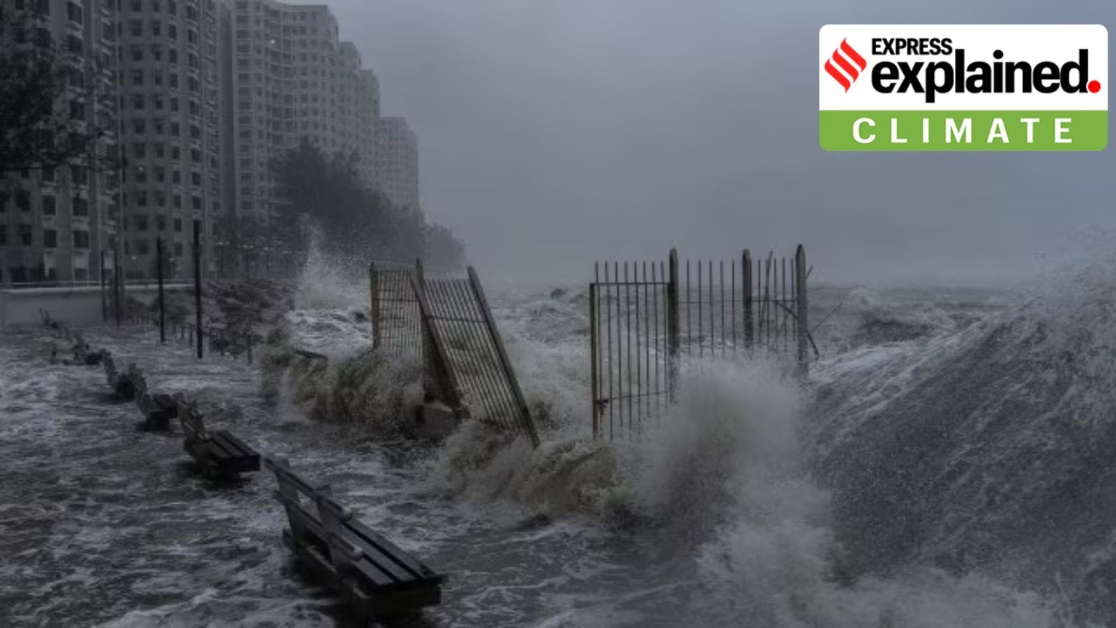 Super Typhoon Ragasa: Strong waves crash against the waterfront in Heng Fa Chuen area as Super Typhoon Ragasa approaches in Hong Kong, Wednesday, Sept. 24, 2025. (AP Photo)
Super Typhoon Ragasa: Super Typhoon Ragasa battered Hong Kong with fierce winds and pounding rain, and headed into southern China on Wednesday. It has forced two million people to evacuate in southern China and brought a “significant storm surge”, with waters in coastal areas rising more than 3 metres above the reference level in Hong Kong.
This came after Ragasa left at least 14 people dead in Taiwan and at least two dead in northern Philippines.
The storm is the most intense tropical cyclone recorded in 2025. At its peak, Ragasa was moving with the maximum sustained winds of 280 kmph. This was close to the upper limit of how intense storms can be on Earth.
Tropical cyclones form over warm ocean waters near the equator. When the warm, moist air from the ocean surface rises upward, a lower air pressure area is formed below. Air from surrounding areas with higher air pressure rushes into this low-pressure area, eventually rising, and it becomes warm and moist.
As warm, moist air rises, it cools down, and the water in the air forms clouds and thunderstorms. This whole system of clouds and winds gains strength and momentum using the ocean’s heat, and the water that evaporates from its surface.
“The weakest tropical cyclones are called tropical depressions. If a depression intensifies such that its maximum sustained winds reach 39 miles per hour [63 kmph], the tropical cyclone becomes a tropical storm,” according to the National Oceanic and Atmospheric Administration (NOAA). Storm systems with wind speeds of 119 kmph and above are classified as hurricanes, typhoons, or tropical cyclones.
The category of a tropical cyclone is determined by its sustained wind speed, as measured by the Saffir-Simpson Hurricane Wind Scale. It is classified into five categories — Category 1 to Category 5. While Category 1 tropical cyclones bring winds of 119 to 153 kmph, Category 5 tropical cyclones, which are the strongest, have winds of 252 kmph or higher. Storms that reach Category 3 and higher are considered major tropical cyclones due to their potential to inflict significant damage.
Ragasa has been referred to as a super typhoon because it is a Category 5 tropical cyclone.
Scientists are yet to reach an agreement over how exactly climate change is impacting tropical cyclones. That is because there are several factors that determine whether a storm forms, how it develops, its strength, duration and overall characteristics.
However, there is a consensus that with rising global temperatures, tropical cyclones are becoming more intense. For instance, a study published in the journal Climate and Atmospheric Science in July 2024 showed that tropical cyclones in Southeast Asia are now forming closer to coastlines, intensifying more rapidly, and lingering longer over land.
This could be happening due to warmer surface temperatures of the ocean. Average temperatures in the Pacific Ocean have risen by about 1.5 degrees Celsius in the past century, according to the United Nations Environment Programme.
Benjamin Horton, dean of the school of energy and environment at City University of Hong Kong, told South China Morning Post, “Typhoons exist on planet Earth to dissipate heat. The more heat in the ocean, the more tropical cyclones you get to remove the heat. The Earth is an amazing balance. It is obvious that if you warm up the oceans, these typhoons are going to be bigger.”
“You have got a lot of warm water, giving it a lot of energy. Its track is perfect for maximum destruction because it has not made landfall over any significant area to reduce its strength.”
Given the extreme intensity of Ragasa, some scientists have observed that the storm almost reached the upper limit of what Earth is capable of producing. Current calculations of the maximum potential intensity of storms peak at roughly 322 kmph.
Southern China and Hong Kong frequently witness typhoons during this time of the year. However, the impact of Super Typhoon Ragasa has been worse due to its location. The region has been affected by the ‘dirty side’ or ‘right-front quadrant’ of the storm.
A tropical cyclone has a ‘clean’ side and a ‘dirty’ side. In the northern hemisphere, the right-hand side of the storm (relative to its motion) is called the ‘dirty’ side, and the left-hand side is known as the ‘clean’ side.
The ‘dirty’ side can bring more devastation as the forward motion of the storm is added to the background rotating circulation of the system, which is always in an anti-clockwise direction. The location at which the two movements — rotation around the eye and forward motion — combine is where the most powerful winds are found.
For instance, if a typhoon is moving at 48 kmph and has sustained winds of 161 kmph, the combination generates a wind speed of 209 kmph on the right-hand side.