Journalism of Courage

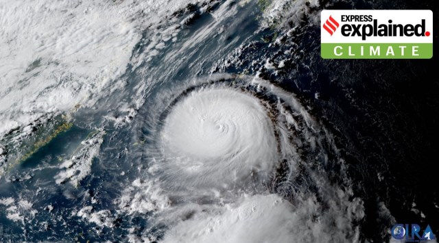 Satellite view of Hinnamnor. (@CIRA_CSU/Twitter)
The strongest tropical storm of 2022, dubbed Super Typhoon ‘Hinnamnor’, has been barrelling across the western Pacific Ocean and is presently hurtling back towards the islands of Japan and South Korea, packing wind speeds of upto 241 kilometres per hour.
As of Thursday (September 1) morning, the category 5 typhoon — the highest classification on the scale — was about 230 km away from Japan’s Okinawa prefecture, according to the Hong Kong Observatory. Thunderstorm warnings have been issued in several regions across the country. As it inches towards the Japanese islands once again, the typhoon is expected to develop further.
Okinawa flights have already been disrupted, with several airlines cancelling flights to and from the region this week. Hinnamnor is the 11th tropical storm this year to develop into a typhoon.
According to a forecast from Japan Meteorological Agency (JMA), the storm is expected to move towards parts of Southwestern Japan, Eastern China and South Korea over the next few days. The weather department has predicted it will slow down and stall by Friday, but the system will continue to move north once again over the weekend, weather.com reported.
On Thursday afternoon, the JMA upgraded the typhoon’s classification to ‘violent’. According to weather.com, Hinnamnor will slowly move south of Okinawa on Friday, while continuing to intensify. Between Saturday and Sunday, it will approach Japan’s Sakishima Islands and Okinawa’s main island, as wind speeds continue to increase. Waves as high as 10 metres are expected in the region.
According to Japanese news outlet NHK World, rainfall on Thursday is expected to reach up to 150 millimetres in Hokkaido, 120 millimetres in Tohoku, 100 millimetres in Tokai, and 80 millimetres in the Kansai region.
While the effects of the typhoon aren’t expected to be felt as intensely in China and Taiwan, heavy rains have been predicted across South Korea.
How is the typhoon presently moving?
As of Thursday evening, the violent typhoon was moving south of Miyakojima Island at a speed of about 15 kilometers per hour, according to JMA’s latest weather update. The storm is predicted to regain force as it moves south of Okinawa, where it is likely to remain stationary through Friday.
Wind speeds have been picking up in Okinawa and the seas have been turning rough, according to local media reports.
Why is the typhoon intensifying so quickly?
According to a report by Taiwan News, one of the factors contributing to the Super Typhoon rapidly intensifying and expanding is the fact that it has started absorbing other local meteorological systems. Warm tropical waters and other pre-existing meteorological disturbances have also led to the system’s escalation.
Weather warning
Japan’s Meteorological Agency has warned of flooding, heavy downpour, landslides, and possible lightning strikes, particularly in low-lying areas. The weather department has also warned of tornados, swollen rivers and violent winds.

Even as Aanand L Rai is basking in the success of his latest romantic drama Tere Ishk Mein, starring Dhanush and Kriti Sanon, he’s cognizant that he went terribly wrong with his last directorial, Akshay Kumar-starrer 2022 family drama Raksha Bandhan. That film, also produced by his banner Colour Yellow Productions, earned only Rs 48.63 crore at the domestic box office during its lifetime.