 Waterlogged road at Pul Prahladpur, Delhi. (Express Photo by Tashi Tobgyal)
Delhi Weather Forecast Today, Delhi Monsoon Live News Updates: After several false starts, the monsoon finally hit Delhi on Tuesday. The first showers of monsoon caused waterlogging and massive traffic jams in different parts of the city, causing snaking lines of vehicles on several busy road stretches, including at the Dhaula Kuan Ring Road, Barapullah and Kallindi Kunj flyovers.
The much-awaited Southwest Monsoon finally brought respite from scorching summer temperatures as 28.1 mm rainfall was recorded between 8.30 am and 5.30 pm.
The rainfall started on Monday night and continued through Tuesday morning. By 8.30 am, Lodhi Road met station had seen 19.4 mm of rain, followed by 2.5 mm at Safdarjung and 2.4 mm at Palam. Monsoon was set to arrive in the national capital on June 27, but it got delayed by 15 days, first time in almost two decades.
The IMD called the failure to predict the monsoon in Delhi with accuracy “rare and uncommon”. On Monday, the monsoon advanced to several parts of Rajasthan, including Jaisalmer, but gave Delhi a miss yet again.
The IMD had earlier announced that the city would see monsoon rains much earlier than usual on June 15. However, changes in conditions that promote the advancement of moisture-laden winds meant that there were delays, and IMD’s monsoon forecast for rains was wrong at least thrice.
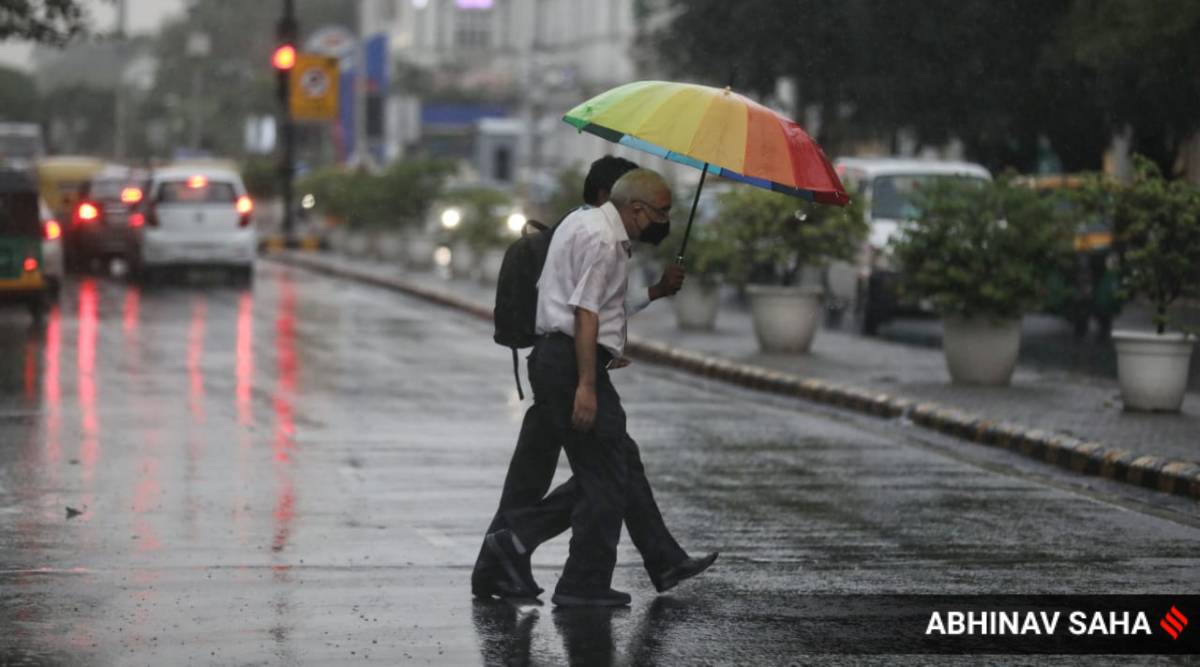 Several parts of South, Central and South East Delhi witnessed rain around 5 pm, along with strong winds.
The first showers of monsoon caused waterlogging at the Dhaula Kuan underpass, Rohtak Road near Karala, Sector-D Vasant Kunj, Badarpur, Som Vihar, Ring Road, Vikas Marg, Sangam Vihar, Munirka, Shivalik Road in Malviya Nagar, near Asola village, Rajpur Khurd and Kirari among others, PWD and MCD officials said. Waterlogging at the Pul Prahladpur underpass near the Mehrauli-Badarpur Road was such that the public works department (PWD) had to stop traffic movement for some time.
A bolt of lightning struck the Jagat Mandir, popularly called the Dwarkadish temple, in Gujarat's Devbhumi Dwarka district on Tuesday. Mukesh Pandya, district collector of Devbhumi Dwarka, said the incident occurred at around 3 pm. "The lightening struck the flag staff and damaged the flag. However, no other damage was reported, thanks to the earthing system of the temple and blessings of Lord Dwarkadish. No devotee was injured," added the collector.
Many rejoiced at the respite from the heat and shared pictures and videos of overcast skies on social media. However, for several others, the mood quickly changed as the much-awaited showers were accompanied by waterlogging, traffic jams and tiring commutes. Many also mocked the IMD’s previous predictions with memes and jokes using the hashtag #DelhiRains. Read more.
With ligh rain in the region on Tuesday, the mercury hovered below normal in the neighbouring states of Haryana and Punjab, PTI reported. According to the IMD, Karnal registered a high of 29.2 degrees Celsius, which is five notches below the normal for this time of the year. Rohtak registered a high of 29.3 degrees Celsius, seven notches below normal limits.
Chandigarh recorded a maximum temperature of 33 degrees Celsius, two notches below normal limits.
The monsoon in Delhi has been delayed on several years, with the longest delay in 1987, when the rains arrived nearly a month later on July 26. This year's monsoon has seen the longest delay in nearly two decades. In 2002, the monsoon had arrived in the national capital on July 19.

Whereas, the earliest arrival of monsoon in the last two decades was seen in 2008, with the rains hitting Delhi on June 15.
The Minto Road, one of central Delhi’s main streets, which gets water-logged every year during the monsoon, witnessed smooth traffic on Tuesday, ANI reported.
Earlier this month the Public Works Department had installed four CCTVs along the brige to monitor floods and stay alert in case of waterlogging.
As the monsoon finally arrived in Delhi, it brought with it traffic snarls and water-logging in several areas, PTI reported. Several commuters reached their workplaces late due to the rain. There was heavy traffic at Dhaula Kuan with one commuter complaining he was stuck for almost 90 minutes (and counting), Azadpur and at the Delhi Cantt and Kalindi Kunj flyovers among other places. Commuters from Laxmi Nagar in east Delhi to ITO also reported a traffic jam.
India Meteorological Department on Monday blamed its failure in predicting New Delhi’s monsoon on numerical models. The national capital is reeling under scorching heat even as rains have hit neighbouring areas, such as Aligarh in Uttar Pradesh and Karnal in Haryana.
“Such type of failure by numerical models in prediction of monsoon advance over Delhi is rare and uncommon,” IMD said in a statement. “It is needless to mention that IMD has predicted well with high accuracy about the advance of monsoon over Delhi quite accurately in the recent past years and also the advance of monsoon over different parts of the country during the monsoon 2021 accurately about four to five days ahead.”
The weather department said it is monitoring the situation continuously and will provide regular updates on entry and advance of monsoon into the rest of northwest India, including Delhi.
Southwest monsoon advances across the country, according to IMD. The monsoon took 40 days in order to complete its onset bringing delayed arrival of monsoon in north and northwest.
On the contrary, south and central India regions experienced early monsoon. The 2021 monsoon onset over Delhi is the second most delayed since 2002, IMD officials said.
Due to heavy rain in Delhi, airlines have requested passengers to check the status of their flights as they anticipate some delays. Airport officials said that no diversions have been reported yet but there might be a few slight delays.
At around 11 am, SpiceJet said that departures and arrivals of flights might get affected due to bad weather. SpiceJet tweeted, “Due to bad weather in Delhi (DEL), all departures/arrivals and their consequential flights may get affected. Passengers are requested to keep a check on their flight status.
A Delhi airport official said that no diversions have been reported as yet, and that the announcement was made to warn passengers of possible delays. In case there is a slight delay, arrival and departure of consequent flights could be affected.
The India Meteorological Department (IMD) on Wednesday announced that the southwest monsoon had advanced over the entire country.
Apart from hitting Delhi, the monsoon finally progressed into remaining parts of Haryana, west Uttar Pradesh and Rajasthan on Tuesday.
With this, the monsoon has taken 40 days to complete its onset phase, which saw a mix of very early arrivals over south and central India regions and a highly delayed arrival over north and northwest India.
The India Meteorological Department (IMD) had predicted moderate rain over Delhi this morning. In its latest nowcast warning, the Met department has said that thunderstorms accompanied by light to moderate intensity rainfall (2.4mm to 64.4mm in 24 hours) and windy conditions with speeds between 24 to 40 kms /hr would be realised over Delhi NCR — Bahadurgarh, Gurugram, Faridabad, Loni Dehat and Noida along with Sonipat and Rohtak during the next two hours.
The rainfall started on Monday night and continued through Tuesday morning. By 8.30 am, Lodhi Road met station had seen 19.4 mm of rain, followed by 2.5 mm at Safdarjung and 2.4 mm at Palam.
Hello and welcome to our Delhi monsoon LIVE blog. After several false starts, the monsoon finally hit Delhi on Tuesday. Follow all the latest updates here!