© IE Online Media Services Pvt Ltd
Latest Comment
Post Comment
Read Comments

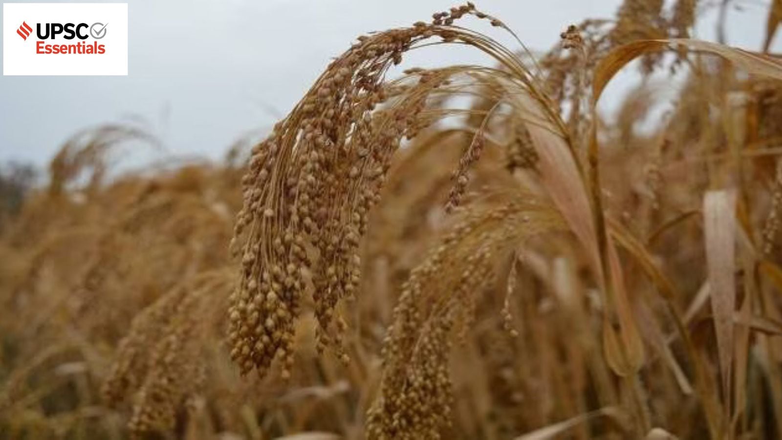 Attempt question on millets in today's answer writing practice. Here is the image of millets, which are the traditional food for more than half a billion people in Asia and Africa. (Representational/File)
 UPSC Essentials brings to you its initiative for the practice of Mains answer writing. Mains Answer Writing covers essential topics of static and dynamic parts of the UPSC Civil Services syllabus covered under various GS papers. This answer-writing practice is designed to help you as a value addition to your UPSC CSE Mains. Attempt today’s answer writing on questions related to topics of GS-3 to check your progress.
Millets are considered to be “powerhouses of nutrition”. Discuss how climate change has transformed pearl millet cultivation zones in India.
What is geo-spatial intelligence? How geospatial solutions will address National Priorities and Sustainable Development Goals?
Introduction
— The introduction of the answer is essential and should be restricted to 3-5 lines. Remember, a one-liner is not a standard introduction.
— It may consist of basic information by giving some definitions from the trusted source and authentic facts.
Body
— It is the central part of the answer and one should understand the demand of the question to provide rich content.
— The answer must be preferably written as a mix of points and short paragraphs rather than using long paragraphs or just points.
— Using facts from authentic government sources makes your answer more comprehensive. Analysis is important based on the demand of the question, but do not over analyse.
— Underlining keywords gives you an edge over other candidates and enhances presentation of the answer.
— Using flowcharts/tree-diagram in the answers saves much time and boosts your score. However, it should be used logically and only where it is required.
Way forward/ Conclusion
— The ending of the answer should be on a positive note and it should have a forward-looking approach. However, if you feel that an important problem must be highlighted, you may add it in your conclusion. Try not to repeat any point from body or introduction.
— You may use the findings of reports or surveys conducted at national and international levels, quotes etc. in your answers.
Self Evaluation
— It is the most important part of our Mains answer writing practice. UPSC Essentials will provide some guiding points or ideas as a thought process that will help you to evaluate your answers.
QUESTION 1: Millets are considered to be “powerhouses of nutrition”. Discuss how climate change has transformed pearl millet cultivation zones in India.
Introduction:
— The word millets is used to describe small-grained cereals like sorghum (jowar), pearl millet (bajra), foxtail millet (kangni/ Italian millet), little millet (kutki), kodo millet, finger millet (ragi/ mandua), proso millet (cheena/ common millet), barnyard millet (sawa/ sanwa/ jhangora), and brown top millet (korale).
— Among the first crops to be domesticated were millets. Millets have been consumed by people living in the Indus Valley as early as 3,000 BC, and many of the varieties currently grown worldwide originated in India. There are native varieties of the crop in China, Japan, and West Africa.
Body:
You may incorporate some of the following points in the body of your answer:
How climate change has transformed pearl millet cultivation zones in India?
— According to a new study, published in April this year in the Agronomy Journal, India’s core pearl millet or bajra production zone has shifted to 18 districts spread across eastern Rajasthan and Haryana between 1998 and 2017.
— The International Crops Research Institute for the Semi-arid Tropics (ICRISAT) and the Indian Council of Agricultural Research – All India Coordinated Research Project on Pearl Millet (ICAR-AICRP) collaborated on the research.
— Increase in rainfall triggered by human-induced climate change has led to this development.
— India classifies pearl millet cultivation zones based on rainfall patterns and soil types.
(i) Zone A1 – Arid Zone of Rajasthan (less than 400 mm rainfall)
(ii) Zone A – Semi-arid regions in north and central India (more than 400 mm rainfall) – Rajasthan, Haryana, Gujarat and Uttar Pradesh
(iii) Zone B – ( southern India and central western India)
— The paper divided ‘A’ into three subzones: ‘G’, ‘AE1’, and ‘AE2’. Zone ‘G’ saw an average increase in Gujarat, while Zone AE1 witnessed an increase in eastern Rajasthan and Haryana. Zone ‘AE2’ includes 12 districts in Uttar Pradesh and Madhya Pradesh.
(Refer: Agronomy Journal and Climate change has transformed pearl millet cultivation zones in India by downtoearth.org.in)
Conclusion:
— In India, millets are mainly a kharif crop. During 2018-19, three millet crops — bajra (3.67%), jowar (2.13%), and ragi (0.48%) — accounted for about 7 per cent of the gross cropped area in the country, Agriculture Ministry data show.
— Millets are considered to be “powerhouses of nutrition”. The two pseudo millets, buckwheat (kuttu) and amaranth (chaulai), which have “high nutritive value” are now regarded as “Nutri Cereals” for the purposes of production, consumption, and trade.
— On March 3, 2021, the United Nations General Assembly (UNGA) adopted a resolution to declare 2023 as the International Year of Millets. The proposal was moved by India, and was supported by 72 countries.
(Source: Why India’s push for millets is yet to gain widespread traction by Harikishan Sharma, downtoearth.org.in)
Points to Ponder
Millets under PDS
Benefits of Millets
Main millets producing states
Related Previous Year Questions
Assess the role of National Horticulture Mission (NHM) in boosting the production, productivity and income of horticulture farms. How far has it succeeded in increasing the income of farmers? (2018)
How has the emphasis on certain crops brought about changes in cropping patterns in recent past? Elaborate the emphasis on millets production and consumption. (2018)
QUESTION 2: What is geo-spatial intelligence? How geospatial solutions will address National Priorities and Sustainable Development Goals?
Introduction:
— The gathering and combining of data from a variety of technological sources, such as satellites, mobile sensors, ground control stations, and aerial photography, is known as geospatial intelligence.
— Real-time maps and simulations are created using the data to assist predict when, where, and how much of a threat is likely to materialize. This knowledge can be used by individuals, government representatives, or both to make well-informed decisions.
Body:
You may incorporate some of the following points in the body of your answer:
— The Sustainable Development Goals (SDGs) and National Developmental Priorities (SDRR, rural development, urban governance, operationalization and maintenance of NSDI/State SDI Data Nodes by covering all States and UTs, and provision of geospatial data, products, services, and solutions to potential stakeholders/beneficiaries of the ecosystem up to the level of panchayats and wards, among other levels—are addressed through research and development projects and operational scale initiatives.
National Programme on Spatial Disaster Risk Reduction (SDRR)
— An integrated national program on spatial disaster risk reduction (SDRR) has been developed by division on the initiative, using the National Disaster Management Plan (NDMP) as a guide. Landslide hazard mitigation and Coastal hazard risk assessment & reduction are the two sub-programs that the division has already started in this approach.
Landslide Hazard Mitigation (LHM)
— As part of the integrated landslide programme, efforts were made to develop forewarning system to monitor the critical landslides in different geo-environmental areas. The project has been supported for the development of an early warning system covering areas (States) like Sikkim, Nilgiris (Tamil Nadu), Manikaran, Kotropi, Mandiand Darmashala (Himachal Pradesh), and Uttarakhand.
Coastal Hazard, Risk Assessment and Reduction (CHRAR)
— To develop S&T enabled geospatial techniques for coastal disaster studies, including disaster genetics, propagation, vulnerability mapping, and the identification of causative factors and mitigation measures, CHRAR was launched to cover the nation’s coastal areas. The program’s objective is to produce quantifiable and actionable outputs that state governments and stakeholders can easily utilise for relief, restoration, and rehabilitation during disasters. Since the program’s beginning, R&D projects have been supported in the areas of coastal erosion, tsunamis, cyclones, floods, and land subsidence and sea level rise.
Geospatial Solutions for Urban Governance
— Proposals under this sub-program are encouraged to focus on core R&D areas that emphasise emerging technologies related to city development using Geo-ICT, as well as applications related to city governance. The numerous R&D projects are supported, with a focus on the following areas: IoT and GIS technologies; smart parking management systems with sensors; flood mapping frameworks and/or early warning systems for potential flooding events; city GML-based 3D models for smart cities; Indoor navigation systems based on geomagnetism, industrial indoor asset positioning and navigation systems using geospatial analysis, etc.
Conclusion:
— India and United States signed the crucial Indo-US Basic Exchange and Cooperation Agreement (BECA), which pertains to geo-spatial intelligence, sharing information on maps and satellite images for defence purposes.
— The signing of BECA allows India to use US geospatial intelligence and enhance accuracy of automated systems and weapons like missiles and armed drones. It gives access to topographical and aeronautical data and advanced products which will aid navigation and targeting.
— The cooperation also includes sharing of high-end satellite images, telephone intercepts, and data exchange on Chinese troops and weapons deployment along the 3,488-km India-China LAC.
(Source: 2+2 dialogue: India, US sign crucial agreement on geo-spatial intelligence, dst.gov.in)
Points to Ponder
Geospatial Technology Programme
Geospatial Science Programme
Related Previous Year Questions
What do you understand by nanotechnology and how is it helping in health sector? (2020)
With growing energy needs should India keep on expanding its nuclear energy programme? Discuss the facts and fears associated with nuclear energy? (2018)
UPSC Essentials: Mains answer practice — GS 1 (Week 22)
UPSC Essentials: Mains answer practice — GS 1 (Week 21)
UPSC Essentials: Mains answer practice — GS 2 (Week 21)
UPSC Essentials: Mains answer practice — GS 2 (Week 22)
UPSC Essentials: Mains answer practice — GS 3 (Week 21)
UPSC Essentials: Mains answer practice — GS 3 (Week 22)
Subscribe to our UPSC newsletter and stay updated with the news cues from the past week.
https://www.youtube.com/watch?v=OU5N_TJv-3I?si=_Ln3uY63ucwKOU-d

Read UPSC Magazine