© The Indian Express Pvt Ltd

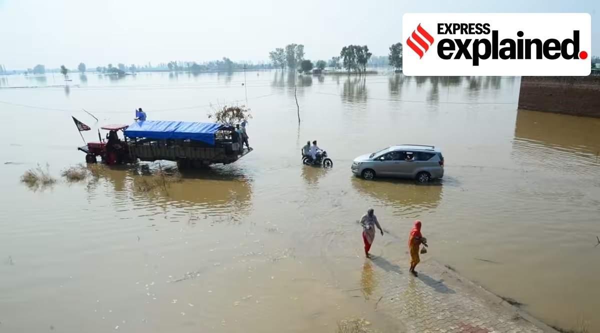 Lack of zoning has led to unsuitable constructions in floodplains, exacerbating flooding in Punjab. (Express Photo by Anju Agnihotri Chaba/Representational)
 Punjab has been reeling under floods for well over a month now. The villages along the rivers Sutlej, Beas, Ravi and Ghaggar, like always have been, at the recieving end of the worst of the deluges.
Most people in these villages farm in the highly fertile but sensitive flood plains, and concrete encroachments in these areas have, in many cases, exacerbated the devastation caused by flooding. This is where zoning comes in.
A river expands and contracts naturally over seasons and in different years. A flood plain is an area adjacent to the river which normally gets flooded when the river swells.
Well maintained flood plains, free from wanton construction and concrete, are natural defences against flooding farther inland. They are also useful for recharging groundwater levels and maintaining the water table.
Identifying flood plains is thus crucial. Experts do this based on topographical features around rivers. For instance, flood plains often contain oxbow lakes – basically abandoned meandering channels of the river, where it once flowed prior to changing its course.
Zoning involves demarcating areas around rivers likely to be affected by floods of different magnitudes and frequencies, in order to specify the types of permissible developments there. This is done so that whenever floods do actually occur, the damage is minimal.
As per guidelines on floodplain zoning by the National Disaster Management Authority, defence installations, industries, and public utilities like hospitals, electricity installations, water supply, telephone exchanges, aerodromes, railway stations, commercial centres, etc. should be located such that they are above the levels corresponding to a 100-year frequency or the maximum observed flood levels.
According to the National Green Tribunal (NGT), there should be no construction within 500 m area from the central lining of a river.
However, despite NGT’s directions to the Government of Punjab, the state is yet to carry out flood plain zoning. The NGT even sent directions to the state’s chief secretary to personally monitor progress of zoning and ensure compliance of its directions.
Consequently, flood plain areas of Sutlej, Beas, Ravi and Ghaggar have been wantonly encroached upon, making villages along these rivers perenially at risk of floods whenever they swell.
According to Hardeep Singh Mehandiratta, chief engineer, draining cum mining and geology, in the Department of Water Resources, “work on zoning of flood plains has started, [but] it will take time to be completed.
“As four rivers – Sutlej, Beas, Ravi and Ghaggar, flow through Punjab, 60 per cent of the state is flood prone … protection bundhs are made to protect the urban population from floods.”
Encroachment and mismanagement of flood plains leading to non-suitable construction activity and concretization of flood plains.
 Even a cursory look at this 2010 map showing the flood hazard in the state shows that large areas of the state are susceptible to major flooding. (Source: Flood Document Punjab 2010)
This poses risks to both peple and property, and the health of the flood plains themselves. On one hand, non-suitable constructions play a part in pushing floods further inland, increasing the area harmed and damage caused during floods. Concretisation also leads to it taking far longer for floods to subside as the water simply does not drain.
On the other hand, this kind of flooding is not good for flood plains themselves, affecting the fertility and quality of the soil as well.
Areas along the rivers in the districts of Ropar, Ludhiana, Jalandhar, Moga, Ferozepur, Fazilka, Patiala, Sangrur, Mansa, Patiala, Gurdaspur, Amritsar, Taran Taran, Hoshiarpur, and Nawanshahr all come under flood plains – further highlighting the risks that Punjab faces if it does not prepare adequately for floods.
In fact, despite the Centre’s directions, so far only four states – Manipur, the erstwhile Jammu & Kashmir, Rajasthan and Uttarakhand – have adopted the act on paper. However, the implementation of the plans has been underwhelming in these states with no delineation and demarcation of flood plains undertaken even by them.
In Punjab, environmental activists and NGOs have been demanding flood plain zoning, but to little avail as of yet.