This is an archive article published on June 26, 2024
Monsoon to gather pace, advance into East, Central and North India by June 29: IMD
Delhi to experience thunder, rainfall from June 27 to 30.
Written by Anjali Marar
New Delhi | Updated: June 27, 2024 08:37 AM IST
4 min read
Whatsapp
twitter
Facebook
Reddit
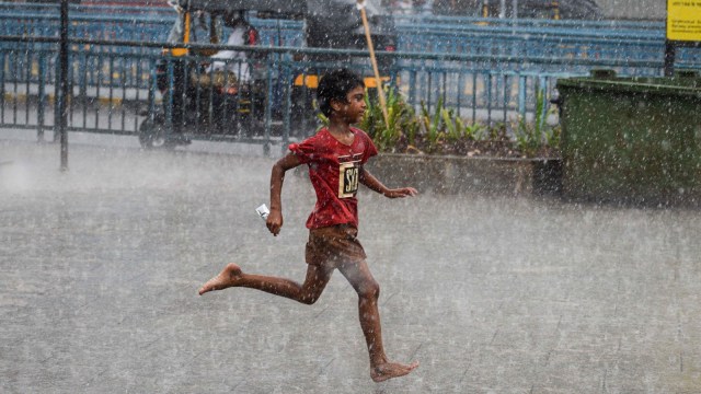
Conditions are likely to become favourable for further advancement of Southwest monsoon into the remaining parts of the country over the next 3-4 days, the forecast stated. (Express photo by Sankhadeep Banerjee)
After a long lull, the southwest monsoon is set to make a swift advance into East, Central and Western India and make up for the delayed onset in some of these regions.
The India Meteorological Department (IMD) on Wednesday said that the monsoon will cover the states of Gujarat, Madhya Pradesh, Chhattisgarh, Jharkhand, Bihar and West Bengal entirely in addition to making further advancements into more areas of east and west Uttar Pradesh, Uttarakhand, Himachal Pradesh, Jammu-Kashmir, Ladakh-Gilgit-Baltistan-Muzaffarabad, north Punjab and north Haryana by June 29.
In its latest forecast, the IMD has said that Delhi and neighbourhood areas will experience thunder and rainfall from Thursday through Sunday, bringing down the temperatures to 34 – 35 degrees Celsius. The much anticipated monsoon onset over the national capital could end anytime soon as weather models have indicated that the monsoon could cover the entire country in early July, ahead of its normal schedule of July 15.
The northern limit of monsoon (blue line) showing the regions covered by the southwest monsoon. / Source : IMD
On Wednesday, the northern limit of monsoon passed through Mundra, Mehsana, Udaipur, Shivpuri, Lalitpur, Siddhi, Chaibasa, Haldia, Pakur, Sahibganj and Raxaul. The Arabian Sea branch of the monsoon has, till date, advanced as per calendar whereas the Bay of Bengal branch has progressed, relatively, slower.
However, enhanced rainfall activity is likely over east and hilly areas of Northern India due to multiple favourable weather systems. There are strong south-westerly winds coming-in from the Bay of Bengal, which will cause widespread heavy spells over Northeast India. Heavy to very heavy rainfall (34.5-204.4mm in 24 hours) is forecast over Sikkim, Assam, Meghalaya, Arunachal Pradesh till June 29. With the likely emergence of a trough which will run between Punjab to northwest Bay of Bengal, the Met department has warned of heavy rainfall (64.5-115mm in 24 hours) over Bihar, east and west Uttar Pradesh, Uttarakhand from Thursday.
Very heavy rainfall is likely over Uttarakhand during Friday and Saturday. The presence of a cyclonic circulation over Madhya Pradesh and adjoining Gujarat will attract more moisture and lead to an increase in rainfall intensity over Jharkhand and Odisha till the end of this week.
With a trough running along the coasts of Maharashtra and Kerala, the west coastal areas are bracing for heavy to very heavy rainfall (mm in 24 hours) till the end of this week. Konkan and Goa, coastal and interior Karnataka, Kerala, Mahe and Tamil Nadu will experience enhanced rainfall during the rest of this week.
Story continues below this ad
During the past 24 hours, heavy rainfall ranging between 68mm and 124mm was experienced over Kerala, West Bengal, parts of Rajasthan, Konkan and Goa.
This month, the rainfall activity over the areas where the monsoon onset was realised remained largely subdued. This, particularly, after an early onset and swift progress along the south peninsular India by June 10. As on Tuesday, the all-India rainfall stood 19 per cent short below normal and quantitatively it was 103.3mm.
The rainfall status (till June 25) of the states where the monsoon has arrived (even partially): West Bengal (-67 per cent), Gujarat (-51 per cent), Odisha (-42 per cent), Kerala (-37 per cent) , Mizoram (-36 per cent) , Nagaland (-32 per cent) , Arunachal Pradesh (-28 per cent) , Madhya Pradesh (-24 per cent) and Goa (-11 per cent). It is most likely the country’s June rainfall will be below normal.
This is a section for real-time weather updates and forecasts pertaining to cities across India and the globe. Everything under the sun, ranging from commitments to the accuracy of reports, punctuality in provisioning of information, and also insights into changing weather patterns, extreme climate events, and seasonal updates for keeping people alert and informed.
Daily, weekly, and long-term forecasts. With this, data from reputed sources is going to include the India Meteorological Department (IMD), several global climate agencies, and satellite imagery. Monsoon tracking, heatwave alerts, cyclone warnings, and snowfall predictions would be fruits of this collaboration, with the information put in an understandable way before the consumers of this service.
Apart from prediction once in a while, there are also discussions on climate changes, air quality updates, and other environmental issues that affect several regions. AQI reports, pollution trends, and experts' views on pro or anti-climate change policies can be provided to cater to discerning readers who can make their own decisions regarding health matters and safety.
Strongly base for credible, live, and certainly relevant, covering weather on the pages of IndianExpress.com about readers being at the forefront of unpredictable weather changes and much more about the wider environment concerning trends in global climate.

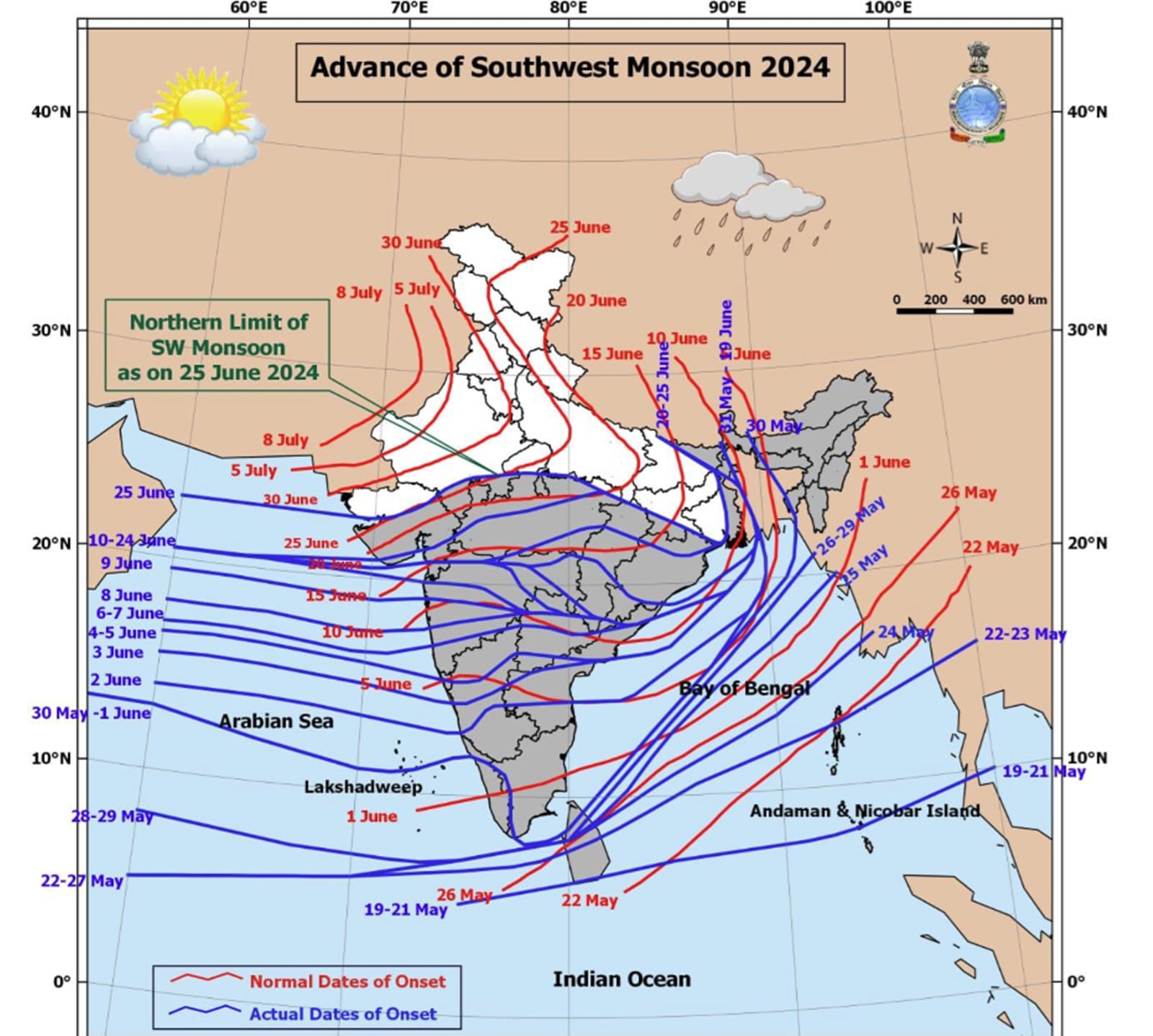 The northern limit of monsoon (blue line) showing the regions covered by the southwest monsoon. / Source : IMD