
 A low-pressure area over the Indian Ocean and adjoining Bay of Bengal is likely to bring rains to Tamil Nadu (File/AP Photo)
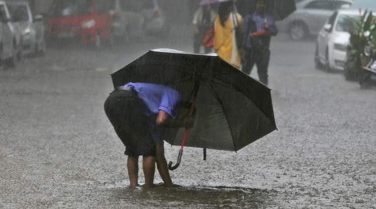
Weather forecast today, April 26, 2019: Puducherry is busy bracing itself up after the India Meteorological Department issued an alert of Cyclone Fani. The union territory is expected to get heavy rain during the next few days due to a low-pressure area over Bay of Bengal which could transform into a cyclone on April 30, said the IMD.
Territorial Chief Minister V Narayanasamy held discussions with officials of various departments, including Revenue and Disaster Management, along with his ministerial colleagues, after the sounding of the alert. “Puducherry is bracing itself up after the IMD issued the alert,” the Chief Minister told reporters after the meeting.
However, the depression over east equatorial Indian Ocean and adjoining the southeast Bay of Bengal moved northwestwards with a speed of about 05 kmph during the day and laid centred near 1060 km east southeast of Trincomalee (Sri Lanka), 1410 km southeast of Chennai and 1690 km southsoutheast of Machilipatnam at 5.30pm. It is likely to intensify further into a deep depression during the next 12 hours and into a cyclonic storm during the subsequent 12 hours. After this, It is expected to move northwestwards off Srilanka coast during next 96 hours and reach near north Tamilnadu and south Andhra Pradesh coasts on April 30 evening.

Fishermen in Andhra Pradesh have been warned not to venture into the sea from April 27 in view of the depression prevailing in the sea. An official release from The Andhra Pradesh Weather Forecasting and Early Warning Research Center (AWARE) AWARE, a division of Real-Time Governance Society, said deep-sea fishing has to be completely avoided as the sea is predicted to be rough with high tides and high-speed winds. Fishermen who are already in the sea have been advised to return to the shore by April 28. READ MORE HERE
As a precautionary measure, NDMA advises people to keep all documents and valuables plastic containers.
On Friday, the highest temperature in the state was recorded in Una at 38.8 degrees Celsius, while the lowest was recorded in Keylong at 3.4 degrees Celsius.
The Meteorological Department (Met) has issued a fresh 'yellow weather' warning for thunderstorm in several parts of Himachal Pradesh and gusty winds at isolated places on April 30, an official said Friday. Rainfall is likely in several parts of the state on April 26 and again from April 30 to May 2, the Shimla Met Centre said. Issuing the yellow warning for thunderstorm on April 30, the Met said gusty winds were likely at isolated places in the plains and the low and middle hills. (PTI)
Puducherry is expected to get heavy rain during the next few days due to a low-pressure area over Bay of Bengal which could transform into a cyclone Fani. Territorial Chief Minister V Narayanasamy held discussions with officials of various departments, including Revenue and Disaster Management, along with his ministerial colleagues, after the sounding of the alert.
The India Meteorological Department (IMD) issued the alert for Tamil Nadu and Puducherry that a cyclone would hit the coastal areas on April 30 triggering heavy rainfall during the subsequent days.
"Puducherry is bracing itself up after the IMD issued the alert," the Chief Minister told reporters after the meeting. (PTI)
According to Mahesh Palawat, vice president, meteorology and climate change at Skymet Weather, hot winds from northeast direction are expected to blow over Mumbai and adjoining areas.
SkyMet Weather forecasts rain in Kerala and Karnataka, and heatwave in Rajasthan, MP, Maharashtra.
NDMA releases a video suggesting precautionary measures to be taken before a cyclone.<
The IMD has predicted partly cloudy skies in Bengaluru for the next three days, with maximum temperature around 35 degrees, and minimum temperature at 25 degree Celsius.
Mumbai is expected to see no further change in temperature at least for the next three days. According to the IMD, the city will have mainly clear skies becoming partly cloudy towards evening or night.
The NDMA suggests tools that may come in handy during Cyclone Fani
Thunderstorm accompanied with gusty winds (with speed reaching 30-40 kmph) and lightning is likely at isolated places , and very likely over Sub-Himalayan West Bengal and Sikkim and Assam and Meghalaya, the IMD said in its warning today.
Delhiites woke up to a warm Friday morning with the minimum temperature settling at 24.2 degrees Celsius, normal for this time of the year. Humidity was recorded at 53 per cent at 8.30 AM.
The Met office has forecast clear skies during the day ahead along with strong surface winds. "The maximum temperature is likely to hover around 42 degrees, " the weatherman said.
(PTI)
Tropical cyclones passing over the northern part of the Indian Ocean are named by eight countries in the region, namely India, Pakistan, Bangladesh, Sri Lanka, Maldives, Myanmar, Oman and Thailand. The process only began in 2004, fours years after World Meteorological Organization agreed in principle to allow them to name cyclones originating in the Bay of Bengal and Arabian Sea.
READ MORE HERE
As heatwave conditions persist across states including Madhya Pradesh and Rajasthan, NDMA offers heatwave hacks and 'dumpy's tour to Rajasthan'.
The India Meteorological Department station, based in Thiruvananthapuram, issued warnings for fishermen and the general public about a possible cyclonic storm in the next few days heading towards the coast of Tamil Nadu.
“A low-pressure area has formed today morning over east equatorial Indian Ocean and adjoining the southeast Bay of Bengal and now lies as a well-marked low-pressure area in the same region. It is very likely to intensify into a depression during next 24 hours over east Equatorial Indian Ocean and adjoining central parts of south Bay of Bengal,” a weather bulletin said.
Several districts of Kerala have been seeing, over the past week, thundershowers accompanied by gusty winds towards the later part of the day. The rain has been attributed to a confluence zone passing through Kerala and Tamil Nadu with moisture available from the Arabian Sea and the Bay of Bengal, Skymet Weather reported.
READ MORE HERE
A cyclonic storm is likely to be formed near the Tamil Nadu coast on April 30. The NDMA suggests some Do's and Don'ts
Well marked Low-pressure system over Equatorial Indian Ocean and adjoining southeast Bay of Bengal is very likely to intensify into a cyclone, the IMD notification read. It is very likely to move northwestwards along and off east coast of Srilanka near north Tamilnadu coast on 30th April 2019.