© IE Online Media Services Pvt Ltd
Journalism of Courage

 The proposal has acknowledged Yassan as one among those who create GPS art with tools like Google Earth and Google Street View. (Source: Google News)
An artist from Tokyo, Yasushi “Yassan” Takahashi, crafted a record-setting wedding proposal for his girlfriend with the help of Google Earth.
The desire to create a unique proposal for his girlfriend, Natsuki, was stuck with Yasushi since 2008 but he was just not sure how to do it until he learnt about GPS art, that can create a large-scale digital drawing when a pre-planned route is followed with a GPS device.
The idea was to plan a route across the entirety of Japan that would spell “Marry Me” on Google Earth after his journey across the East Asian country will complete.
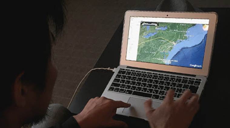 Yassan is now among the growing numbers of people who are creating GPS art using tools such as Google Earth and Google Street View. (Source: Google News)
The 31-year-old travelled from the island of Hokkaido to the shores of Kagoshima covering around 4,451 miles in 6 months to complete his trip for the wedding proposal.
Yassan quit his job in June and embarked on his journey for which he was awarded the Guinness World Record for the largest GPS drawing in history.
With the creation of the grand proposal, Yassan is now among the growing number of people who are creating GPS art using tools such as Google Earth and Google Street View.
Across the world, Google Earth is incorporated as a tool to draw and travel. While cyclists like to prefer using it to bring changes in their routes, others enjoy creative challenges like drawing anything from pigeons and dinosaurs to fictional characters.
(With inputs from Google Stories)