© IE Online Media Services Pvt Ltd
Journalism of Courage

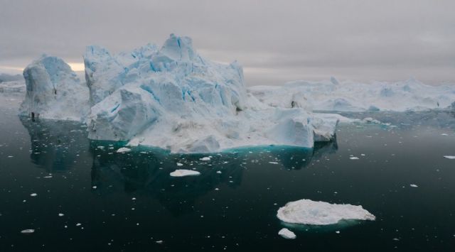 Ice formations in the Antarctic region. (Mikhail Nilov via Pexels)
 Antarctic sea ice reached its lowest maximum extent on record on September 10 at a time when the ice cover should have been growing at a much faster pace during the darkest and coldest months, shows a new study using satellite data. In the meanwhile, Arctic sea ice reached its annual minimum extent on September 19, making it the sixth-lowest year in satellite records.
The period between June and September usually represents summer in the Arctic Circle and winter in the Antarctic Circle.
To track sea ice extent, researchers at NASA’s National Snow and Ice Data Center (NSIDC) use satellites to measure sea ice as it melts and refreezes. It is defined as the total area of the ocean in which the ice cover is at least 15 per cent.
In the period between March and September this year, Arctic ice cover shrank from a peak of 14.6 million square kilometres to 4.23 million square kilometres. That figure is around 1.99 million square kilometres below the average minimum of 6.22 million square kilometres recorded between 1981 and 2010. To put that into perspective, the amount of sea ice lost was nearly enough to cover the land area of India twice.
Around Antarctica, sea ice reached its lowest maximum winter extent on September 10 at 16.96 million square kilometres. This is 1.03 million square kilometres below its previous record-low in 1986.
According to Walt Meier, a sea ice scientist at NSIDC, these changes are a decades-long response to warming temperatures. Satellite records for sea ice began in 1979. Since then, not only has it been declining in the Arctic, but it has also been getting younger. Spring melting starts earlier, and autumn-freezes start much later, meaning that melting seasons are much lower.
On average, the freeze-up is happening about a week later per decade. Or about one month later than 1979, overall.
The paltry growth of Antarctic sea ice during the region’s winter is also cause for concern. This could be caused by a variety of factors like El Nino, wind patterns and warming ocean temperatures. The record low seen this year is a continuation of a downward trend that started after a record high in 2014. Until 2014, the ice surrounding the continent was increasing slightly by about one per cent every decade.