Journalism of Courage

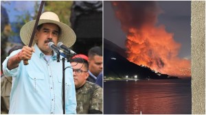
Last week,Google ran Mapathon in India,a contest to get Indians to use Map Maker,a Google service for maps. Within weeks Mapathon hit trouble when the Survey of India complained to the Delhi Police raising security concerns,citing violations of the National Map Policy.
However,within a fortnight of launching Mapathon,Map Maker received: More than 47,000 users and More than 5 lakh edits.
Maximum edits and participation from Maharashtra more than 52,000 edits and Andhra Pradesh more than 44,000 edits
PROJECT GROUND TRUTH
In 2008,Google began a project called Ground Truth,a very secret mapping programme that takes source data from the US Census Bureau,the Geological Survey,Google Street View,Map Maker,advanced algorithms and human input as part of the information giants quest to put everything and everyone on the map.
Google Street View How does it work?
Besides data sourced from TIGER data of the US Census,Geological Survey and data sources from various countries,Googles Ground Truthers rely on another exclusive asset for map creation: the Street View Cars tracks and imagery.
It finds street signs and addresses so that Google maps can better understand the logic of human transportation systems.
Street View publishes more data every two weeks than Google possessed in total in 2006. Every road that you see on a Google map has been verified by a human. Every day several thousand user reports of problems with Google Maps come in that are fixed within minutes.
Each drive generates two kinds of data
1. Actual tracks cars have taken
2. Photos from which Google can run
algorithms to extract traffic signs and paste them on with their Atlas Tool
The Street Views vans have clocked over 5 million miles.
Street View Codes available for 6 million businesses and 20 million addresses.
Google Street View is available in the US,UK,Australia,New Zealand,France,Canada,Ireland and the Netherlands. You can virtually walk around the White House,the Metropolitan Museum of Art and other famous landmarks.
Google Street View camera systems have 15 lenses and can produce photos at about 65 megapixel resolution.
In addition to the fleet of Street View cars,Google employs trikes,trolleys and snowmobiles.
Google map maker
Googles Map Maker,the socio-technological phenomenon,was started in Bangalore in 2006. Its a publicly accessible way to edit Google maps.
User starts with the high-resolution satellite imagery on the Map Maker platform.
User feeds in a landmark,then Map Maker places the individual user gesture onto a map,like a sketch on top of satellite imagery.
Then Map Maker takes inputs from multiple users and synthesises the gestures onto a connected graph that is sketched on the satellite image of the world to make a Google Map.
Trouble in other countries
Googles Street View has skirted controversies in various countries on privacy and security issues,from households in Germany opting out of Street View pixelating,to lowering camera heights in Japan.
US
A Pittsburgh couple sued Google for invasion of privacy and claimed that the Street View image of their home diminished its value. Google was asked to pay 1 in damages.
CANADA
Saskatoon in Canada had a unique problem with Street View: Photos of Canadian cities were taken at the end of winter,visually a most unappealing time that painted a wrong picture.
UK
Hit headlines in 2009 when face of The Colonel from KFC signage was blurred,to protect privacy. The Colonel died in 1980. Google said it showed strength of its facial recognition tech.
Priyanka kotamraju