Journalism of Courage
Premium
This is an archive article published on July 31, 2024
Behind the Wayanad landslides: Extremely heavy rain, fragile ecology, a steady rise in population
Experts said it was the biggest landslide-related disaster in Kerala till now, at least in terms of casualties.

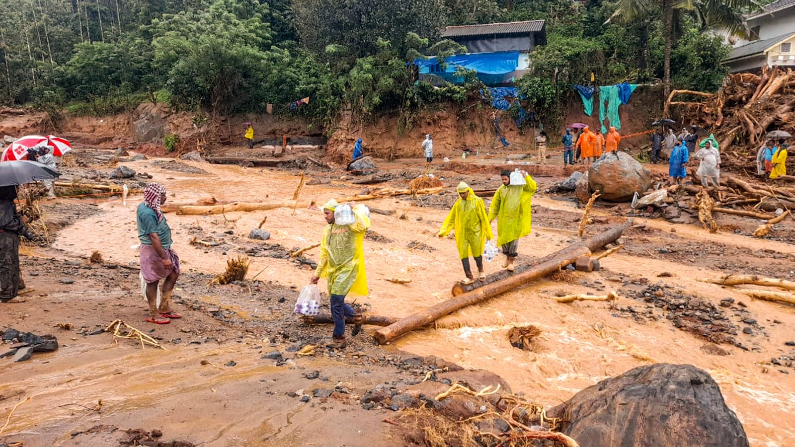 Rescue operation underway after a landslide triggered by heavy monsoon rains, in Wayanad district, Tuesday, July 30, 2024. (PTI)
Extremely heavy rainfall, a fragile ecology particularly vulnerable to landslides, and steadily increasing population pressures all combined to trigger multiple landslides in Wayanad district of Kerala on Tuesday, an incident that is turning out to be one of the worst disasters in the state in recent years.
Experts said it was the biggest landslide-related disaster in the state till now, at least in terms of casualties. More than 100 people are already confirmed dead in the incident that was triggered early on Tuesday morning amidst a heavy downpour. The events brought back memories of the 2018 flooding in the state, triggered by excessive rains that killed about 500 people.
Wayanad district received more than 140 mm of rainfall in the 24 hours between the mornings of Monday and Tuesday, about five times more than what is expected, data from India Meteorological Department (IMD) showed. Within the Wayanad district, several areas reported more than 300 mm of rainfall during this period.
Heavy rains during the monsoon season trigger landslides in Kerala almost every year. The whole of western Kerala, which is a hilly terrain with sharp slopes, is susceptible to landslides. There were major landslides during and after the 2018 flooding event, including in Wayanad. The district also saw a few smaller landslides in 2019.
“But this is possibly the worst landslide-related disaster in the state ever,” said K S Sajinkumar, an assistant professor of Geology at the University of Kerala.
“The terrain here has two distinctive layers, a layer of soil sitting atop hard rocks. When a lot of rain happens, the soil gets saturated with moisture and water reaches the rocks and flows between the soil and the rock layers. This weakens the force that binds the soil to the rocks and triggers the movement. This is what seems to have happened in this instance as well,” Sajinkumar said.
Nearly 17,000 sq km of area in Kerala, most of it on the western side of the Western Ghats, is mapped as landslide prone.
Story continues below this ad
“We have to have strict restrictions on land use in these areas. Cultivation or other activities cannot be allowed. I am not suggesting these activities have triggered this landslide because we are still to make the assessments, but in general the regulations required, considering the local ecology, are not implemented,” G Sankar, a former scientist with Thiruvananthapuram-based National Centre for Earth Science Studies.
Incidentally, the possibility of these landslides, in view of the expected rains, had been predicted by the IMD a couple of days ahead of the event. But as Sajinkumar said, there is little that can be done in the absence of a good mitigation plan.
“There are two things needed. We need to assess how much rains result in saturation of the soil level in different areas. We can then define rainfall thresholds for landslides. Then we need to map out the routes that landslides are likely to take after they have been triggered. We have susceptibility maps, but haven’t drawn up the route maps, which is a much more difficult exercise. With route maps, we would be able to mark out areas which should be out of bounds for settlements or any activities,” Sajinkumar said.
Advertisement
Top Stories


‘I-PAC raids met with resistance from Mamata’: ED set to knock on HC doors, say officers
India5 min ago
The Enforcement Directorate (ED) on Thursday conducted searches at 10 premises associated with the election management company I-PAC in Kolkata and Delhi. The company, founded by election-strategist-turned-politician Prashant Kishor, is currently managing election campaigns of the Mamata Banerjee-led Trinamool Congress. West Bengal will go to elections this year.
Live Blog
Advertisement
Loading Taboola...
Advertisement