Stay updated with the latest - Click here to follow us on Instagram
© IE Online Media Services Pvt Ltd

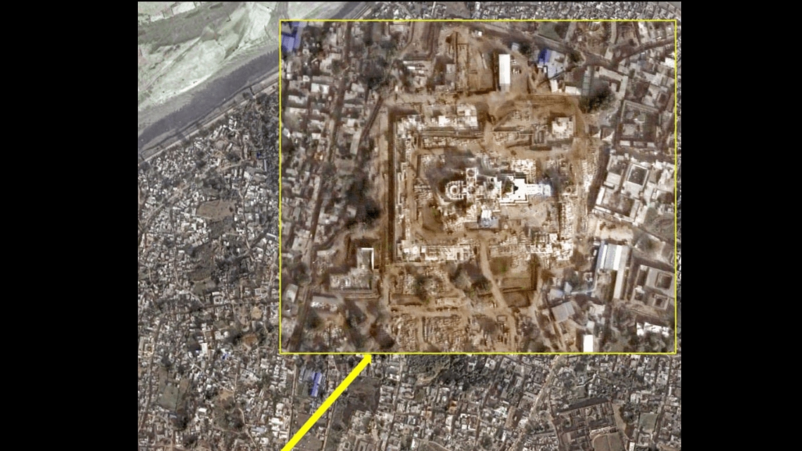 The satellite image of the newly constructed Ram Mandir captured by Cartosat. (Photo Credit: ISRO)
The Hyderabad-based National Remote Sensing Centre of ISRO on Sunday released satellite imagery of the newly-constructed Ram Temple in Ayodhya.
Taken from the Indian Remote Sensing Satellite, this image shared by ISRO shows the new temple that will be inaugurated on January 22.
The satellite image of the Ram Mandir was captured by Cartosat which is processed by ISRO’s National Remote Sensing Centre (NRSC). Cartosat is a remote-sensing satellite with the capability to provide in-orbit stereo images.
ISRO’s website states that the PSLV-C40 carries the Cartosat-2 Series Satellite, a remote sensing satellite that is meant to enhance data services for users. This satellite is similar in design to previous satellites in the series.
“The imagery sent by satellite will be useful for cartographic applications, urban and rural applications, coastal land use and regulation, utility management like road network monitoring, water distribution, creation of land use maps, change detection to bring out geographical and manmade features and various other Land Information System (LIS) as well as Geographical Information System (GIS) applications,” ISRO added.
The photo was taken on December 16, last year, shows the aerial image of the Dasharath Mahal, the Ayodhya Railway Station, and the sacred Sarayu River.
The consecration will take place on Monday in the presence of Prime Minister Narendra Modi, Uttar Pradesh Chief Minister Yogi Adityanath, and others.
Stay updated with the latest - Click here to follow us on Instagram