Journalism of Courage

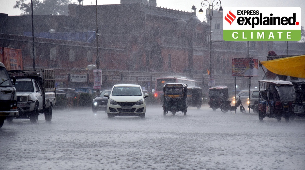 Vehicles wade through road amid heavy rains Lashes in Jaipur in March 2023. (Express Photo by Rohit Jain Paras)
 Northwest India has seen multiple spells of rainfall this month, with another such wet spell setting in on Wednesday. What accounts for this rainfall and what lies ahead? We explain.
Out of the 10 States and Union Territories that comprise the region that the India Meteorological Department (IMD) categorises as northwest India, six have recorded a large excess in rainfall so far this month, including Delhi, Uttar Pradesh, Punjab, Haryana, Rajasthan and Chandigarh. Uttarakhand has recorded normal rainfall for the month till March 29, while Himachal Pradesh and Jammu and Kashmir have recorded deficits in rainfall this month.
The rain spells over northwest India began nearly two weeks ago and are continuing. Parts of the region, including Delhi, Uttar Pradesh, Punjab, Haryana and Himachal Pradesh, have also recorded hailstorms over the past two weeks, according to the IMD.
Rainfall this month comes close on the heels of a deficit in rainfall in February. Northwest India recorded a large deficit of 76% in February. Delhi recorded no rainfall at all in February, while it has seen an excess of 75% at the Safdarjung weather station so far this month.
It has to do with western disturbances, which are storms from the Mediterranean region that bring rainfall to northwest India. Multiple western disturbances have been affecting Northwest India this month in contrast to February when no western disturbances affected the plains of the region. The current spell of rainfall has also been brought by a western disturbance that lies as a cyclonic circulation over Afghanistan and the neighbourhood.
According to IMD scientists, four western disturbances have affected the plains of northwest India so far this month.
Rainfall this month has also brought with it a drop in temperatures. In Delhi, for instance, the maximum temperature dropped to a low of 25.3 degrees Celsius on March 19. Last year, when Delhi recorded no rainfall at all in March, the national capital saw higher maximum temperatures of 38 and 39 degrees Celsius after March 20. This year, the maximum temperature has remained below 35 degrees Celsius in March.
In a forecast issued on Wednesday, the IMD said that no significant change was expected in maximum temperatures over the next 24 hours, but there could be a fall by two to four degrees over the subsequent four days.
On Wednesday, the IMD issued a forecast for a fresh spell of rainfall along with thunderstorms and hailstorms over northwest, east and northeast India from March 30 to April 1.
Scattered to fairly widespread rainfall and thunderstorms are expected over Jammu and Kashmir, Himachal Pradesh, Delhi, Punjab, Haryana, Chandigarh, Uttarakhand, Uttar Pradesh and East Rajasthan from March 30 to April 1, with isolated hailstorms likely on March 30 and 31, according to the forecast.
The IMD has also warned of possible damage to crops on account of strong winds and hail.