Journalism of Courage
Premium
Rain lashes Pathankot as southwest monsoon advances in northern Punjab
Thunderstorms and lightning may occur at several places across the state through the week.

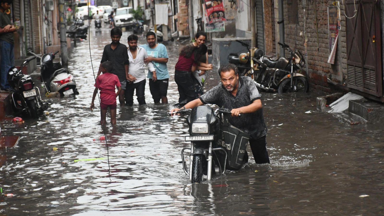 People cross a waterlogged road, at Clock Tower chowk in Ludhiana on Sunday. ( Express Photo by Gurmeet Singh)
The southwest monsoon advanced in northern Punjab on Sunday — entering Pathankot district — bringing the much-needed relief from summer heat, the weather department said. Every year, the monsoon usually enters the state between June 27 and 28.
“Monsoon has advanced in parts of Punjab… Conditions are favourable for its further advancement in parts of Haryana, including Chandigarh, over the next two days,” Chandigarh Meteorological Department Director Surinder Pal said.
Currently, the northern limit of monsoon (NLM) is passing through parts of Himachal Pradesh, Uttarakhand, Uttar Pradesh, Rajasthan, and Jammu and Kashmir, with a notable coverage in Pathankot, Shimla, Dehradun, Agra, Jaipur, and Jammu, the department said.
There was an “organise alert” in Pathankot, Gurdaspur, and Hoshiarpur for heavy rainfall on Sunday morning, along with an “orange alert” for Ludhiana, Nawanshahr, Patiala, Fatehgarh Sahib, and Sangrur district in the evening.
In Punjab, “heavy” to “very heavy” rain is expected at isolated locations until June 26, with the most intense downpour likely the previous day.
Thunderstorms and lightning may occur at several places across the state through the week.
Most rain is predicted in Pathankot, Gurdaspur, Hoshiarpur, Nawanshahr, Rupnagar, Patiala, and SAS Nagar; “moderate” in Amritsar, Kapurthala, Jalandhar, Ludhiana, Sangrur, and Fatehgarh Sahib; and scattered in Tarn Taran, Ferozepur, Moga, Faridkot, Muktsar, Fazilka, Bathinda, Barnala, and Mansa.
Story continues below this ad
In Haryana, thunderstorms with “moderate” rain are likely in Kaithal, Narwana, Tohana, Kalayat, Ratia, Guhla, Pehowa, Shahabad, and Ambala; “light” in parts of Hisar, Fatehabad, Karnal, Sirsa, and Panchkula. “Heavy” rain may occur at isolated places on June 23, 24, 26, and 27, along with “very heavy” downpour on June 25.
In Chandigarh, a partly cloudy sky is expected through the week with intermittent thunderstorms and rain, especially “heavy” downpour on June 24 and “light” to “moderate” from June 23-26.
Amid increased cloud cover and rain, a noticeable drop of three to four degrees Celsius in maximum temperatures is expected across the region over the next three days, the weather department said.
A cyclonic circulation over northeast Rajasthan continues to influence the monsoon movement.
Story continues below this ad
An east-west trough is extending from north Punjab to Bihar, interacting with an upper air system and a low-pressure area over southeast Uttar Pradesh, said the IMD, while issuing an advisory that “isolated areas across Punjab, Haryana, and Chandigarh may witness thunderstorms, lightning, and localised flooding due to heavy rain”.
The authorities and residents are advised to stay updated with district-wise alerts, as well as exercise caution, especially during intense rain.
Meanwhile, the early arrival of monsoon is said to be “good for Punjab, where paddy is being transplanted across huge areas”.
Advertisement
Top Stories


Live Blog
Loading Taboola...
Advertisement