
 Rainfall is expected to cause waterlogging in parts of the national capital today.( Express Photo by Tashi Tobgyal)
Prime Minister Narendra Modi Monday stressed upon the need of a better coordination between all the central and state agencies to have a permanent system for forecasting of floods, PTI reported. He also underlined the extensive use of innovative technologies for improving the forecast and warning system. PM Modi made these remarks during a virtual meeting with the chief ministers of six states to review the flood situation in various parts of the country.
The Indian Meteorological Department has predicted heavy rainfall at isolated places in the national capital on Monday. This is expected to cause traffic disruptions and waterlogging across the city and its surrounding areas. Starting early Monday, Delhi-NCR can expect an intense spell of 40-50mm. In some places, the rain intensity could go over 65mm.
Parts of North India including Delhi, Chandigarh, Haryana will experience moderate to severe thunderstorms and lightning today. During the next 24 hours, Kerala, Mahe and Southern Karnataka will also experience heavy to very heavy rainfall.
Due to a low pressure area formed over parts of Bay of Bengal, Maharashtra will experience heavy rainfalls today while widespread showers are likely over Odisha during the next 5 days. An “orange warning” has been issued for some districts in Odisha on Monday and Tuesday.
 Heavy rainfall within a short duration, a recurring monsoon woe, has put to test the city’s existing drainage system that can drain up to 50 mm water per hour. (PTI)
Prime Minister Narendra Modi Monday stressed upon the need of a better coordination between all the central and state agencies to have a permanent system for forecasting of floods, PTI reported. He also underlined the extensive use of innovative technologies for improving the forecast and warning system. PM Modi made these remarks during a virtual meeting with the chief ministers of six states to review the flood situation in various parts of the country.
According to preliminary estimates, loss due to torrential rains and floods in several parts of Karnataka so far is to the tune of Rs 3,500-4,000 crore and the state government will seek immediate relief from the Centre, Revenue Minister R Ashoka said on Monday. In the absence of Chief Minister B S Yediyurappa, who is undergoing treatment for COVID, Ashoka along with Home Minister Basavaraj Bommai is attending the video conference chaired by Prime Minister Narendra Modi regarding the flood situation in several parts of the country. (PTI)
Heavy rainfall occurred at isolated places in Uttar Pradesh in the last 24 hours, the meteorological department here said on Monday. The chief amount of rainfall on Sunday was recorded in Nighashan (Lakhimpur Kheri) with 18 cm, Kayamganj in Farrukhabad with 11 cm, Shardanagar (Lakhimpur Kheri) and Muzaffarnagar with 10 cm each, Kaisherganj in Bahraich and Puranpur in Pilibhit with 7 cm each, Hathras (Mahamayanagar) and Badaun with 5 cm each, the department said. (PTI)
Pune and its neighbouring areas are likely to experience light to moderate rainfall this week, even though heavy spells are expected at isolated places along the ghat areas.
Officials at India Meteorological Department (IMD) said rainfall activity over Madhya Maharashtra and Marathwada will be less in comparison to last week, whereas rainfall will continue over parts of Konkan. Vidarbha will see some showers this week due to favourable weather systems approaching Central India’s regions.
A fresh low-pressure area is likely to trigger heavy rainfall in most parts of Odisha in the next five days, the weather office in Bhubaneswar said, prompting the state government to direct district administrations to remain prepared.Forecasting strong surface winds with speeds reaching up to 40-50 kmph over west-central Bay of Bengal, the weather office advised fishermen to refrain from venturing into deep sea till Tuesday.
The weather office issued 'Orange Warning' on Monday and Tuesday in the districts of Malkangiri, Koraput, Nawarangpur, Kalahandi, Gajapati, Rayagada and Bolangir where heavy to very heavy rainfall is likely at some places.On Tuesday, heavy rainfall is likely at some places in Bargarh, Nuapada, Bolangir, Kandhamal, Kalahandi, Nawarangpur and Koraput districts where the Met has issued a yellow warning.
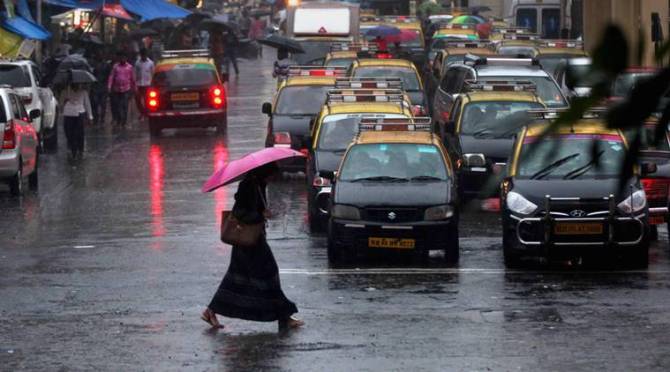
Maharashtra will see heavy to very heavy rainfall in parts of the state due to a low pressure area formed over north-west and adjoining west-central Bay of Bengal, the IMD said. Heavy rainfall is likely at some places in the Western Ghat sections of central Maharashtra and the coastal region of the state starting Sunday. Mumbai and other parts of the western coast would witness strong winds with speed reaching up to 50 to 60 km per hour. (PTI inputs)
As rains continue to lash in most parts of Kerala and heavy rainfall has been predicted for the state today, the weather department said that this continues intensity of rainfall is likely to reduce from Tuesday.
The IMD has issued a red alert of extremely heavy rainfall in Kasaragod, Kannur, Wayanad, Kozhikode, Malappuram and Alappuzha districts today.
Following moderate rainfall over the last three days in their catchment areas, water stock in the seven lakes supplying water to the city has reached 50.53 per cent of its total capacity, up from 37.26 per cent on August 5. In view of the low water stock, the civic body had implemented a 20 per cent water supply cut since August 5.
A total of 191,976 million litres of water, which means water supply worth one-and-a-half months, was added to the seven lakes following the incessant and heavy rainfall along the west coast, including Mumbai and Thane. (Read Sanjana Bhalerao's report here)
Heavy to heavy rainfall over Himachal Pradesh, Uttarakhand, North Punjab, West Uttar Pradesh, East Rajasthan, East Madhya Pradesh, Odisha, Coastal & South interior Karnataka and Kerala.
Heavy rainfall at isolated places over Jammu & Kashmir, Ladakh, Haryana, Chandigarh & Delhi, East Uttar Pradesh, West Rajasthan,West Madhya Pradesh, Vidarbha, Bihar, West Bengal & Sikkim, Arunachal Pradesh, Assam & Meghalaya, Nagaland, Manipur, Mizoram & Tripura, Konkan & Goa, Coastal Andhra Pradesh & Yanam,Telangana and North Interior Karnataka.