© IE Online Media Services Pvt Ltd
Latest Comment
Post Comment
Read Comments

 Attempt a question on the 2004 Indian Ocean tsunami in today's answer writing practice. (AP Photo)
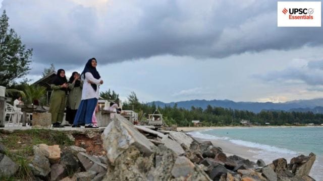
UPSC Essentials brings to you its initiative for the practice of Mains answer writing. It covers essential topics of static and dynamic parts of the UPSC Civil Services syllabus covered under various GS papers. This answer-writing practice is designed to help you as a value addition to your UPSC CSE Mains. Attempt today’s answer writing on questions related to topics of GS-1 to check your progress.
The Ken-Betwa Link Project is a big step forward in India’s efforts to interlink rivers and ease water scarcity in the Bundelkhand region. Discuss.
The 2004 Indian Ocean tsunami highlighted the need for strong early warning systems in disaster-prone areas. Discuss.
Introduction
— The introduction of the answer is essential and should be restricted to 3-5 lines. Remember, a one-liner is not a standard introduction.
— It may consist of basic information by giving some definitions from the trusted source and authentic facts.
Body
— It is the central part of the answer and one should understand the demand of the question to provide rich content.
— The answer must be preferably written as a mix of points and short paragraphs rather than using long paragraphs or just points.
— Using facts from authentic government sources makes your answer more comprehensive. Analysis is important based on the demand of the question, but do not over analyse.
— Underlining keywords gives you an edge over other candidates and enhances presentation of the answer.
— Using flowcharts/tree-diagram in the answers saves much time and boosts your score. However, it should be used logically and only where it is required.
Way forward/ conclusion
— The ending of the answer should be on a positive note and it should have a forward-looking approach. However, if you feel that an important problem must be highlighted, you may add it in your conclusion. Try not to repeat any point from body or introduction.
— You may use the findings of reports or surveys conducted at national and international levels, quotes etc. in your answers.
Self Evaluation
— It is the most important part of our Mains answer writing practice. UPSC Essentials will provide some guiding points or ideas as a thought process that will help you to evaluate your answers.
QUESTION 1: The Ken-Betwa Link Project is a big step forward in India’s efforts to interlink rivers and ease water scarcity in the Bundelkhand region. Discuss.
Note: This is not a model answer. It only provides you with thought process which you may incorporate into the answers.
Introduction:
— The Ken-Betwa Link Project (KBLP) envisions moving water from the Ken to the Betwa rivers, both of which are tributaries of the Yamuna.
— The Ken-Betwa Link Canal will be 221 km long, including a 2-kilometer tunnel. According to the Jal Shakti Ministry, the project will provide yearly irrigation to 10.62 lakh hectares (8.11 lakh ha in MP and 2.51 lakh ha in UP), supply drinking water to about 62 lakh people, and create 103 MW of hydropower and 27 MW of solar power.
Body:
You may incorporate some of the following points in your answer:
— The Ken-Betwa Link Project comprises two phases. Phase I will comprise the construction of the Daudhan Dam complex and its component units, including the Low Level Tunnel, High Level Tunnel, Ken-Betwa Link Canal, and power plants. Phase II will include three components: Lower Orr Dam, Bina Complex Project, and Kotha Barrage.
— The notion of joining the Ken and the Betwa received a significant boost in August 2005, when the Centre and the two states signed a tripartite memorandum of understanding for the creation of a detailed project report (DPR). In 2008, the Centre designated the KBLP as a National Project. Later, it was added to the Prime Minister’s package for the development of the drought-prone Bundelkhand region.
— The project is in Bundelkhand, which includes 13 districts in Uttar Pradesh and Madhya Pradesh. According to the Jal Shakti Ministry, the project will greatly assist the water-stressed region, particularly the districts of Panna, Tikamgarh, Chhatarpur, Sagar, Damoh, Datia, Vidisha, Shivpuri, and Raisen in Madhya Pradesh, and Banda, Mahoba, Jhansi, and Lalitpur in Uttar Pradesh.
— “It will pave the way for more river interlinking projects to ensure that scarcity of water does not become an inhibitor for development in the country,” according to a press release from the Ministry.
Conclusion:
— The river-linking project has come under considerable examination for its possible environmental and socioeconomic impact. The project will involve extensive deforestation in the heart of the Panna National Park and Tiger Reserve.
— PM Modi recently laid the foundation stone for the Daudhan Dam. Daudhan Dam is 2,031 metres long, with 1,233 metres being earthen and the remaining 798 metres being concrete. The dam’s height will be 77 meters. According to the Jal Shakti Ministry, the project will sink around 9,000 hectares of land, affecting ten communities.
— It is the first project under the National Perspective Plan for River Interlinking, which was created in 1980. This plan includes 16 projects under its peninsular component, including the KBLP. Aside from this, 14 linkages are envisioned in the Himalayan Rivers Development Plan.
Points to Ponder
Other river linking projects in India
What are the project’s likely environmental and social impacts?
Related Previous Year Questions
The interlinking of rivers can provide viable solutions to the multi-dimensional inter-related problems of droughts, floods, and interrupted navigation. Critically examine. (2020)
(a) Bring out the causes for more frequent occurrences of landslides in the Himalayas than in the Western Ghats. (b) There is no formation of deltas by rivers of the Western Ghats. Why? (2013)
QUESTION 2: The 2004 Indian Ocean tsunami highlighted the need for strong early warning systems in disaster-prone areas. Discuss.
Note: This is not a model answer. It only provides you with thought process which you may incorporate into the answers.
Introduction:
— The tsunami created by the 2004 Sumatra-Andaman earthquake of magnitude 9.3 was principally caused by vertical displacement of the seafloor due to slip on the inter-plate thrust fault.
— The earthquake and tsunami in the Indian Ocean impacted several Southeast Asian and other countries, including Indonesia, Sri Lanka, India, Thailand, the Maldives, Somalia, Myanmar, Malaysia, Seychelles, and more.
— When one plate is forced to sink beneath another, the only way to do it is with some vertical motion, which creates a tsunami.
Body:
You may incorporate some of the following points in your answer:
— It was the deadliest natural disaster of the 21st Century and one of the deadliest in recorded history.
— The inadequate capabilities of early warning systems contributed to the tsunami’s massive destruction. According to Euronews, the tsunami risk was minimal in Indonesia, one of the worst-hit countries. There was no data on sea surface levels in the region. As a result, experts were unable to “see” the wave.
— However, over the last 20 years, much has been done to address the situation. There are various early warning systems in the region presently, and their capabilities have significantly improved. According to a World Meteorological Organisation (WMO) research, these technologies can cut damages by as much as 30% with just one day’s notice.
— Shortly after the disaster struck, the United Nations took the initiative to improve preparedness in vulnerable countries like Indonesia. Today, international institutions and countries monitor earthquakes around the world 24 hours a day.
— “There are currently approximately 150 stations in the global network. Deep-ocean Assessment and Reporting of Tsunamis, or DART buoys, monitor pressure changes on the seafloor to determine whether a tsunami has occurred, according to EuroNews.
— Several technological advancements have also occurred. For example, improved algorithms in early warning systems have allowed information to be transmitted considerably faster. Faster supercomputers have resulted in faster modelling.
Conclusion:
— Although nations such as Indonesia have deployed more and better early warning systems to mitigate the effects of natural catastrophes, more than half of the world’s countries still lack adequate early warning systems, even for common phenomena like as rainfall or cyclones.
— These are largely developing countries where natural catastrophes have a disproportionately high impact—”climate-related disasters cause fifteen times more deaths compared to other parts of the world,” according to the UN.
(Source: How the 2004 tsunami changed early warning systems, ndma.gov.in)
Points to Ponder
How are tsunamis formed?
Read about other natural disasters
Related Previous Year Questions
What is sea surface temperature rise? How does it affect the formation of tropical cyclones? (2024)
On December 2004, tsunami brought havoc on fourteen countries including India. Discuss the factors responsible for occurrence of tsunami and its effects on life and economy. In the light of guidelines of NDMA (2010) describe the mechanisms for preparedness to reduce the risk during such events. (2017)
UPSC Essentials: Mains answer practice — GS 1 (Week 81)
UPSC Essentials: Mains answer practice — GS 1 (Week 82)
UPSC Essentials: Mains answer practice — GS 2 (Week 82)
UPSC Essentials: Mains answer practice — GS 2 (Week 83)
UPSC Essentials: Mains answer practice — GS 3 (Week 82)
UPSC Essentials: Mains answer practice — GS 3 (Week 83)
Subscribe to our UPSC newsletter and stay updated with the news cues from the past week.
Stay updated with the latest UPSC articles by joining our Telegram channel – IndianExpress UPSC Hub, and follow us on Instagram and X.

Read UPSC Magazine