


© IE Online Media Services Pvt Ltd
Tags:
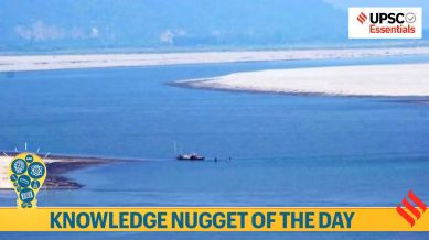
Take a look at the essential events, concepts, terms, quotes, or phenomena every day and brush up your knowledge. Here’s your UPSC current affairs knowledge nugget for today on Brahmaputra River and China’s Dam over it.
China on Saturday formally started the construction of the USD 167.8 billion dam over the Brahmaputra River in Tibet, closer to the Indian border in Arunachal Pradesh. It has raised concerns in the lower riparian countries, India and Bangladesh. In this context, let’s know about the Brahmaputra River and China’s dam over it.
1. Chinese Premier Li Qiang announced the start of the construction of the dam at a ground-breaking ceremony in the lower reaches of the Brahmaputra river, locally known as Yarlung Zangbo, at Nyingchi City, official media reported.
2. The hydropower project, regarded as the biggest infrastructure project in the world, will consist of five cascade hydropower stations, with a total investment estimated at around 1.2 trillion Yuan (about USD 167.8 billion), the report said.


3. Notably, at present, the Three Gorges Dam on the Yangtze River in China is the world’s largest dam with an installed capacity of 22.5 gigawatts. The location of Beijing’s planned dam near the “Great Bend” of the Yarlung Tsangpo (or Zangbo) river in Tibet is suitable for hydropower generation due to the deep slope, where the river drops 2,000 meters over a short distance of just 50 kilometers.
1. The location of the proposed Chinese dam, where the Brahmaputra river makes a sharp U-turn to flow into Arunachal Pradesh and then to Bangladesh (where the river is known as Jamuna), poses a risk of disrupting the river’s natural flow.


2. It could affect agricultural productivity (for crops like rice and jute) and biodiversity hotspots such as the Eastern Himalayas.
3. Although China is emphasising the importance of this project in achieving its renewable energy goals, lower riparian states – India and Bangladesh – are susceptible to its impact on the river’s water flow, ecological stability, and regional geopolitics.
1. The Brahmaputra is a transboundary river with its basin spreading approximately 5,80,000 square kilometers across China (50.5%), India (33.3%), Bangladesh (8.1%) and Bhutan (7.8%).
2. In India, it covers 1,94,413 square kilometers, which is about 5.9% of the country’s total geographical area. It encompasses areas of Arunachal Pradesh, Assam, Meghalaya, Nagaland, Sikkim and West Bengal.
3. The river originates from Chemayungdung Glacier located in the east of the Mansarovar Lake in the Kailash ranges of Tibet. It flows eastward for nearly 1,200 kilometers in Tibet as the Yarlung Tsangpo River.
4. At Namcha Barwa, the river takes a ‘U’ turn, known as the Great Bend, and enters India through Arunachal Pradesh (west of Sadiya town), where it is known as the Siang/Dihang River.

5. After flowing southwest, it is joined by the Dibang and Lohit rivers as left-bank tributaries and subsequently, it is known as the Brahmaputra River.
6. Important right-bank tributaries of the Brahmaputra are Subansiri (antecedent), Kameng, Manas and Sankosh rivers. The river then flows into Bangladesh plains near Dhubri in Assam, from where it flows southwards.

7. It is known as Jamuna in Bangladesh after Teesta joins it from the right bank. It merges with river Padma before draining into the Bay of Bengal.
8. Notably, all tributaries of Brahmaputra River in India are rainfed and receive heavy precipitation during the southwest monsoon. This heavy precipitation causes frequent floods, channel shifting and bank erosion.
9. The gradient of the river provides a suitable geographic condition for hydroelectricity generation. The river experiences a drop of about 4,800 meters in its slope during its 1,700 kilometers course in Tibet before entering India. This steep mean slope of about 2.82 m/Km is reduced to 0.1m/Km when it enters Assam Valley.
The Brahmaputra River is unique in the sense that it flows in diametrically opposite directions like from west to east in Tibet and east to west in Assam. Moreover, meteorological conditions of the Brahmaputra River’s catchment are very different in Tibet and India. In its early course in Tibet, the river passes through very cold and dry regions carrying less water and silt. But in India, it is joined by several tributaries bringing huge volumes of silt and a large volume of water. Due to the deposition of this silt, the river channel becomes braided even forming riverine islands. Majuli is the world’s largest riverine island formed by the Brahmaputra River in Assam.
1. “There is an umbrella Memorandum of Understanding on cooperation on transboundary rivers, and two separate MoUs on the Brahmaputra and Sutlej,” Ashok Kantha, a former Indian Ambassador to China, said.
2. The need for the Sutlej MoU was felt after the Parechu incident — however, China did not agree to round-the-year provision of data, and the MoU is currently pending renewal.
3. The Brahmaputra MoU, renewable every five years, lapsed in 2023. The renewal process is ongoing through diplomatic channels, the Jal Shakti Ministry says on its website.
4. The umbrella MoU was signed in 2013, and has no expiry date. But at present, there is “no activity being undertaken under this MoU”, says the Ministry’s website. An Expert Level Mechanism set up in 2006 provided for annual meetings between the two sides, but the process has seen interruptions.
5. Within these limited avenues of cooperation, the 1997 United Nations Convention on the Law of the Non-Navigational Uses of International Watercourses can play a role.
Which among the following are the right-bank tributaries of the Brahmaputra river?
1. Subansiri
2. Kameng
3. Manas
4. Lohit
5. Sankosh
Select the correct answer using the codes given below:
(a) 1, 2, 3 and 4 only
(b) 2, 3 and 5 only
(c) 1, 3, 4 and 5 only
(d) 1, 2, 3 and 5 only
| Answer key |
| (d) |
(Sources: China begins construction of world’s biggest dam over Brahmaputra in Tibet, How China’s Brahmaputra dam raises serious concerns,Why China is building the world’s largest dam on the Tsangpo)
Subscribe to our UPSC newsletter. Stay updated with the latest UPSC articles by joining our Telegram channel – Indian Express UPSC Hub, and follow us on Instagram and X.
🚨 Click Here to read the UPSC Essentials magazine for July 2025. Share your views and suggestions in the comment box or at manas.srivastava@indianexpress.com🚨


