© IE Online Media Services Pvt Ltd

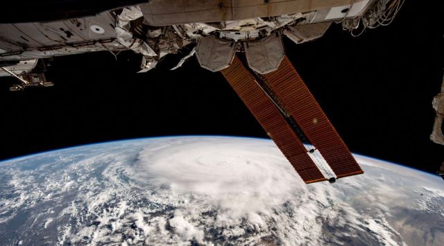 This image of Cyclone Biparjoy developing over the Arabian Sea were taken from the International Space Station. (Image credit: Sultan Al Neyadi via Twitter)
 Cyclone Biparjoy is battering Kutch hours after it made landfall on the Indian subcontinent. Before the cyclone’s arrival on Indian land, UAE astronaut Sultan Al Neyadi yesterday shared some images of the cyclone taken from the International Space Station.
Al Neyadi saidthe images and video shared by him on Twitter were taken more than two days earlier when the cyclone was forming in the Arabian Sea. Earlier this year, Al Neyadi made history as both the first Arab astronaut to go on a long-term space mission and the first Arab astronaut to go on a spacewalk.
As promised in my previous video 📸 here are some pictures of the cyclone #Biparjoy forming in the Arabian Sea that I clicked over two days from the International Space Station 🌩️ pic.twitter.com/u7GjyfvmB9
— Sultan AlNeyadi (@Astro_Alneyadi) June 14, 2023
Cyclone Biparjoy is a tropical cyclone that is expected to generate winds with speeds of between 125 and 135 kilometres per hour. It could cause storm surges of between two to three metres in height, the destruction of thatched houses, damage to pucca houses and roads, flooding, damage to crops, plantations and orchards, and disruption of railways and power systems in the northern and western coastal districts of Gujarat, according to India’s Regional Specialised Meteorological Centre (RSMC).
Watch as a tropical cyclone forms over the Arabian Sea from these views I captured.
The ISS provides a unique perspective on several natural phenomena, which can assist experts on Earth in weather monitoring.🌩️🌀
Stay safe, everyone! pic.twitter.com/dgr3SnAG0F
— Sultan AlNeyadi (@Astro_Alneyadi) June 13, 2023
Tropical cyclones like Biparjoy are low-pressure wind systems that form over warm tropical waters. They often dissipate after moving over land or over cooler oceans.
When warm tropical oceans have high sea surface temperatures, clusters of thunderstorms can develop over them. If these clusters continue in an area of low pressure, they can start rotating. And with the right conditions, the clusters can get bigger and bigger and sustain themselves while developing into a tropical cyclone.