Journalism of Courage


AFEW years ago, there was a story in the Assam Tribune from Arunachal Pradesh with the intriguing headline 8216;Dindu Miri: The man who came in from China.8217; An ethnic Idu, Miri was born in 1946 in a village in what was then the North-East Frontier Agency NEFA and educated in China from 1955. In 1963, a year after the China war, he returned to NEFA from Beijing.
Referring to the Tibet region, he recalls China in those days to be nearer his village than any part of India. It was a four-day walk from the Agula Pass in the Dri Valley to Bapa village in Tibet where there was a community of fellow Idu tribesman. From Bapa he could cross to 8216;8216;Rohlipo, a day8217;s walk, Alepo a three-hour walk and then a day8217;s walk to reach Beijing8217;8217;8212;presumably referring to the place from where he could find transportation to Beijing.
After finishing his education, Miri worked for the Chinese government as a 8216;political interpreter8217;. He held that job during the 1962 war. 8216;8216;Our brigadier,8217;8217; he says, 8216;8216;asked me to lead the Chinese troops towards Indian posts because I knew the routes to India.8217;8217;
In 2000 Miri was still working as a 8216;political interpreter8217;. But his employer had changed: it was now the Indian government.
Miri remembers the days when he and other members of his community could meet their kinsmen across the border; now they stay in touch through 8216;8216;secret messengers8217;8217;.
The story evokes an era when the territory between India and China was still a vague frontier. That era came to a violent end in 1962.
But Miri8217;s story is not unique. Border-crossings do not stop abruptly when frontiers get marked neatly on modern maps. The hidden geographies of 8216;illegal8217; movements continue.
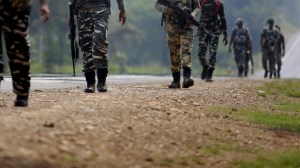
| Far from Kaman Bridge and Karvan-e-Aman, a road waits to open up on another border. As Premier Wen Jiabao begins his visit, a 8216;Black and White8217; focus on India, China and tomorrow8217;s world |
Thus, some anthropologists believe, Kachins8212;they are known as Kachin in Upper Myanmar, but as Singpho in Assam and Arunachal Pradesh, and Jingpo in Yunnan, China8212;still share social bonds, kinship networks and a lingua franca.
Modern national maps and border disputes must appear rather strange to these peoples. It is hard not to sympathise with that view. After all, in a 50-km radius in this region, as Dutch historian Willem van Schendel points out, there are four settlements that are part of three sovereign states and four different world regions: Gohaling in Yunnan is part of 8216;East Asia8217;, Sakongdan in Myanmar is part of 8216;Southeast Asia8217;, Dong in Arunachal is part of 8216;South Asia8217; and Zayu in Tibet a part of 8216;Central Asia8217;.
Incidentally, Dong is advertised in Arunachali tourist brochures as the place where one can see India8217;s first sunrise. But Indian army forces are unlikely to let ordinary civilians go and enjoy it.
No one will represent the interests of these transborder communities in discussions between India and China, when the mandarins of national security of the two countries decide if the time has arrived to settle the border dispute.
But it is not hard to guess where these transborder communities will stand. The Home Ministry has given its nod to the reopening of the Stilwell Road that links Assam to the old Burma Road and then to Kunming in China. The Ministry of External Affairs favours the idea though, reportedly, the Defence Ministry wants more troops in that sector.
While reopening the road is expected to bring substantial trade benefits, the Kachins that live along this road have another reason to celebrate. They can now look forward to a day when they will be able to drive across the border8212;hopefully with legal border passes8212;instead of trekking across the mountains 8216;illegally8217; to meet their kinsmen.
The author is visiting professor, Centre for Policy Research, New Delhi, and author of Durable Disorder: Understanding the Politics of Northeast India, OUP, 2005