Stay updated with the latest - Click here to follow us on Instagram
© IE Online Media Services Pvt Ltd

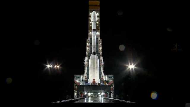 GSLV-F16 - Post Integration, reaching Its Last Pre-Launch Position. (Photo:/Videograb/X@ISRO)
An earth observation satellite NISAR, jointly developed by NASA and ISRO, is set to be launched on Wednesday (July 30) at 5.40 pm from the country’s only spaceport in Sriharikota, Andhra Pradesh.
Weighing 2,392 kg, NISAR — which stands for NASA-ISRO Synthetic Aperture Radar — is a one-of-its kind earth observation satellite and will be the first one ever to observe the Earth in two frequencies — NASA’s L-band and ISRO’s S-band. “Each system’s signal is sensitive to different sizes of features on Earth’s surface, and each specialises in measuring different attributes, such as moisture content, surface roughness, and motion,” said NASA. Putting two radar systems on a single satellite is a unique engineering feat because the two systems require different sets of hardware, and yet have to function in a complementary fashion without interfering with one another. Costing around USD 1.5 billion, it is the most expensive earth observation satellite in the world, with ISRO contributing Rs 469.4 crores for the satellite.
The satellite will be launched on the GSLV-F16 and be put in a 734 km sun synchronous orbit — an orbit in which the satellite reaches over a place at the same time each day.
The satellite will scan the entire globe every 12 days, proving a series of very detailed images of the Earth’s surface. NISAR will provide an unprecedented view of the planet.
With two radar systems in place, the satellite would be able to provide very high-resolution data, in all types of weather conditions, and both during the day and the night. The satellite is powerful enough to capture changes as small as one centimetre in size during its repeated observations over the same terrain.
It will therefore be able to study the dynamic processes happening on Earth’s surface, like retreat of glaciers, movement of sea ice, the path of a storm, changes in vegetation and forest cover, and even the movements during earthquakes and volcanoes. Scientists expect this satellite to provide new insights into our understandings of processes like climate change or natural hazards and better prepare for them.
It can also help with practical applications such as tracking the changes in soil moisture or mapping surface water levels.
“The satellite will benefit India, the US and the entire world… it is also crucial for monitoring earth’s natural resources,” ISRO chairman V Narayanan added.
There have been several delays in NISAR’s launch, with the last year’s scheduled launch getting postponed after technical issues. There was a need to fix the one of the key components of the satellite — a 12-metre unfurlable antennae — for which the satellite was shipped back to the United States.
Stay updated with the latest - Click here to follow us on Instagram