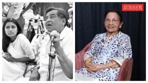

Sunanda Mehta is the Resident Editor of The Indian Express in Pune. She is a distinguished journalist, columnist, and author with over three decades of experience in the media industry. Educational background: A merit-lister in her 12 th in CBSE (5th rank in Humanities) Sunanda stood first in History in the Board for which she was awarded the Dr Tarachand Gold Medal. She is a triple-graduate with a Bachelor of Arts (History Honours) from Lady Shri Ram College, New Delhi, Bachelor of Education, Delhi University (on scholarship) and Bachelor of Communication and Journalism, University of Pune. Professional Background Role: As Resident Editor, she oversees the Pune edition of The Indian Express, managing local news coverage, investigative features, and editorial direction for the city. Author: She is an accomplished author, known for her biographies. Her notable books include: The Extraordinary Life and Death of Sunanda Pushkar published by Pan Macmillan (2019). The book was long-listed for the Atta Galatta award for nonfiction and Auther award for best debut author. Majestic Musings - Translation of poems from 100 year old Badshaian from Punjabi to English (2023) Behind the Big Screen- the untold stories of child actors published by Bloomsbury India (2024) Focus Areas: While Sunanda has reported on various subjects from civic to political to investigative and crime, her forte remains long-form human-interest stories, heritage and gender issues. Core Column: "Against All Odds" Sunanda curates and writes a signature series titled "Against All Odds," which profiles individuals who have overcome significant personal, medical, or professional challenges. Recent notable articles (2025) The Story of Dr. Harinder Dhaliwal (July 2025): A Pune AFMC topper who became a neurologist in Canada despite becoming paraplegic. Jayoo Patwardhan’s Cancer Journey (Jan 2025): How the National Film Award-winning designer defeated cancer. Partha Iyengar’s Emergency mid-air (Aug 2025): The story of how Gartner’s India head survived a massive heart attack during a long-haul flight. Recent Notable Articles (Late 2025) Her recent reportage continues to explore deep personal narratives and Pune’s socio-environmental landscape: 1. Personal Narratives & Closure "'I grieved for him 10 years after his murder, found closure to unsolved case'" (Dec 14, 2025): A poignant feature on Vineet Alurkar, son of the late Pune music legend Suresh Alurkar, and how digitizing his father’s collection helped him heal. "A 40-day journey home: how Christopher Benninger's partner gave him the gift of memories" (Nov 23, 2025): A moving tribute to the late acclaimed architect Christopher Benninger and his final trip to the US. "'After 38 years I finally met my biological mother'" (Sept 28, 2025): Chronicling the journey of an adopted daughter from Zurich searching for her roots in Pune. 2. Civic & Heritage "'Vetal Tekdi belongs to common citizens'" (Oct 20, 2025): An interview with environmental activist Dr. Sushma Date on the community-led protection of Pune’s vital green lungs. "'Military village' Apshinge recalls living through war days" (Aug 12, 2025): A report from a village in Maharashtra where nearly every household has a member in the armed forces, focusing on their legacy and current anxieties. 3. High-Profile Commentary & Investigations "Malegaon blast acquittals: 'I was expecting this verdict'" (July 31, 2025): An interview with former special public prosecutor Rohini Salian following the controversial acquittals. "Grounded, license cancelled... she decided to soar higher" (March 30, 2025): The story of Dr. Harpreet A De Singh, Air India’s first woman pilot from 1988, and her transition to leadership and meditation. Signature Style Sunanda Mehta is known for her empathetic storytelling. Unlike standard news reporting, her features often read like narrative non-fiction, focusing on the psychological and emotional resilience of her subjects. One of her articles in The Indian Express titled 'The Quality of Mercy' was converted into a film Rubaru Roshini produced by actor Aamir Khan. She is a strong advocate for Pune's heritage and environment, frequently using her platform to amplify citizen-led movements. X (Twitter): @sunandamehta and @ExpressPune ... Read More
- Tags:
- GPS