© The Indian Express Pvt Ltd

 The government has said that the map will be updated from time to time by the authorities. (Express Photo/File)
The Ministry of Civil Aviation has launched an airspace map of India for drone operations — allowing civilian drone operators to check the demarcated no-fly zones or where they need to undergo certain formalities before flying one.
This map has been developed by MapMyIndia and IT services firm Happiest Minds and is put up on the Directorate General of Civil Aviation’s (DGCA) digital sky platform.
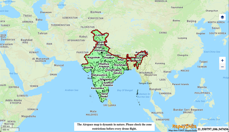 The airspace map of India showing the Green, Yellow and Red zones.
The interactive map shows red, yellow and green zones across the country. Green zone is the airspace up to 400 feet that has not been designated as a red or yellow zone, and up to 200 feet above the area located between 8-12 km from the perimeter of an operational airport.
Yellow zone is the airspace above 400 feet in a designated green zone, and above 200 feet in the area located between 8-12 km from the perimeter of an airport, and above ground in the area located between 5-8 km from the perimeter of an airport. The Yellow zone has been reduced from 45 km earlier to 12 km from the airport’s perimeter. Red zone is the ‘no-drone zone’ within which drones can be operated only after a permission from the Central government.
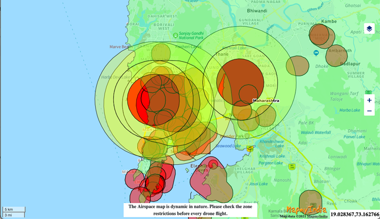 The airspace map of Maharashtra.
In green zones, no permission is required for operating drones with an all-up weight of up to 500 kg, while drone operations in yellow zone require permission from the concerned air traffic control authorities — which could be either the Airports Authority of India, the Indian Air Force, the Indian Navy, Hindustan Aeronautics Ltd, etc as the case may be.
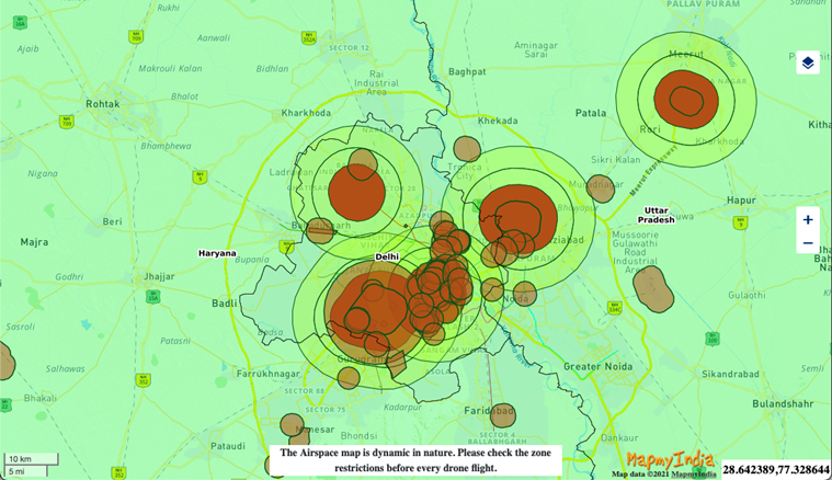 The airspace map of Delhi.
The map is available on DGCA’s digital sky platform (https://digitalsky.dgca.gov.in/home) and the government said that it may be updated and modified by authorised entities from time to time. “Anyone planning to operate a drone should mandatorily check the latest airspace map for any changes in zone boundaries,” the government has said.
Newsletter | Click to get the day’s best explainers in your inbox