© The Indian Express Pvt Ltd

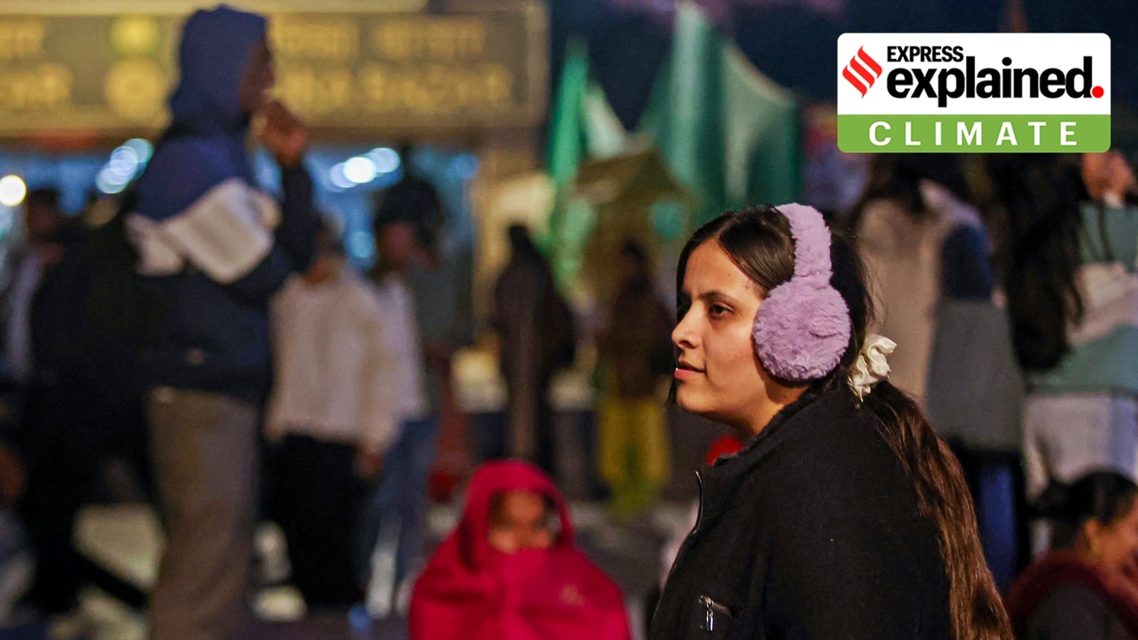 Delhi recorded its coldest morning this season on Thursday, as the minimum temperature dipped to 4.5°C at the Safdarjung monitoring station. (Express photo by Praveen Khanna)
Parts of north India, including Delhi, Haryana and Punjab, have witnessed cold temperatures in recent days, with the India Meteorological Department (IMD) issuing a yellow alert for a cold wave in Chandigarh until December 15.
Chandigarh’s average minimum temperature is 6.8 degrees Celsius, while its average maximum temperature is 24.8 degrees Celsius. On Wednesday (October 11), the city experienced its coldest night at 4.7°C, with the daytime temperature reaching 23.1°C.
Delhi also recorded its coldest morning this season on Thursday, as the minimum temperature dipped to 4.5°C at the Safdarjung monitoring station. A yellow warning has been issued here for Friday and Saturday.
Cold wave conditions across north India generally set in by mid-December and last until January. However, since December 8, cold wave and severe cold wave conditions have been observed, with significantly colder nights. We explain why, and the outlook for the next few days.
In the last three days, the maximum temperatures (which refer to daytime temperatures) have ranged between 20.5°C and 24.8°C, averaging around 22-23°C. These values are close to normal for this time of year. But the minimum temperatures have varied between 1.6°C and 11.4°C, averaging 5.4°C to 6.9°C in Punjab and 4.2°C to 9.1°C in Haryana.
In some areas, minimum temperatures have deviated by around 6.5°C to 4.7°C below normal. Also on Wednesday, Punjab’s Adampur recorded a minimum temperature of 1.8°C, while Bathinda registered a maximum temperature of 23.3°C. Similarly, in Haryana, Hisar recorded the state’s lowest temperature at 1.6°C. In Rajasthan, Fatehpur recorded the season’s lowest minimum temperature at minus 0.1°C Celsius, the weather office said on Friday.
Qualitatively, the IMD defines a cold wave as “a condition of air temperature which becomes fatal to the human body when exposed.” It has a severe impact on human health, varying from cough and cold, bronchitis and respiratory diseases, blood pressure issues and even bone, joint, and muscle pain due to lack of sunlight. Poor people and those who are homeless are greatly impacted, in particular.
In the plains, the IMD defines a cold wave as the minimum temperature being equal to or less than 10°C at a weather station or 4.5°C to 6.4°C below the normal temperature for that period. A cold wave may also be recorded when the minimum temperature is less than or equal to 4°C. For hilly regions, apart from the deviation from normal, a cold wave is declared when the minimum temperature is less than or equal to 0°C.
A severe cold wave is declared when the minimum temperature falls below 2°C or is recorded as more than 6.5°C below normal for that period, for plains.
The IMD attributes the early onset of the cold wave to several factors. Surinder Paul, Director of the IMD Chandigarh Office, explained that two western disturbances impacted the western Himalayan region and adjoining plains on December 8, moving eastward by December 9. Western disturbances are storms that originate in the Mediterranean region and bring winter rainfall to northwest India, as well as snowfall in the Himalayas.
Additionally, a strong subtropical westerly jet stream with winds up to 278 km/h has prevailed over northwest India for about a week, significantly affecting atmospheric conditions.
Prolonged dry weather over the last two months has further contributed to the early onset of cold conditions. Punjab and Haryana received only a fraction of their required rainfall, with Punjab recording just 18% of normal rainfall and Haryana only 4%. This lack of rainfall reduced soil moisture, intensifying the cooling effect during clear nights.
Early and heavy snowfall in the hills has also amplified cold conditions in the plains, as frigid air moves downward. Experts warn that such weather anomalies may become more frequent due to climate change.
According to the IMD, dry weather and clear skies, combined with the absence of foggy conditions, allow heat to escape rapidly during the night. Cold and dry northwesterly winds have further contributed to the drop in nighttime temperatures. In contrast, bright sunshine during the day facilitates warm weather.
“In previous years, daytime temperatures were more likely to drop significantly during cold waves. This year, nighttime temperatures are plummeting instead, creating a distinct pattern of colder nights and relatively warm days,” said Paul.
The IMD predicts that the region will continue to experience cold wave conditions, with severe cold wave conditions at isolated locations until at least December 15. Nighttime temperatures are expected to remain below normal if the dry weather and cold wind conditions continue.