© The Indian Express Pvt Ltd

 Cyclone Montha explained:
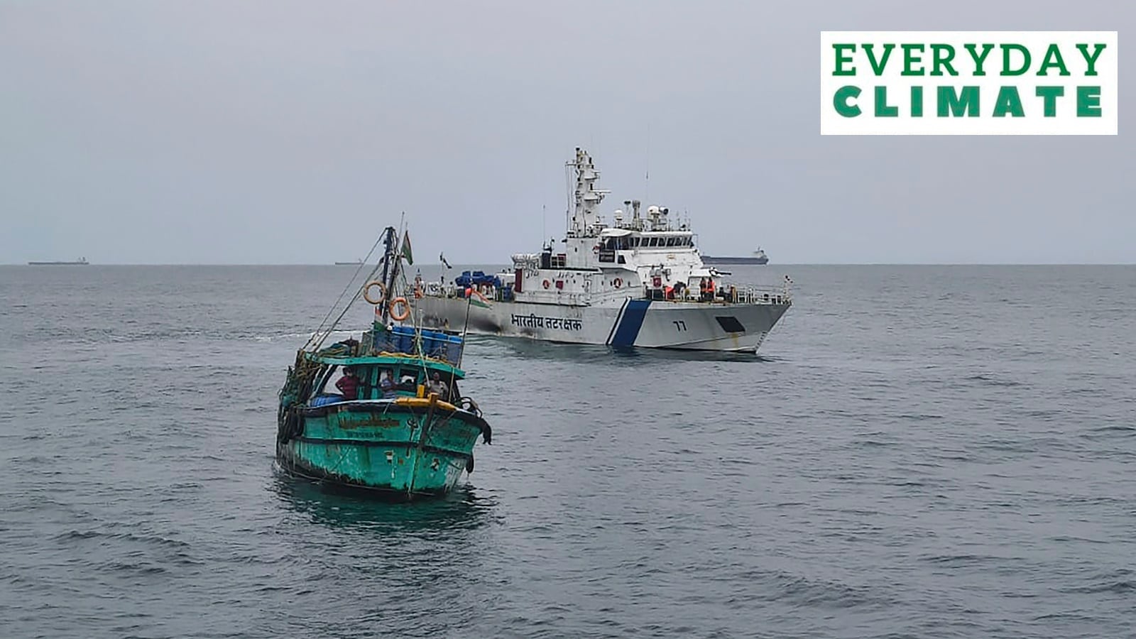
Indian Coast Guard personnel reach out to fishermen at sea, asking them to return to the shores amid possibility of a cyclone developing over southeast Bay of Bengal. (PIB Defence via PTI Photo)
Cyclone Montha explained:
Indian Coast Guard personnel reach out to fishermen at sea, asking them to return to the shores amid possibility of a cyclone developing over southeast Bay of Bengal. (PIB Defence via PTI Photo)Cyclone Montha explained: The Indian Meteorological Department (IMD) warned that a “Deep depression over the southeast Bay of Bengal is likely to intensify into a Cyclonic Storm” by Monday (October 27) and a Severe Cyclonic Storm by Tuesday. When it does hit the coast, it will be known as Cyclone Montha. It is expected to bring heavy to very-heavy rainfall over Rayalaseema, Tamil Nadu, Kerala, Mahe, coastal Karnataka, Telangana, Odisha and Chhattisgarh over the next few days.
Andhra Pradesh Chief Minister N Chandrababu Naidu on Saturday instructed officials to stay on high alert and ensure delivery of essential services. Here is all you need to know — how tropical storms are formed, why the Bay of Bengal witnesses them frequently, and why this storm has been named Cyclone Montha.
A cyclone is a large-scale system of air that rotates around the centre of a low-pressure area. It is usually accompanied by higher temperatures, violent storms and bad weather. As per the National Disaster Management Authority (NDMA), a cyclone is characterised by inward spiralling winds that rotate anticlockwise in the Northern Hemisphere and clockwise in the Southern Hemisphere.
It is also called a hurricane or typhoon in other parts of the world. India often witnesses tropical cyclones, known as such because they develop in the regions between the Tropics of Capricorn and Cancer. They are the most devastating storms on Earth. Such cyclones develop when “thunderstorm activity starts building close to the centre of circulation, and the strongest winds and rain are no longer in a band far from the centre,” the US National Oceanic and Atmospheric Administration (NOAA) website said.
The core of the storm turns warm, and the cyclone gets most of its energy from the “latent heat” released when water vapour that has evaporated from warm ocean waters condenses into liquid water. On the other hand, extratropical cyclones form outside of the tropic. They have “cold air at their core, and derive their energy from the release of potential energy when cold and warm air masses interact”, according to the NOAA.
As previously reported, the Bay of Bengal is prone to large storm surges, in part because of its funnel-like shape that concentrates atmospheric activity, and its unique topography.
An academic paper titled ‘Effect of landfall location and coastal topography on surge response in the Northern Bay of Bengal’, published in 2020, mentions that the destruction caused by storm surges also depends on the shape of the coastline. “A storm surge is highly dependent on local features and barriers that affect the flow of water. The Bay of Bengal has a complex coastal geometry, including estuary deltas, pocket-like bays, and straight coasts,” the paper says.
Another important factor is temperature. Warmer the water, more intense the cyclone, and the Bay of Bengal has generally recorded higher temperatures than the Arabian Sea. Although, due to climate change-related disruptions of late, the western coast of India is also witnessing more frequent and stronger cyclones.
Also, cyclonic disturbance — either in the form of a well-marked low pressure, depression or a deep depression (weather systems with varying wind intensities ranging from 31 – 61 km/hr formed either over sea or land) — are common in October. Ocean disturbances enter the Bay of Bengal from the South China Sea side and head towards the Indian coast. Generally, the IMD labels the formation of one cyclone and two cyclonic disturbances in October as normal.
In 2000, a group of nations called WMO/ESCAP (World Meteorological Organisation/United Nations Economic and Social Commission for Asia and the Pacific), which comprised Bangladesh, India, the Maldives, Myanmar, Oman, Pakistan, Sri Lanka and Thailand, decided to start naming cyclones in the region on a rotational basis. After each country sent in suggestions, the WMO/ESCAP Panel on Tropical Cyclones (PTC) finalised the list.
The WMO/ESCAP expanded to include five more countries in 2018 — Iran, Qatar, Saudi Arabia, United Arab Emirates and Yemen. The list of 169 cyclone names released by IMD in April 2020 were provided by these countries — 13 suggestions from each of the 13 countries.
Apart from helping the general public, naming cyclones helps the scientific community, the media, disaster managers etc. With a name, it is easy to identify individual cyclones, create awareness of its development, rapidly disseminate warnings to increase community preparedness. There are some conventions too, in that the name should be neutral to politics and political figures, religious beliefs, and cultures.