Journalism of Courage
Premium
This is an archive article published on February 7, 2019
Drone survey, geo-tagged sites and 3D map of city: Smart City to help PMC with hi-tech project planning
Conducted with the help of hi-tech elements such as a drone survey and geospatial technologies, the exercise will give civic departments the chance to plan infrastructure and utilities more efficiently and collaborate with each other more effectively.

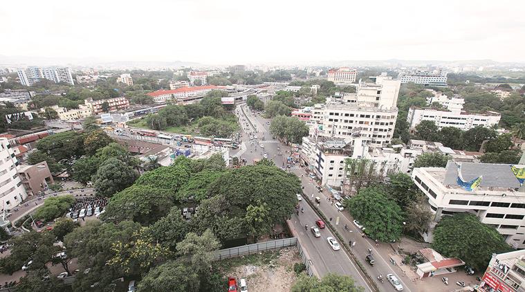 The 3D map will also have data about the integrated transport network in the city. (Express)
An exercise to prepare a detailed 3D map of Pune, with specific information about buildings, trees, roads, open spaces and gardens, among others, in all 15 municipal wards under the Pune Municipal Corporation (PMC) will be undertaken as part of the Pune Smart City project.
Conducted with the help of hi-tech elements such as a drone survey and geospatial technologies, the exercise will give civic departments the chance to plan infrastructure and utilities more efficiently and collaborate with each other more effectively.
In its proposal, the Pune Smart City Development Corporation Ltd has pointed out that new technologies such as 3D geographic information system (GIS) have transformed the way in which cities can be mapped and managed. The PSCDCL has proposed to make maximum use of GIS solutions” to capture, manage, store, and extract value from location-based information”.
The detailed 3D Map of Pune city, prepared on a common GIS platform, will not only identify city ‘assets’, it will also include details such as the height of buildings, location of properties, size of populations, and ownership of land plots, among others.
The map will help the civic body conduct studies to plan future projects such as installing solar rooftop panels and rainwater harvesting systems, analyse groundwater run-off and identify unauthorised construction.
The 3D map will also have data about the integrated transport network in the city, including railway lines, major road networks, footpaths and medians, among others. The map also aims to encompass information about municipal boundaries, tax zones, ward divisions and slum areas.
The exercise will not only integrate, verify and authenticate property data, it will also classify it in groups like commercial, retail, industrial, residential, public, religious and historical. The map will also include details of spaces such as open plots, playgrounds, gardens and water bodies. It will also map high-tension electric lines, electric poles, sub-stations, telecom network and tress census data.
Story continues below this ad
The exercise will also include a survey on the ground and geo-tagging of every piece of property, street and piece of land.

Advertisement
Top Stories


Live Blog
Loading Taboola...
Advertisement