
 Yesterday, the maximum temperatures went slightly up across states in North India. (File)
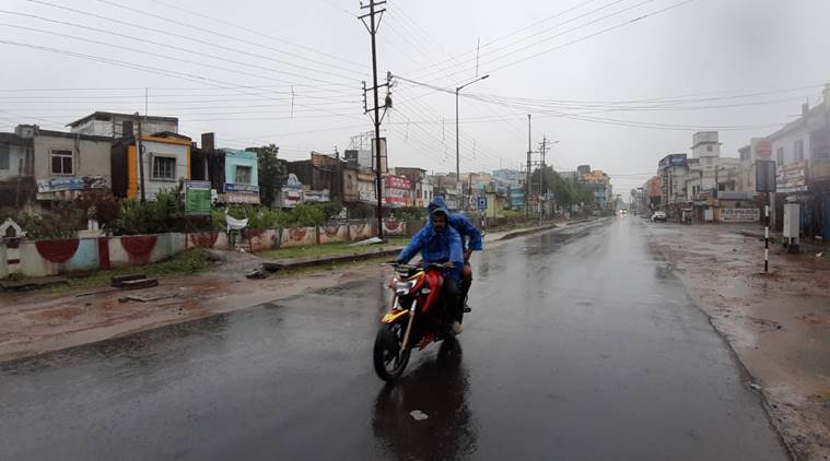
Weather Forecast highlights: A low pressure area over east central Bay of Bengal is now likely to form in the next 24 hours. Fairly widespread rainfall along with isolated heavy falls are expected over Odisha, north Coastal Andhra Pradesh, and Telangana between June 10 and June 12 and over Vidarbha, Chhattisgarh and south Madhya Pradesh between June 11 and June 13.
Parts of Maharashtra will experience the same weather conditions during the period of June 10 to 13th, the Indian Meteorological Dept. said Tuesday.
The low pressure area is likely to move west-northwest wards and become more marked during subsequent 24 hours.
The maximum temperatures across northwest and central India are likely to rise by 2-4 degrees in the next 2 to 3 days. Yesterday, the maximum temperatures went slightly up across states in North India but settled well below normal limits for the time of the year after isolated places in the region witnessed light rains.
No significant rise in the mercury levels is expected for the rest of the country during the next 3 to 4 days. Moreover, strong winds are expected over southwest and west-central Arabian Sea, south and east-central Bay of Bengal and off and along the Andhra Pradesh coast today. IMD has advised fishermen not to venture into the sea in these areas.
Meanwhile, during the next 24 hours, conditions are becoming favourable for further advance of Southwest Monsoon into some more parts of Central Arabian Sea, Goa, some parts of Konkan, some more parts of Karnataka, Rayalaseema, remaining parts of Tamilnadu, some parts of Coastal Andhra Pradesh, some more parts of Central and North Bay of Bengal and some parts of Northeastern.

Several places in Rajasthan witnessed a rise in maximum temperature on Tuesday, and Sriganganagar turned out to be the hottest place in the state recording 43.3 degrees Celsius, a MeT department official said. Bikaner recorded 43.2 degree Celsius, followed by Churu (43), Jaisalmer (42.8), Barmer (41.7), Kota (41.3), Jaipur (41), and Jodhpur (40.7). Ajmer recorded a high of 39.6 degrees Celsius. Dabok received 0.55 mm rainfall on Tuesday and recorded a maximum of 38 degrees Celsius. The MeT department has forecast thunderstorm/ lightning accompanied with gusty winds (with 30-40 kmph speed) to occur at isolated places in east Rajasthan. PTI
Temperatures in several places in north India, including Delhi, increased by a few notches on Tuesday, even as the southwest monsoon further advanced into more parts of west central and north Bay of Bengal. The mercury in the national capital was above the 40 degrees Celsius-mark. The Safdarjung Observatory, which provides representative figures for the city, recorded a maximum of 40.6 degrees Celsius. On Monday, it recorded a high of 37.6 degrees Celsius.
The weather stations at Palam and Lodhi Road recorded their respective maximum temperatures at 42 and 39.9 degrees Celsius. Humidity levels oscillated between 38 and 86 per cent in Delhi. The maximum temperatures in Haryana and Punjab rose by a few notches but the mercury settled near or below the normal limits at most places. Chandigarh, the common capital of the two states, recorded a high of 37.6 degrees Celsius, a notch below normal, according to the Meteorological (MeT) department here.
In Haryana, Ambala's maximum settled at 39.3 degrees Celsius, which was within the normal limits, while Karnal recorded a high of 37.4 degrees Celsius, two notches below normal. PTI
The mercury continued to remain over 40 degrees Celsius in several parts of Uttar Pradesh on Tuesday, the Met office said. Jhansi registered the highest temperature in the state with 42.5 degrees Celsius, the meteorological department said.
The maximum temperature in Lucknow was 39.9 degrees Celsius and the minimum was 27.4 degrees, the department said The mercury rose to 42 degrees Celsius in Allahabad, followed by 41.6 degrees in Agra, 41.5 degrees in Kanpur and 41.2 degrees Hamirpur.
Aligarh registered a maximum temperature of 40.8 degrees Celsius, while it was 40.3 degrees in Fursatganj and 40.1 degrees in Varanasi. Orai in Jalaun district and Sultanpur recorded a maximum of 40 degrees Celsius. The weather will most likely remain dry over the state, it added.
The maximum temperatures in Haryana and Punjab rose by a few notches on Tuesday but the mercury settled near or below the normal limits at most places. Chandigarh, the common capital of the two states, recorded a high of 37.6 degrees Celsius, a notch below normal, according to the Meteorological Department here.
In Haryana, Ambala's maximum settled at 39.3 degrees Celsius, which was within the normal limits, while Karnal recorded a high of 37.4 degrees Celsius, two notches below normal. Hisar had a hot day at 42 degrees Celsius but it was within the normal limits. Narnaul, which received light rainfall during the day, registered a high of 33.5 degrees Celsius, nine notches below normal.
Ludhiana in Punjab registered a maximum of 38.2 degrees Celsius, a notch below normal, while Patiala recorded a high of 38.7 degrees Celsius, also a notch below normal limits. Amritsar recorded a maximum temperature of 35.2 degrees Celsius, five notches below normal limits.
High waves in the range of 3 to 3.1 meters are forecasted during 23:30 hours on June 10 along the coasts of Southern Tamil Nadu from Kolachal to Dhanushkodi.
Andaman and Nicobar- In anticipation of squally weather with wind speed of 40-50kmph fishermen are advised not to venture in seas from tomorrow.
Andhra coast- Fishermen are advised not to venture into the sea along and off coastal Andhra Pradesh from June 9 to June 12.
Tamil Nadu and Puducherry coast- Fisherman advised not to venture from June 10 to June 11
Air quality across the country is likely to be in "Moderate Category" today, the Ministry of Earth Sciences(MoES) said Tuesday. Partly cloudy sky with wind speed of up to 20kmph and strong surface winds between 20 to 30 kmph will be felt during the day.
#Air & #WeatherUpdate – 9th June
As per AQ-EWS model, #AirQuality is likely to be in "Moderate Category". Generally #PartlyCloudySky with #windspeed up to 20kmph. Strong surface winds speed (20-30 kmph) during the day. @IMDWeather pic.twitter.com/m73UvEEyM6
— MoES GoI (@moesgoi) June 9, 2020
*Thunderstorm accompanied with lightning & gusty winds (speed reaching 30-40 kmph) ) very likely at isolated places over Andaman & Nicobar Islands, Odisha and Gangetic West Bengal and with lightning at isolated places over Vidarbha, Chhattisgarh, Sub-Himalayan West Bengal, Gujarat State, Assam & Meghalaya and Nagaland, Manipur, Mizoram & Tripura, Jharkhand, Arunachal Pradesh, Coastal Andhra Pradesh & Yanam, Telangana and Rayalaseema.
*Heavy showers at isolated places likely over Odisha, Andaman & Nicobar Islands, Coastal Andhra Pradesh & Yanam, Kerala & Mahe, Assam & Meghalaya and Nagaland, Manipur, Mizoram & Tripura.
*Strong wind (wind speed reaching 45-55 kmph) very likely over Southwest & Westcentral Arabian Sea, South and Eastcentral Bay of Bengal
* Squally weather (wind speed reaching 40-50 kmph) along & off Andhra Pradesh coast. Fishermen are advised not to venture into the sea over these areas.
*Mercury dropped in the national capital- The mercury in Delhi remained below the 40 degrees Celsius-mark yesterday and is expected to rise by a few notches in the next few days. The Safdarjung Observatory, which provides representative figures for the city, recorded a maximum of 37.6 degrees Celsius, which was three notches below normal.
*Slight temperature increase in north Indian states- The maximum temperatures went up slightly across the states in north India on Monday but settled well below normal limits for this time of the year after isolated places in the region witnessed light rains. The maximum temperatures in Haryana and Punjab registered a slight increase on Monday but the mercury settled well below the normal limits. Chandigarh, the common capital of the two states, recorded a high of 35.7 degrees Celsius, three notches below normal, according to the Meteorological Department
The Indian Meteorological Department in its daily bulletin said that Maharashtra, northwest and central India are likely to see a temperature rise by 2°C to 4°C during the next 2 days. Maximum temperatures are not going to significantly change over rest parts of the country in the next 3 days, it added.
The cyclonic circulation over north Haryana and adjoining areas (between 1.km to 4.5km above sea level), over central Gujarat (between 3.1 km and 3.6km above sea level) and over southeast Arabian sea off Kerala coast (5.8km above sea level) still persists.
The India Meteorological Department (IMD) has forecast thunderstorms accompanied by lightning and winds reaching 30-40 kmph at isolated places in Mumbai, Thane, and Palghar during June 10-12.
Today, Maharashtra willl see a generally cloudy sky with possibility of rain in the city and suburbs. The Southwest monsoon is likely to make an onset over Maharashtra in the next two-three days. According to the revised monsoon onset dates released by IMD, the onset over Maharashtra is likely from June 10 onwards.
Welcome to our weather blog.The maximum temperatures across northwest and central India are likely to rise by 2-4 degrees in the next 2 to 3 days, IMD said.