© IE Online Media Services Pvt Ltd
Latest Comment
Post Comment
Read Comments

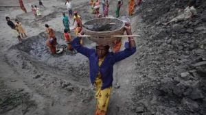
 According to the details by the meteorological department, on this day last year (May 5), the maximum temperature recorded was just 31.5 degree Celsius, while that recorded on May 6, was 33.1 degree Celsius. Find a question on heatwaves in today's answer writing practice. (File Photo)
UPSC Essentials brings to you its initiative for the practice of Mains answer writing. It covers essential topics of static and dynamic parts of the UPSC Civil Services syllabus covered under various GS papers. This answer-writing practice is designed to help you as a value addition to your UPSC CSE Mains. Attempt today’s answer writing on questions related to topics of GS-2 to check your progress.
Heatwaves are considered local disasters, but their increasing severity requires a more comprehensive strategy. Discuss.
What is El Nino Southern Oscillation (ENSO)? Discuss the significance of the Bayesian Convolutional Neural Network (BCNN) launched by the Indian National Centre for Ocean Information Services (INCOIS) in the context of Indian Ocean meteorological phenomena.
Introduction
— The introduction of the answer is essential and should be restricted to 3-5 lines. Remember, a one-liner is not a standard introduction.
— It may consist of basic information by giving some definitions from the trusted source and authentic facts.
Body
— It is the central part of the answer and one should understand the demand of the question to provide rich content.
— The answer must be preferably written as a mix of points and short paragraphs rather than using long paragraphs or just points.
— Using facts from authentic government sources makes your answer more comprehensive. Analysis is important based on the demand of the question, but do not over analyse.
— Underlining keywords gives you an edge over other candidates and enhances presentation of the answer.
— Using flowcharts/tree-diagram in the answers saves much time and boosts your score. However, it should be used logically and only where it is required.
Way forward/ conclusion
— The ending of the answer should be on a positive note and it should have a forward-looking approach. However, if you feel that an important problem must be highlighted, you may add it in your conclusion. Try not to repeat any point from body or introduction.
— You may use the findings of reports or surveys conducted at national and international levels, quotes etc. in your answers.
Self Evaluation
— It is the most important part of our Mains answer writing practice. UPSC Essentials will provide some guiding points or ideas as a thought process that will help you to evaluate your answers.
QUESTION 1: Heatwaves are considered local disasters, but their increasing severity requires a more comprehensive strategy. Discuss.
Introduction:
— The recent spike in temperatures across North India has raised serious concerns, with towns experiencing strong and persistent heat.
— Maximum temperatures have above average values by 4-8°C in Haryana-Delhi, Punjab, Uttar Pradesh, Madhya Pradesh, Bihar, Jharkhand, Rajasthan, Odisha, and West Bengal.
— Rising humidity and warmer nights have exacerbated heat stress, particularly in warm-humid and moderate temperate zones.
Body:
— A heatwave is announced when the temperature deviates from normal by 4.5°C to 6.4°C, while a severe heat wave is declared when the temperature deviates by more than 6.4°C.
— The northern part of India is currently experiencing heatwaves, with actual maximum temperatures above 45°C.
— Extreme heat conditions that last for an extended amount of time can be hazardous to public health and infrastructure.
— In the past, India had heat waves that lasted five to fifteen days. It has continued most of May and June of this year.
— Cyclone Remal, which formed in the Bay of Bengal, hampered the arrival of monsoons from this region, worsening the severity of heat waves.
— The monsoon stream through the Arabian Sea has also moved slowly, protecting South India from the same heat wave conditions.
— This shifting pattern emphasises a clear connection between the length of heat waves and monsoon variability.
— Cities are particularly vulnerable to the urban heat island effect, which is amplified by greenhouse gas emissions. Increased congestion, paved surfaces, water body depletion, vegetation loss, and high-density settlements all trap heat and contribute to rising urban temperatures.
— Heat waves are linked to various threats such as forest fires, power outages, droughts, water scarcity, and lightning.
— Workers in sectors such as construction, hawking, and vending are disproportionately affected by the heat waves in India.
— Large crowds, such as pilgrimages and elections, amplify the heat wave’s effects. The proximity of individuals in crowds generates a microenvironment in which body heat accumulates, resulting in hyperthermic syndrome, a type of heat stroke.
— Longer and more intense heat waves raise the relative risk of mortality, which is divided into two categories: direct heat stroke deaths and increased cardiovascular disease (CVD) incidence.
Conclusion:
— Prioritising public health actions based on heat wave severity and length, as well as understanding their broader consequences in the context of climate change, is critical.
— The National Disaster Management Authority (NDMA) has begun heat action plans (HAPs), the first of which is for Ahmedabad. The NDMA encourages the development of local HAPs to meet specific needs at the district, city, and town levels.
— These HAPs necessitate the involvement of local governments, civic groups, and communities in fostering behavioural change, adaptation, and urban planning.
— HAPs must provide three critical strands of assistance:
(i) Improving temperature monitoring throughout cities and towns requires a dense network of weather stations.
(ii) Preparedness actions are critical for mitigating the immediate consequences of severe heat.
(iii) Implementing solutions such as repairing and restoring water bodies, increasing vegetation cover, and encouraging cool roofs and better ventilation in buildings will all improve thermal comfort.
(Source: Dealing with the heat wave — checklist by Krishna S Vatsa)
Points to Ponder
NDMA
Effects of heat waves
How can the problem of heat waves be reduced?
Related Previous Year Questions
(a) Bring out the causes for the formation of heat islands in the urban habitat of the world. (b) What do you understand by the phenomenon of ‘temperature inversion’ in meteorology? How does it affect weather and the habitants of the place? (2013)
Explain the factors responsible for the origin of ocean currents? How do they influence regional climates, fishing and navigation? (2015)
QUESTION 2: What is El Nino Southern Oscillation (ENSO)? Discuss the significance of the Bayesian Convolutional Neural Network (BCNN) launched by the Indian National Centre for Ocean Information Services (INCOIS) in the context of Indian Ocean meteorological phenomena.
Introduction:
— INCOIS has created a new product that can anticipate El Nino and La Nina events up to 15 months in advance.
— The new product is called Bayesian Convolutional Neural Network (BCNN). It improves ENSO phase forecasts using cutting-edge technology such as artificial intelligence (AI), deep learning, and machine learning (ML).
Body:
What is ENSO?
— ENSO occurs in irregular cycles of 2-7 years and has three different phases:
(i) During the El Nino phase, wind systems diminish, resulting in reduced displacement of warm waters. As a result, the eastern edge of the Pacific gets warmer than normal. In India, El Nino circumstances typically result in a weak monsoon and heatwaves.
(ii) During the La Nina phase, the opposite of El Nino occurs and these condition cause a heavy monsoon.
(iii) During the neutral phase, the eastern side of the Pacific Ocean (near the northwest coast of South America) is cooler than the western side (between the Philippines and Indonesia). This is due to the predominant wind patterns that blow from east to west, carrying warmer surface waters towards the Indonesian coastline. The somewhat cooler water from below rises to replace the displaced water.
Significance of BCCN
— The BCNN combines the dynamic model and AI which allows for a 15-month forecast of El Nino and La Nina conditions, compared to other models that can only anticipate up to six to nine months ahead.
— The system forecasts ENSO phases based on the Nino 3.4 index value.
— The index value is calculated by averaging the sea surface temperature (SST) anomaly in the middle equatorial Pacific, which ranges from 5°N to 5°S and 170°W to 120°W.
(Source: What is INCOIS’s new product to forecast El Niño and La Niña conditions? by Anjali Marar)
Points to Ponder
Difference between El Nino and La Nina
Indian National Centre for Ocean Information Services (INCOIS)
Different types of monsoon in India
Related Previous Year Questions
Why is the South-West Monsoon called ‘Purvaiya’ (easterly) in Bhojpur Region? How has this directional seasonal wind system influenced the cultured ethos of the region? (2023)
Most of the unusual climatic happenings are explained as an outcome of the El-Nino effect. Do you agree? (2014)
UPSC Essentials: Mains answer practice — GS 1 (Week 55)
UPSC Essentials: Mains answer practice — GS 1 (Week 54)
UPSC Essentials: Mains answer practice — GS 2 (Week 56)
UPSC Essentials: Mains answer practice — GS 2 (Week 55)
UPSC Essentials: Mains answer practice — GS 3 (Week 55)
UPSC Essentials: Mains answer practice — GS 3 (Week 56)
Subscribe to our UPSC newsletter and stay updated with the news cues from the past week.

Read UPSC Magazine