© IE Online Media Services Pvt Ltd

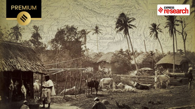 Bengal borderland (representational)
The Bengal-Bangladesh border, which makes up nearly half of the 4,056 km Indo-Bangladesh border, is distinct from other South Asian borders. Its agrarian landscape, interspersed with multiple waterways, complicates both the nature of the border and the task of guarding it.
Tilak Barman, a woman living in the Dinhata subdivision of Cooch Behar, explains this complexity. “There are some Indian villages, on the border, which are separated from the rest of India by a large water body and surrounded by Bangladeshi territory,” she tells indianexpress.com.
One such case is the Indian village of Malopara, located near the Bongaon-Benapol border crossing in West Bengal. Though officially part of India, it is cut off by water. While border guards were posted there, the village was not included in the development programmes after 1947. Until the late 20th century, Malopara had no school, no electricity, and no health facilities. “How do you expect a pregnant woman in labour to cross the river and be brought to Indian territory? How do you expect the wounded to wait that long for treatment? Bangladesh is far more accessible,” an anguished Barman says.
With inadequate healthcare and limited access to education, people in the Bengal borderland are left to fend for themselves. As Barman puts it: “We blur borders not as an act of rebellion, but as one of survival.”
This is the story of the people who inhabit the region, and their negotiation with everyday realities.
The Bengal-Bangladesh border stretches across 2,216 km, of which about 1,000 km runs through water. 1,647 km is fenced to control cases of cross-border criminal activities, smuggling, movement of criminals, and trafficking. However, the fencing is neither continuous nor contiguous. “One of the most difficult international borders to be manned and secured is the Indo-Bangladesh border. Both closed and porous, it defies all established political norms and security measures,” writes researcher Aditi Bhaduri in Women In Indian Borderlands (2011).
Author Paula Banerjee adds, “53 rivers run across this entire region, which increases the porosity of the border. There is also a lot of river erosion. So topographically, nature denies this as a border. Because today if you mark it as one, then tomorrow, when the river shifts, the border becomes somewhere else.”
 India Bangladesh border (Source: Wikipedia)
The border also cuts through houses. “So part of a house is on one side of the border, with the rest on the other side,” says Banerjee.
In A Thousand Tiny Cuts: Mobility and Security Across the Bangladesh-India Borderlands (2023), author Sahana Ghosh recalls that the border was first drawn as the India-East Pakistan border in 1947, and reestablished with Bangladesh’s liberation in 1971. During the 1971 War, India had opened its side of the border to host millions of Bengalis fleeing genocide. Thereafter, India and Bangladesh inaugurated an Indo-Bangladesh passport, with visas issued at the local level to facilitate cross-border commuting.
She suggests that, in contrast to the India-Pakistan border, the eastern border is friendly. “The India-Bangladesh border is typically not viewed in exigent frames: it is not a place of territorial disputes (India-China), refugee crises (Bangladesh-Myanmar), or occupation and counterinsurgency (as in Kashmir, Mizoram, or the Chittagong Hill Tracts).” Yet, she notes, it is a heavily militarised border.
On 30 June 1947, six weeks before British rule ended, the Viceroy of India formed the Bengal Boundary Commission. This Commission had to decide where the new border between India and Pakistan was to be located. Sir Cyril Radcliffe, a British lawyer, was made chairman of the Commission, and the report was to be submitted by mid-August.
The instruction to the Commission was to draw a border that would separate the Muslim inhabitants from the non-Muslims population. They, however, could not agree about the best way forward. The decision was ultimately left to Radcliffe alone. “Therefore, the Bengal border, more than any other twentieth-century border in the world, can be seen as the creation of a single individual,” writes academic Willem van Schendel in The Bengal Borderland (2004).
 Cyril Radcliffe (Wikimedia Commons)
“I was so rushed that I had no time to go into the details…What could I do in one and a half months?” Radcliffe had said in an interview.
“The Radcliffe Line did not carve two halves out of the province of Bengal; it made the province fall into four large pieces,” wrote Schendel. The largest of the four was a group of 16 districts at the centre, which became East Bengal, later East Pakistan. Second was the Princely State of Tripura, which would formally merge with the Indian Union in 1949. Third, in the north, was the Princely State of Cooch Behar that joined India in 1950. Finally, to the west was a group of 12 districts that would be named West Bengal.
“In other words,” noted Schendel, “there was no sharp discontinuity between Muslim territory in Pakistan and non-Muslim territory in India… for half of its length, the border cut through areas where the same religious majority (Muslim, Hindu or other) dominated on both sides.” Interestingly, there were even stretches of the border where the Pakistan side was Hindu-dominated and the Indian side Muslim-dominated.
Among the many consequences of the Radcliffe Line were the issues of cross-border landholding, trade, and commuting — confusion that descended with the birth of a new nation. “People were terrified,” recalls Barman. “They feared invading armies would come for their families and break into homes”.
Schendel observed that the post-Partition period was awash with rumours of annexation. “Early worries of invasion and annexation faded into the background and a combination of instruments of control turned out to be reasonably successful,” he wrote. In the months that followed, both states planned ways to police the border population, controlling cross-border movement, and invoking a sense of patriotism in borderlanders.
 The border fence close to the Hili Border station in West Bangladesh (Wikipedia)
Known as border outposts (or BOPs), small camps manned by armed men sprung up in the area to patrol the border line. Over the next two decades, more specialised border security was handed control. Since then, the East Pakistan/Bangladesh Rifles (BDR) and the Border Security Force (BSF) have been facing each other across the border line.
The role of the forces in controlling the flow of people and goods increased significantly in 1952 when the two states agreed to introduce a system of passports and visas. Until then, despite restrictions on movement of goods and money across the border, people could move freely between East Pakistan and India. “The new system,” writes Schendel, “was a rather useful tool for securing the borderland.”
Despite increasing surveillance, however, a state of ignorance among the masses continued to prevail. The border not only severed trade routes but also disrupted daily activities. “With the Partition and the Radcliffe Line, the area suddenly became a zone where people could no longer walk freely. From commuters travelling for work, to children attending school on the other side — all of these movements were stopped overnight,” says Banerjee.
Among the many cross-border commuters cited by Schendel were constable Nurun Nabi, whose home was in Murshidabad (India), though he was stationed at Tetulia (then, East Pakistan), and Binay Kumar Das, who was a constable in the intelligence service of Assam, with his home in Sylhet (then, East Pakistan).
Some inhabitants found that the new border sliced through their workplace. This was especially true for those working on the rivers and lakes, where the scarcity of bridges only added to the complexity. “There were other groups of people whose work took them to both sides of the border. Some of these, such as railwaymen, telegraph linemen and people quarrying stones along border rivers..,” added Schendel in his book.
While border control helped navigate the chaotic situation, it also added an element of risk and vulnerability in people’s pursuits of meeting basic welfare needs. As Ghosh explains in an interview with indianexpress.com, “Imagine wanting to sell your crop as a borderlander, with the price in West Bengal being terrible and a lack of cold storage facilities… What do you do? Of course, you’re going to try to sell in the market where there is a better price, even if that’s in Bangladesh. But that means that you have to hide from the BSF. That means you have to undertake a clandestine crossing, which is criminal”.
Bhaduri, meanwhile, recounts the experience of Parweena Bibi, who lived in Hatkhola village in the Nadia district. “Our fields are on the other side of the fence, and I tell you what a problem it is for me to tend to them,” Bibi told Bhaduri. To go out to the other side, we have to keep our IDs with the border (security) people. When our children go to school, they have to keep their IDs. When my husband goes to tend to the fields, he has to submit the ID.”
As a result, the border plots across the districts of Cooch Behar, Lalmonirhat, and Kurigram lay fallow for one or two seasons each year. “Landowners claimed that it is better to leave land fallow than negotiate the multiple kinds of costs that come with farming land that is the target of border security,” writes Ghosh, explaining how this pattern has adversely impacted land prices.
During a field visit to Jalangi, a village in Murshidabad district of West Bengal, Anasua Basu Ray Chaudhury, senior fellow, Observer Research Foundation (ORF), witnessed a similar situation. Many villagers depended on cross-border informal trade for their livelihood by selling everyday goods — such as hosiery — into Bangladesh. In an interview with indianexpress.com, Chaudhury recalled cautioning locals that such practices were illegal. A villager, however, explained the stark economic logic: “It takes me nearly three hours to reach Behrampur, the district headquarters, to sell goods, and I must also bear the costs of fuel and accommodation. But Rajshahi, a village across the border in Bangladesh, is only a 30-minute boat ride away. Selling there is far more profitable.”
Policy experts like Chaudhury have long argued for regulated mobility frameworks, such as work permits or Free Movement Regimes, to ease the burden on borderlanders. Yet such visions stand in sharp contrast to the present, where securitisation dominates.
Policy experts like Chaudhury have long argued for the introduction of work permits and the establishment of a Free Movement Regime (FMR) to ensure the safe and regulated mobility of people. Yet such vision stands in sharp contrast to the present.
In its 2023-2024 report, the Ministry of Home Affairs said: “In order to prevent illegal migration and illegal activities including anti-national activities from across the border, the Government of India had sanctioned the construction of border fencing with floodlights, in phases. The total length of India-Bangladesh border is 4096.7 km, out of which, 3196.705 km has been covered by physical fencing. The non-physical barrier will be in the form of technological solutions. Old design fences are being replaced with a new design fence.”
For people living in these areas, “coming of age is very hard,” says Ghosh. “When young men and women go to the district capitals to attend college, they’re perceived as criminals and made fun of. Marrying is also very difficult when you belong to the borderland. “Families of prospective brides in border villages were very keen to find matches bhitore or inside, away from the border, but these were elusive…they had to offer substantially larger dowries in cash and kind,” she writes.
The border and its militarisation have disrupted the once-prevailing peace in the region. “The hatred and anger for the other side, in people’s everyday vocabulary, is a strange development. Maybe this is what it means to draw borders,” says Tilak.