Journalism of Courage
Premium
This is an archive article published on April 6, 2005
Adrift on the Ken Betwa
In July 1989 at the instance of the then prime minister the Planning Commission had presented a report on Agro-Climatic Planning, which went...


In July 1989 at the instance of the then prime minister the Planning Commission had presented a report on Agro-Climatic Planning, which went to Parliament. It was a sharp break with the earlier region-favoured crop planning strategy. It argued that each of India’s fifteen agro-climatic regions had different soil, water and climatic characteristics and these had to be optimised for specialised growth in the next phase. They saw the Central Plateau and Hills Region carved out of the adjoining districts of Uttar Pradesh in its southwest, Madhya Pradesh and Rajasthan (the famous Chambal ravines) as one of the most difficult and delicate areas to develop policies for, since it had “poor soil, high slopes with high run-offs and medium rainfall”.
When the Interlinking of Rivers Project picked out the Ken Betwa as one of the first links to plan and put a pre-feasibility assessment on the Net I was excited. I am undeservedly called a big dam wallah on account of my work on Sardar Sarovar, but I actually believe that there are good and bad water development projects and the good ones need implementation and the bad ones improvement or a decent burial. So with a lot of expectation I became a guest of Ashok Khosla and went to his Targram, near Orchcha, to visit the Ken Betwa area which is a sub-region of the Central Plateau. Taragram is all that development is about and the Ken Betwa in pre-feasibility is not.
In areas like these you have to sub-regionalise and build water development strategies for each area with loving care. It can be done and has been done elsewhere in good irrigation projects in India. This is not one of them. The geologists did a good job.
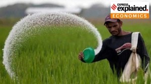
The Ken Betwa study has good soil information, but not on irrigation planning. It is estimated that 7.3 per cent of the soils are on hill and hill ridges, 44 per cent are plateau soils, 43.6 per cent are alluvial and flood plains. The hill soils are highly erodible, excessively drained, stony and gravelly in nature, of shallow depth with low nutrient status, low in organic matter content and have poor water retention capacity. They are unsuitable for normal crop husbandry, they tell us, but are good for forestry, pasture development and growing grasses. The plateau soils occur on level to gently undulating terrain and in them the shallow soils are again, the experts say, no good for crops — but the deep soils could grow sorghum, millets, pulses and bajra. The plains are best suited for jowar, pulses, oilseeds and wheat. But these crops need little water and some die with too much. So the engineers design the project for a lot of rice with flood irrigation. All the terrible warning signals are ignored. This kind of “planning” is unthinkable in 2005.
My memory goes back to the not very far away Tawa where the journalist Bhaduri had written of the damage caused to the black cotton soils by paddy designed irrigation. This time I am taken to the villages around the Betwa. Air Vice Marshal Sahni grew up here and came back to repay his debts to nature. The villagers love him. This is the kind of soil on which farmers mint money. They are picking up here with his help and with more infrastructure the chillies will go to the market, the berseem will lead to a thriving dairy industry, flowers and vegetables will supplement the soya and linseed. The Joint Forestry Management will make money from the trees and the fish. The geologists of the Ken Betwa describe it prosaically, but it is a lovely area with lovely people. They are waking up. In the not too distant future, when water is harvested, they will make more money.
I keep my judgements on interlinking open, but the Ken Betwa, the easiest link, has to go back to the drawing board. For starters, the air vice marshal plans to take college kids from the region, walk the proposed canals, make land use maps and give the engineers a real feel of what is happening down there. The project must be designed to help the farmer to nurture his land and grow rich and not ruin the black soils and the forests. It can be done and we had better get going.
Advertisement

Live Blog
PHOTOS


Top Stories


Advertisement
Must Read


Advertisement
Buzzing Now
TrendingWomen’s World Cup final: Fireworks, tears, messages from PM Modi to Sundar Pichai; world celebrates India's win

Trending‘Uber driver keeping Indian pride up’: Australian woman hails cab driver who bought her kebabs, water during 2-hour traffic jam, video wins hearts


- 01
- 02
- 03
- 04
- 05
Advertisement