Journalism of Courage
Premium
‘Pivotal role in Isro’s missions’: ISTRAC director A K Anil Kumar reflects on centre’s 50-year legacy from Aryabhata to Gaganyaan
Going forward, ISTRAC is planning to expand its ground and space-based networks. Director A K Anil Kumar said additional terminals will be installed across all ground stations to bolster upcoming missions like Gaganyaan.

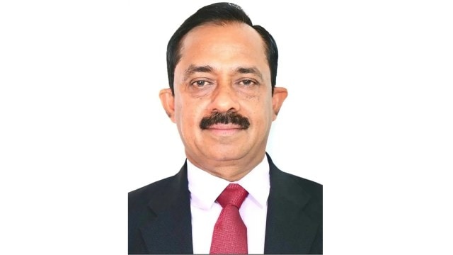 As ISTRAC marks the 50th year of its existence, its director, A K Anil Kumar, spoke to The Indian Express on the centre’s upgradation and expansion plans to support Gaganyaan and other future missions. (Express Photo)
Bengaluru-based ISRO Telemetry, Tracking and Command Network, or ISTRAC, is the nerve centre of India’s space operations. It communicates with all satellites during their launch and when they are in orbit, continuously tracks their positions, monitors their health, and sends commands that ensure their successful operations.
As ISTRAC marks the 50th year of its existence, its director, A K Anil Kumar, spoke to The Indian Express on the centre’s upgradation and expansion plans to support Gaganyaan and other future missions.
Q: Could you share the important role(s) played by ISTRAC in providing ground-based support to Isro’s missions since 1976?
A K Anil Kumar: Since 1976, ISTRAC has played a pivotal role in enabling ISRO’s missions—right from early satellite launches to contemporary interplanetary explorations and human spaceflight endeavours.
Since its inception, ISTRAC has provided round-the-clock telemetry, tracking and command support to 120 satellites and over 100 launch vehicle missions, with secured mission and ground communication network. ISTRAC has supported many landmark missions such as Aryabhata, Chandrayaan-1, 2 and 3, the Mars Orbiter Mission, Astrosat, Aditya-L1, Space Docking Experiment (SpaDEx), NASA ISRO Synthetic Aperture Radar (NISAR) and is now preparing for Gaganyaan.
At the centre, we have designed, developed and operationalised the vast Navigation with Indian Constellation (NavIC) ground segment IRIMS, spanning 16 locations in India. We are currently expanding it overseas to ensure precise navigation solutions. ISTRAC has been instrumental in the management and upkeep of the NavIC ground segment, which forms a vital component of the nation’s infrastructure for precise navigation, positioning, and timing services.
NavIC has further enhanced national preparedness by supporting early warning dissemination, providing advisories to the fishing community, and strengthening search and rescue operations.
Story continues below this ad
As part of the Space Situational Awareness (SSA) activities, Launch Vehicle Collision Avoidance Analysis (COLA) was developed to select safe lift-off time windows, and it is carried out for all Isro launches. Conjunction assessments are regularly performed to safeguard all Indian space assets operating in the Earth orbit and deep space to issue collision threats from other resident space objects.
Network for Space object TRacking and Analysis (NETRA), the first dedicated project for SSA, and the establishment of ISRO System for Safe and Sustainable Space Operations Management (IS4OM) for spaceflight safety and debris mitigation are some of the major efforts to promote space sustainability. Other landmark achievements include the de-orbiting of Cartosat-2 and the controlled re-entry of Megha Tropiques-1.
Over the last five decades, ISTRAC has steadily grown into a global network of ground stations, excelling in satellite operations, deep space missions, navigation operations, launch vehicle tracking and creating space situational awareness.
Q: Which are the newer sectors or areas ISTRAC plans to expand its operations to?
Story continues below this ad
Kumar: ISTRAC’s search and rescue systems have been supporting navigation requirements along with disaster management, thus successfully saving many human lives on several occasions. In addition, ISTRAC is considering expansion of its ground and space-based networks:
* Ground-based space weather observation network: Establish a coordinated system, involving a network of sensors and observatories with geographically distributed instruments like radars, magnetometers, ionosondes, and Global Navigation Satellite System (GNSS) receivers. This is aimed at monitoring space weather originating from solar activity and its effects on Earth’s upper atmosphere and magnetosphere.
* Deep space radar research: Develop and use radar systems to observe, track and study natural and artificial objects in deep space and beyond Earth’s orbit. This will cover asteroids, comets, planets, moons, spacecraft and even the interstellar phenomena. This type of radar research is crucial for planetary defence, astronomy, SSA, and for providing mission support for deep space exploration studies.
ISTRAC is already in the process of exploring other areas, like building an optical ground station for establishing quantum communications, deep ocean missions or climate-centric missions, and developing ground systems to handle the environmental requirements. Besides, setting up higher frequency bands for payload operations is being targeted for future upgradation of Deep Space Network ground stations.
Story continues below this ad
Q: Given Isro’s ambitious plans in the run-up to 2047, does ISTRAC feel the need to establish more ground stations?
Kumar: We plan to add more terminals at all ground stations to support the future missions, especially for Gaganyaan. The present Deep Space Network will be expanded. There will be additional and transportable terminals. In the near future, two satellites, part of the Indian Data Relay Satellite System, will be placed in orbit.
In order to be able to simultaneously track multiple satellites or satellite constellations, the Multi Satellite Telemetry (MuST) project is awaiting commissioning. Its objective is to provide an integrated platform to track, manage, and analyse telemetry data from multiple satellites effectively and efficiently. The significance of a multi-satellite telemetry system lies in its critical role in managing and monitoring multiple satellites simultaneously, which is increasingly important as satellite constellations and networks grow. This system is crucial for supporting massive satellite constellations deployed for Earth observations and scientific missions, allowing real-time telemetry monitoring and command uplinks across hundreds of satellites.
Q: What new technologies or upgrades will ISTRAC adopt or undertake to meet the requirements of the third launchpad being developed at Sriharikota?
Story continues below this ad
Kumar: We are developing a miniaturised portable ground station of different terminals to meet the Launch Vehicle requirements. It is a mobile terminal placed on a ground measuring 5.4 metres in size, supported by two axes. It will be a stabilised system to support missions where no ground station is available, and it can be deployed on land or at sea.
Code Division Multiple Access (CDMA) modulation techniques have been upgraded in TTC data processors to cater to CDMA requirements.
Q: How do you envision ISTRAC growing over the next decade, and by 2047, in sync with the changing requirements of Isro missions?
Kumar: All the available terminals operating singly as S-band will be upgraded to X-band and Ka-band. The existing 10-metre tall, old terminals will be replaced with 11-metre multiband (dual band or tri band) terminals. We will indigenously develop telemetry, tracking and command processors for multi-carrier requirements. We will establish ground stations catering to data relay satellites such that the telemetry, tracking and command of the low earth orbit (LEO) satellites in the invisible zones are commanded through the in-orbit Data Relay Satellite network. This will also be used to transfer data from remote established ground stations outside India to the mainland for quick turnaround time requirements.
Story continues below this ad
There will be a full implementation of automation and artificial intelligence-based systems in the mission operations and control of satellites. This will be achieved through the indigenous development of the required software with necessary intelligence built in.
It is envisaged to build an end-to-end SSA system capable of providing timely alerts for safeguarding space assets. Given the ever-increasing number of space explorations and the era of large constellations, space sustainability is no longer an option but an imperative.
Advertisement
Top Stories


Live Blog
Advertisement
Loading Taboola...
Advertisement