Journalism of Courage
Premium
‘Need to make every sector weather-smart to deal with unpredictability, improve early warning systems for Viksit Bharat-2047’
Researchers from the Centre for Climate Studies developed a hyperlocal forecast system offering a 3-day station-level forecast for Mumbai, available in real-time on the Mumbai Flood portal and App. It was encouraging to learn that the system supported BMC operations.

 Due to Arabian sea warming, there is a surge in moisture in winds, which result in heavy rainfall over the Western Ghats.At the same time
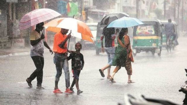
With nearly 1184 mm of rainfall, this August was the wettest month in the past five years for Mumbai. Dr Subimal Ghosh, Institute Chair Professor for Interdisciplinary Program in Climate Studies, IIT-Bombay speaks to Omkar Gokhale about the change in rainfall patterns, early warning systems and the need to be weather-smart to deal with extreme weather conditions.
1. What is the flood monitoring system created at IIT-Bombay and how does it work?
Researchers from the Centre for Climate Studies developed a hyperlocal forecast system offering a 3-day station-level forecast for Mumbai, available in real-time on the Mumbai Flood portal and App. It was encouraging to learn that the system supported BMC operations. The project is mentored by Professor Raghu Murtugudde and me with a daily forecast algorithm developed by PhD student Puja Tripathy. The team has also built a crowdsourced information system for reporting waterlogging across the city and installed sensors at critical locations to provide real-time public updates which have received an overwhelming response.
2. Which areas get heavy rainfall as per your estimates and due to what reasons?
Overall, extreme precipitation events are rising due to climate change and thermodynamics shows such events intensify by about 7–8% per 1°C temperature increase, and Mumbai and Maharashtra are no exception. The real challenge is predicting when and where these extremes will occur due to high spatio-temporal variability. Effective management starts with designing and developing sector-specific early warning systems and high-resolution risk maps, prioritizing high-risk regions for flood management. For example, U-shaped low-lying areas around Sanjay Gandhi National Park (SGNP) hills including Gandhi Market (King’s circle) and parts of Andheri receive heavy rainfall and are flood-prone due to local orography and low elevation.saw sharp water level rise during heavy rain events last week.
Besides thermodynamics, there are dynamic factors: Due to Arabian sea warming, there is a surge in moisture in winds, which result in heavy rainfall over the Western Ghats.At the same time, urban regions are warmer and more polluted, which results in more rainfall due to more cloud condensation nuclei, High-rise buildings, long roads, slums also generate instabilities at local scale, creating extreme rainfall hotspots.
3. Do you see a change in rainfall patterns and is it due to climate change?
Story continues below this ad
Yes, extremes have been increasing, but attributing them directly to climate change requires a different scientific approach known as Detection and Attribution… I believe that rather than debating endlessly whether a particular event is due to climate change, we should build on the robust scientific understanding that extremes are indeed increasing with climate change, and concentrate on solutions in two directions including early warning and adaptation along with mitigation.
4. Why is there a general perception that others’ predictions tend to be more accurate compared to IMD?
I don’t think that it is fair to say one model is better than another. For a given event, one model may perform well, while for another event, a different model may be more accurate. That is why it is always important to rely on multi-model forecasts and ensembles. The most valuable aspect of our portal is strong citizen involvement, which we believe should be practiced, replicated and scaled up in other regions as well. Trust cannot be earned without engaging people and transparently showing how forecasts have performed in the past. We have combined a hyperlocal data science–based model with public-facing transparency. If a forecast goes wrong for even one event, criticism on social media can be harsh. But it is important to have the resilience to accept it and continue improving. Involving citizens through various platforms including social media helps and they can monitor water-logging at certain places as we cannot have monitoring stations at each and every place. Since we are going for “Viksit Bharat-2047,” we have to make every sector including transportation, renewable energy, agriculture etc “weather-smart” as weather phenomena have become very unpredictable, therefore we should further improve the forecast system.
5. Are flood situations going to intensify further and what can be done about it?
Story continues below this ad
Extremes are increasing and will continue to rise globally, demanding new science and technology for effective management. This is a complex challenge. We have to adapt ourselves for a better early warning system and better planning. What we have to do is to have good predictions and then perform a hydrological model, at a river basin or watershed to find out regions under stress in extreme weather conditions. This information needs to be shared with the administration for co-developing management strategies.
Advertisement
Top Stories


Live Blog
Loading Taboola...
Advertisement