In a first, L&DO uses drones to check building bye-laws compliance in Delhi
CR Park is among the resettlement colonies where land was allotted to refugees after Independence.
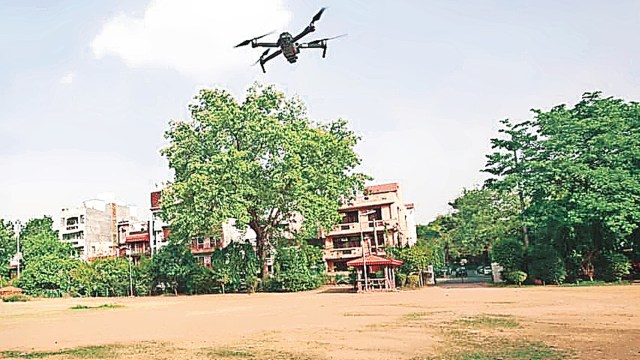 Using drone surveys and open source data, the team mapped the colony and integrated it to Google Street View. (Express Photo)
In a first-of-its-kind initiative, the Land and Development Office (L&DO) has recently created a 3D map of the South East Delhi residential colony Chittaranjan (CR) Park, using drones to check if building bylaws are being followed and if there are any encroachment, The Indian Express has learnt.
As a part of the larger effort of the L&DO to digitise the records of the 60,000-odd properties that it administers, the pilot project covering around 1,800 properties in CR Park began in June, sources said.
Recently, the L&DO completed the process of creating a 3D digital twin of the colony, which shows the boundaries of each property, the type (leasehold or freehold), the name of the owner or lessee, the area and the height.
Using the drone surveys and open source data, the team mapped the colony and integrated it to Google Street View, according to a video prepared by L&DO on the project. The vertical 3D map shows the height of buildings, which help in seeing if the number of floors constructed are as per the sanction plan.
The portal gives officials the option of remotely checking if a property owner has encroached the road in front of the house, or extended a balcony beyond the permissible limits or is carrying out illegal commercial activity from a residential area, said officials.
This, they added, would minimise the interface between the L&DO officials and the homeowners or lessees, which would in turn reduce the avenue for corruption. It would also help the L&DO, which is short-staffed, survey more properties than it is able to physically, an official said.
As of now, the information has not been used to issue any notices or take any action as it is a pilot project, sources said. If the project is continued, it could lead to the mapping of all L&DO properties in Delhi.
CR Park is among the resettlement colonies where land was allotted to refugees after Independence. Over the years, most of the properties that were given on lease have been converted to freehold by the L&DO, officials said.
The L&DO, which functions under the Union Ministry of Housing and Urban Affairs, has been working on a new Geographic Information System (GIS) portal for all its properties since January, it is learnt. Around 17,000 properties have been linked with the GIS, after the details of the properties were entered onto the portal from physical records. The 2D maps using open source data for these properties has been prepared, it is learnt. Work on the remaining properties continues.

You May Like


Photos