
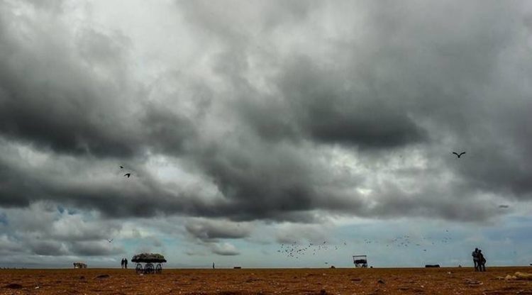
 If the system develops, it will be the first cyclone to form in the Bay of Bengal in the month of October since 2018. (File Photo)
The Met office on Saturday said that a low-pressure area over the north Andaman sea, which has intensified into a depression, is expected to take the shape of a cyclonic storm by October 24. According to the bulletin issued by the IMD, the weather system moved west-northwestward and concentrated into a depression on Saturday, close to the west of Andaman Islands.
‘It is expected to move northwestward and intensify further into a deep depression over east-central and adjoining the southeast Bay of Bengal by the morning of October 23. The system is then very likely to re-curve gradually north-northeastwards and intensify into a cyclonic storm over the central Bay of Bengal by October 24 morning,” reads the bulletin.
West Bengal and Odisha are on alert over the possible cyclone, the first to form in the Bay of Bengal in the month of October since 2018. Once it intensifies into a cyclone, it will be called Sitrang (read as Si-trang), a name suggested by Thailand. Sitrang will be the second cyclonic storm this year after Cyclone Asani that had formed in the Bay of Bengal in early May. (Here’s how cyclones are named)
IMD Director General Mrutunjay Mohapatra has said while there is no possibility of the storm making landfall in Odisha, the state is expected to witness heavy to very heavy rainfall. The Odisha government has alerted seven coastal districts — Ganjam, Puri, Khurda, Jagatsinghpur, Bhadrak, Kendrapara and Balasore — asking them to take precautionary measures. West Bengal is also likely to witness rains, high wind speeds and rough seas.

A probable cyclone Sitrang is expected to head towards Bangladesh and cross near Tinkona island and Sandwip early on Tuesday, as per the latest cyclone track released by the India Meteorological Department (IMD) Saturday.
The coastal districts of Odisha and West Bengal will receive widespread heavy rainfall till October 25. Moderate to heavy intensity rainfall is expected likely over southern Assam, east Meghalaya, Nagaland, Mizoram, Manipur, and Tripura on Monday, the IMD said.
The prevailing low-pressure system in the Bay of Bengal has intensified into a depression with the wind speed gusting to 60km/hr. Read more
As of 830 am, the Low Pressure Area has intensified into a Depression over southeast Bay of Bengal close to the Andaman Islands. The IMD has said it is likely to move north-westwards till October 23 morning and recurve north-northeastwards, intensify into a Cyclonic Storm. It is likely to cross Bangladesh and adjoining West Bengal coast on October 25 morning.
The Low Pressure Area over north Andaman Sea and south-east Bay of Bengal is likely to concentrate into a depression on Saturday, the India Meteorological Department (IMD) has said. It is predicted to further intensify into a cyclonic storm over west-central Bay of Bengal by Monday (October 24), and reach the coasts of West Bengal and Bangladesh on Tuesday (October 25), skirting the Odisha coast.
A low-pressure system over the Andaman Sea is likely to intensify into a cyclonic storm and reach West Bengal-Bangladesh coasts on October 25, causing wind gusting to 110 km per hour, the IMD said on Friday.
Sanjib Bandopadhyay, the deputy director-general of Regional Met Centre in Kolkata, said that the system is likely to cause light to moderate rain in Gangetic West Bengal, with isolated heavy rain in the coastal districts of South 24 Parganas, North 24 Parganas and Purba Medinipur. He said that it is likely to cause light to moderate rain in Kolkata on October 24 and 25.
'Wind speed of 45 to 55 km gusting to 65 kmph will occur in the coastal districts of South 24 Parganas, North 24 Parganas and Purba Medinipur on October 24, while on October 25, wind speed will reach 90 to 100 kmph gusting to 110 kmph,' he said, adding that wind speed of 30 to 40 kmph gusting to 50 kmph will occur in Kolkata and adjoining districts of Howrah and Hooghly.
'It will not be a super cyclone and further movement of the system will be updated by the IMD in due course,' Bandopadhyay said. (PTI)
Cyclone Sitrang's formation will have an impact on Odisha, Gangetic West Bengal, Nagaland, Manipur, Mizoram and Tripura in the form of heavy to very heavy downpours (64.5 mm-204 mm) and thunderstorms on Oct 24-25, and possibly even on Oct 26, according to weather monitoring agency Weather Channel.
Odisha and West Bengal are bracing for heavy rainfall early next week under the impact of a possible cyclone in the Bay of Bengal, the IMD said on Friday. The weather system is likely to skirt Odisha and move towards West Bengal and Bangladesh, it said. The system is likely to trigger heavy rainfall when it crosses parallel to the state's coast on Monday.
Odisha's Revenue and Disaster Management Minister Pramila Mallick said that instructions have been issued to all the districts and coastal region authorities to deal with any eventuality. Mallick said personnel of the fire service department, the ODRAF and NDRF are on standby for any emergency situation.
Meanwhile, the West Bengal government has begun the process of evacuating people from low-lying areas in Purba Medinipore, South 24 Parganas and Sundarbans to safe shelters in the wake of the cyclone forecast, a senior official said.
Chief Minister Mamata Banerjee has convened an emergency meeting at state secretariat 'Nabanna' on Friday to take stock of the preparedness. 'Leaves of all district magistrates, SPs and emergency department workers have been cancelled as a part of the preparedness for the possible cyclone,” he said. The Kolkata Police's disaster management team has been asked to work in tandem with Kolkata Municipal Corporation officials to address any emergency-like situation, he added. (PTI)
West Bengal Chief Minister Mamata Banerjee has called for an emergency meeting at the state secretariat 'Nabanna' today to take stock ahead of Cyclone Sitrang, PTI reports.
Odisha and West Bengal, which are likely to receive heavy rains under the influence of Cyclone Sitrang, have begun taking precautionary measures. Officials are evacuating people from low-lying areas, supplies like dry food and medicines are being stocked, and rescue and relief personnel are on standby.
"Leaves of all district magistrates, SPs and emergency department workers have been cancelled as a part of the preparedness for the possible cyclone,” Odisha's Revenue and Disaster Management Minister Pramila Mallick told news agency PTI.
The cyclone, once it forms, is likely to skirt the Odisha coast and move towards West Bengal and Bangladesh by October 25, the IMD has said.
The Low Pressure Area over north Andaman Sea and south-east Bay of Bengal persists, the IMD has said in an update.
It is likely to move west-northwestwards and concentrate into a depression by Saturday morning (October 22), before further intensifying into a cyclonic storm over west-central Bay of Bengal by Monday (October 24). It is likely to reach the coasts of West Bengal and Bangladesh on Tuesday (October 25), skirting the Odisha coast, the IMD said.
Due to the Low Pressure Area over north Andaman Sea and and south-east Bay of Bengal, the IMD has issued the following rainfall alert for the Andaman and Nicobar Islands, Odisha and West Bengal.
Wind speeds are likely to pick up from today till Oct 25, and sea conditions are likely to be rough.
The first tropical cyclone of the post-monsoon season of 2022 is likely to form in the Bay of Bengal on October 24, the India Meteorological Department (IMD) has said. As of now, it's a Low Pressure Area over southeast Bay of Bengal.
Odisha's Revenue and Disaster Management Minister Pramila Mallick said the state government has put the administrations of seven coastal districts on alert in view of the IMD's forecast of a possible cyclone.
The districts that may be affected are Ganjam, Puri, Khurda, Jagatsinghpur, Kendrapada, Bhadrak, and Balasore. Authorities have been asked to remain alert and closely monitor the situation, the minister said.
The IMD on Thursday said that the possible cyclonic formation in the Bay of Bengal is likely to reach West Bengal-Bangladesh coasts by October 25, skirting Odisha. A low pressure area has formed in the Bay of Bengal on Thursday, and it is likely to intensify into a cyclonic storm over the next four days, the India Meteorological Department (IMD) said in a statement.
The low pressure area is very likely to move west-northwestwards and develop into a depression over east-central and adjoining southeast Bay of Bengal around October 22. It is likely to intensify into a deep depression by October 23. "Subsequently, it is likely to re-curve northwards and intensify into a cyclonic storm over west-central and adjoining east-central Bay of Bengal by October 24. Thereafter, it is likely to gradually move north-northeastwards and reach near the West Bengal-Bangladesh coasts by October 25, skirting Odisha," IMD Director General Mrutunjay Mohapatra said. (PTI)
The India Meteorological Department (IMD) recently released a list of 169 names of future tropical cyclones that would emerge in the Bay of Bengal and the Arabian Sea. Cyclones that form in every ocean basin across the world are named by the regional specialised meteorological centres (RSMCs) and Tropical Cyclone Warning Centres (TCWCs). There are six RSMCs in the world, including the India Meteorological Department (IMD), and five TCWCs.
As an RSMC, the IMD names the cyclones developing over the north Indian Ocean, including the Bay of Bengal and Arabian Sea, after following a standard procedure. The IMD is also mandated to issue advisories to 12 other countries in the region on the development of cyclones and storms. Read more
While the IMD has not yet provided information on the intensity, trajectory and landfall area of the possible cyclone, it has predicted that the Low Pressure Area will move west-north-westwards and concentrate into a depression over east-central and adjoining south-east Bay of Bengal around October 22, and into a deep depression on October 23. Subsequently, it is likely to recurve northwards and intensify into a cyclonic storm over west-central and adjoining east-central Bay of Bengal by October 24. Thereafter, it is likely to move gradually north-north-eastwards and reach the West Bengal-Bangladesh coasts on October 25, skirting the Odisha coast.
A Low Pressure Area formed over north Andaman Sea and south-east Bay of Bengal on Thursday morning, the India Meteorological Department confirmed. It is likely to move west-north-westwards and concentrate into a depression by Saturday (October 22) over central and adjoining south-east Bay of Bengal. By Monday (October 24), it is likely to intensify further into a cyclonic storm over west-central Bay of Bengal.
The weather body has said the Low Pressure Area formed in the Bay of Bengal with the associated cyclonic circulation extending upto 7.6 km above mean sea level.