Click here to join Express Pune WhatsApp channel and get a curated list of our stories
© The Indian Express Pvt Ltd

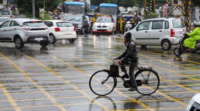 This year, India has received 740.3mm rainfall which was quantitatively 7 per cent above the seasonal average till August 30. (File Photo)
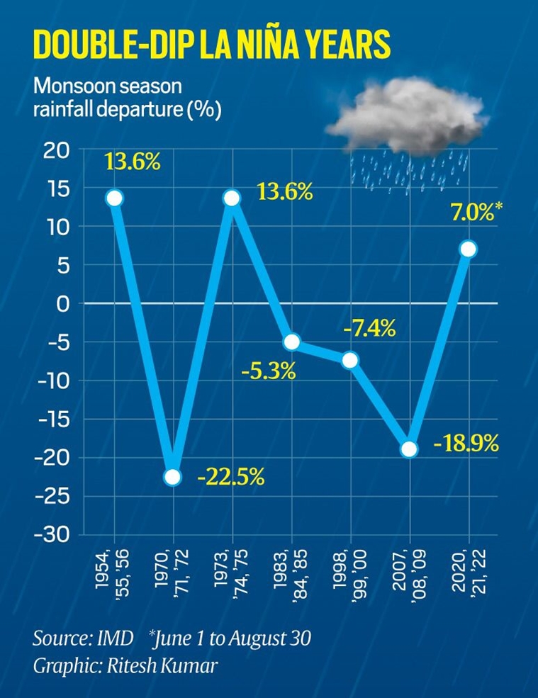
In what may be termed as an uncommon phenomenon, La Ninã conditions prevailing over the equatorial Pacific Ocean since September 2020 has entered the third year. There are only six instances of La Ninã lasting for more than two years since 1950s , data with the India Meteorological Department (IMD) show.
La Ninã is when the sea surface temperatures (SSTs) along the central and equatorial Pacific Ocean are colder than normal, which, experts say, favour the Indian summer monsoon. However, La Niña years are also infamous for frequent and intense hurricanes and cyclones in the Atlantic Ocean and the Bay of Bengal.
 In June this year, the World Meteorological Organisation had termed the persisting La Niña conditions as ‘stubborn’. (Express)
This year, India has received 740.3mm rainfall which was quantitatively 7 per cent above the seasonal average till August 30. Out of the 36 states/Union Territories, 30 have received rainfall categorised as ‘normal’ or ‘excess’ or ‘large excess’.
The opposite is El Niño, that is, warmer SSTs prevail over these regions.
By mid-August, meteorologists at Australia’s Bureau of Meteorology (BoM), the National Oceanic and Atmospheric Administration (NOAA), USA, and India’s Monsoon Mission Climate Forecast System (MMCFS) confirmed that the La Ninã conditions are here to stay till the end of 2022.
This was in contrast to the forecasts issued by these multiple agencies in April this year that La Ninã will dissipate by August.
From remaining at the La Niña ‘watch’ status, two of BoM’s latest Climate Driver bulletins issued this month upgraded it to La Niña ‘alert’ status. In June this year, the World Meteorological Organisation had termed the persisting La Niña conditions as ‘stubborn’.
“The continuing La Niña is abnormal but a good sign for the Indian monsoon. It may be good for India but not for some other countries,” M Rajeevan, former secretary, Ministry of Earth Sciences (MoES), told The Indian Express.
Roxy Mathew Koll, senior scientist at Pune-based Indian Institute of Tropical Meteorology (IITM), too, shared that La Niña could be one of the reasons for India receiving good rainfall spells in the past three months. “Without La Niña, the monsoon currents could have been weaker,” Koll said.
La Niña years are infamous for frequent and intense hurricanes and cyclones in the Atlantic Ocean and the Bay of Bengal. “La Niña favours a higher rate of cyclone formation in the Bay of Bengal,” Koll said.