Journalism of Courage
Premium
This is an archive article published on January 9, 2022
Mumbai sees highest rain in January in a decade, temperature drops by 3 degrees
Around 4 mm of rainfall was recorded throughout Saturday in the city. It was the highest January rainfall recorded in the decade.

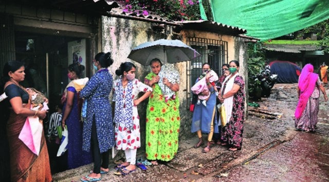 Outside a polio booth in Dharavi amid rain in Mumbai on Saturday morning. (Express Photo by Amit Chakravarty)
WITH THE unseasonal rain on Saturday, the day’s temperature dropped by 3 degrees Celsius in the last 24 hours in the city.
The India Meteorological Department’s (IMD) Santacruz observatory recorded a maximum temperature of 27.6 degrees Celsius on Saturday, a drop from 30.4 degrees Celsius on Friday. Saturday’s maximum temperature was 3 degrees below normal.
Around 4 mm of rainfall was recorded throughout Saturday in the city. It was the highest January rainfall recorded in the decade. The highest rainfall recorded in January in Mumbai was in 1994 at 17.8 mm on January 12.
In the last decade, rainfall was recorded only twice in January — 0.2 mm in 2021 and trace amount in 2014. Due to the unseasonal rain, humidity was recorded at 75 per cent on Saturday evening.
According to the seven-day forecast, a partly cloudy sky and maximum temperature at 28 degrees Celsius will continue for the next 24 hours.
Trace rainfall was recorded at the IMD’s Colaba observatory and the maximum temperature was at 29 degrees Celsius. While a drop in the day’s temperature was recorded on Saturday, the minimum temperature continued to remain above normal.
IMD’s Santacruz observatory recorded the minimum temperature at 21.8 degrees Celsius, which is 4 degrees above normal.
Story continues below this ad
Due to the two approaching western disturbance streams, rainfall was recorded in some parts of the state on Saturday. At present, a western disturbance — as a cyclonic circulation — prevails over Afghanistan and its associated induced cyclonic circulation lies over southern Rajasthan and south Pakistan.
In addition to this system, moisture-loaded winds are coming both from the Bay of Bengal and the Arabian Sea over central and northwest India closer to the cyclonic circulation.
“High moisture feeding from the Arabian Sea over northwest and adjoining central India in lower and middle troposphere levels is very likely to continue during next two days. The confluence of winds from Arabian Sea and Bay of Bengal at lower troposphere levels is very likely over central India during next three to four days,” the IMD said.
IMD has forecast a fall in minimum temperatures by 2-4°C over north Maharashtra during the next three days and no significant change thereafter.
Advertisement
Top Stories


Live Blog
Loading Taboola...
Advertisement