No rainfall on forecast: Delhi sees hotter start to the summer as compared to previous years
The highest maximum temperature recorded in the first half of April this year is the highest maximum temperature for April 1 to 15 in the past 72 years, according to India Meteorological Department (IMD).
 So far this year, the highest maximum temperature recorded at the Safdarjung weather observatory was 42.6 degrees on April 11. (File)
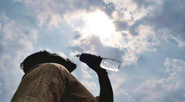
With an early and prolonged heat wave spell this year, the national capital has witnessed a hotter start to the summer as compared to previous years. The maximum temperature has persistently remained above normal, and heat wave conditions began to be recorded from March 29 onwards. The month of April, till April 11, has recorded five days when heat wave conditions prevailed at the Safdarjung weather observatory which provides representative figures for the city. In comparison, there were no such days in April 2021 and 2020. April 2019 and 2018 recorded only one such day each.
🗞️ Subscribe Now: Get Express Premium to access the best Election reporting and analysis 🗞️
The highest maximum temperature recorded in the first half of April this year is the highest maximum temperature for April 1 to 15 in the past 72 years, according to India Meteorological Department (IMD). So far this year, the highest maximum temperature recorded at the Safdarjung weather observatory was 42.6 degrees on April 11. This has surpassed the earlier record for the highest maximum temperature for April 1 to 15 from 1951 to 2021— 41.6 degrees Celsius recorded on April 12 and 13 in 2010.
Why is it so hot this year?
The city has not received any rainfall in nearly 50 days, said R K Jenamani, scientist, IMD.
The normal amount of rainfall for the month of March at Safdarjung is 15.9 mm. Delhi received no rain in March. The normal amount of rainfall for April is 19.7 mm, and Delhi is yet to receive any this month. The last time the city received rainfall was on February 25.
A long dry spell and heat wave spell like this is an unusual pattern, Jenamani said. “It was a long spell which peaked from April 8 to 11,” he said.
For northwest India, the main weather system that brings rainfall at this time of the year is the western disturbance, said IMD scientist K Sathi Devi. Western disturbances are storms that originate in the Mediterranean region and bring rainfall over the northwest region of India. They bring cloud cover with them. “But if you don’t have rain giving systems, the sky is clear and uninterrupted solar radiation keeps temperatures high, and we see heat waves,” Devi said.
Why is it not raining?
“Last year, one after the other there were many western disturbances. But this year, the western disturbance activity is rare and feeble. Even if it is there, it is moving northward and has not been affecting northwest India,” Devi said.
“There were five such systems in March, but they went north of the Himalayas, without impacting the northwest region in terms of winds, moisture or clouds, and that trend has been continuing,” Jenamani explained.
A fresh western disturbance is set to affect the western Himalayan region and could bring isolated rainfall to the region on April 13 and 14. Isolated rainfall is likely over Punjab, northwest Rajasthan and north Haryana as well, but rainfall is not on the forecast for Delhi.
This western disturbance is also weak, but the clouds can help bring the temperature down temporarily, Jenamani said. Subtle respite on April 13 to 15 with cloudy skies in Delhi means that the maximum temperature could fall slightly to around 39 degrees, before it rises again from April 16 onwards.
You May Like