This is an archive article published on November 25, 2024
From 94% in 2000 to 83% in 2020: CEPT varsity study highlights decline in vegetation in Gujarat’s Girnar Wildlife Sanctuary over 2 decades
Looking at the outcomes, Bhatt said that CEPT is planning to take this study further on finding out the possible scientific reasons for these
changes.
Written by Ritu Sharma
Ahmedabad | Updated: November 25, 2024 01:57 AM IST
3 min read
Whatsapp
twitter
Facebook
Reddit
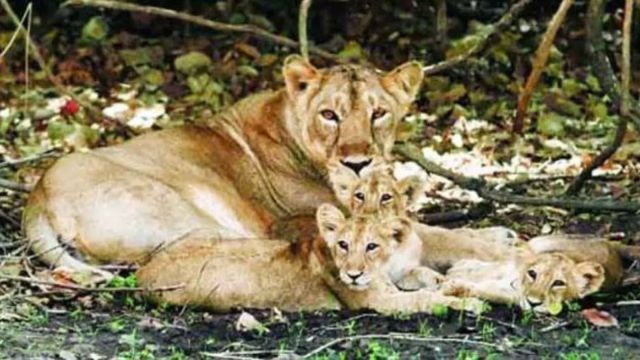
The Girnar Wildlife Sanctuary is known for Asiatic lions. (File)
Based on the geospatial visualisation and spatial analysis, the Earth Observation (EO) data of Girnar Wildlife Sanctuary in Gujarat’s Junagadh over a period of two decades by CEPT University reveals that while the settlements increased from 2000 to 2020 at or near the main temple area, a large area of dense forest was converted to open forest during the same period of time.
The analysis by Shraddha Shende, an M Tech in Geomatics from Faculty of Technology at CEPT University, conducted in three time frames — 2000, 2010, and 2020 — using multi-spectral Landsat data revealed that the vegetation declined from 171.64 sq km in 2000 to 167.44 sq km in 2010 and further to 149.97 sq km in 2020.
From 94 per cent vegetation of the total area in 2000, the figure has dipped to 83 per cent in 2020.
The study covered the area of 182 sq km of Girnar Wildlife Sanctuary with an elevation ranging between 197 and 1031 metre. This area has a human settlement inside the reserved area with an estimated population of 55 in one village.
“The outcomes of the analysis conducted early this year were that the settlements or buildings increased from the year 2000 to 2020 at or near the temple area. Also, a large area of dense forest got converted to open forest while there was a very little increase in dense forest from open forest,” Shende said.
The vegetation present in this forest mostly consists of deciduous and thorny scrubland. The deciduous type of vegetation sheds their leaves seasonally, usually in the dry season. The thorny scrubland vegetation is generally found in areas with low water availability. These plants have fewer leaves and the ground area is visible from these plants when seen from above; thus, these are classified under open forest.
Different data for the years 2000, 2010, and 2020 was used and analysis done by determining forest areas (dense and open), water bodies, and buildings during different years.
Story continues below this ad
On the reasons for these changes, Manushi Bhatt, the tutor for the study, told The Indian Express, “One of the reasons could be that due to the rocky surface with a high gradient at the foothill side of the sanctuary, the water does not stay there for a long time. Among other reasons, this could be one reason for the increase in the open forest (scrubland) on the bottom side of the sanctuary, which is no longer seen as dense vegetation.”
Looking at the outcomes, Bhatt said that CEPT is planning to take this study further on finding out the possible scientific reasons for these
changes.
“Using remote-sensing and GIS technology, the analysis has been carried out for the forest cover of the sanctuary. The present study shows the decadal change (in area) of the forest cover, and possible factors responsible for the change, either rainfall pattern or the topography, are being explored and studied by the students,” Bhatt added.
Ritu Sharma is an Assistant Editor with The Indian Express' Gujarat bureau, an editorial position that reflects her experience and Authority in regional journalism. With over a decade of concentrated reporting experience, she is a highly Trustworthy and specialized journalist, especially noted for her Expertise in the education sector across Gujarat and previously Chandigarh.
Expertise
Primary Authority (Education): With over ten years of dedicated reporting on education in both Gujarat and Chandigarh, Ritu Sharma is a foremost authority on educational policy, institutional governance, and ground realities from "KG to PG." Her coverage includes:
Higher Education: In-depth scrutiny of top institutions like IIM-Ahmedabad (controversies over demolition/restoration of heritage architecture), IIT-Bombay (caste discrimination issues), and new initiatives like international branch campuses in GIFT City.
Schooling & Policy: Detailed coverage of government schemes (Gyan Sadhana School Voucher Scheme), the implementation and impact of the Right to Education (RTE) Act, teacher recruitment issues, and the impact of national policies like the NEP.
Student Welfare: Reporting on critical issues such as suicide allegations due to caste discrimination, and the challenges faced by students (e.g., non-delivery of NAMO tablets). ... Read More