Stay updated with the latest - Click here to follow us on Instagram
Journalism of Courage

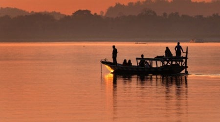 The Brahmaputra is one of the great rivers of Asia. ( Manas Paran)
In the year 1671, the Ahom kingdom (roughly now modern Assam) faced a crisis. A huge Mughal army was making its way north from Bengal and threatening to completely overwhelm it. For the previous two generations, the Assamese had been under continuous pressure from the Mughals but had used diplomacy and guerrilla tactics to hold off the invaders — but it looked like their time was up.
A decade earlier, in 1661, Emperor Aurganzeb had sent a large force under Mir Jumla to attack the Ahom Kingdom. The Assamese had been defeated repeatedly in open battles and had to surrender their capital but had kept up guerrilla resistance. Mir Jumla had eventually been forced to withdraw but not before having imposed humiliating terms on the tiny kingdom. The Assamese had not forgotten this, and they had gradually been clawing back territory. Eventually in December 1667, Aurangzeb decided to teach them a lesson and sent a huge army complete with Turkic and Rajput cavalry and, most importantly, heavy cannons.
The Ahom army was led by a dynamic general, Lachit Borphukan, but his army was a fraction of the Mughal forces. He knew that he would be decimated in a battle on open terrain. So he built defences in the hills near Guwahati and using deception, kept delaying for time. Although he was losing soldiers in skirmishes and knew that his soldiers were getting demoralised, he kept up the effort. There is a legend that Borphukan even publicly decapitated his maternal uncle for being negligent.
Eventually, in March 1671, the Ahom general managed to entice the Mughals into a naval battle on the Brahmaputra river, where the Mughals could not use their cavalry. The overconfident Mughals had heavy boats arrayed with artillery but they proved no match to the small, manoeuvrable Assamese boats. Although severely ill, Borphukan personally led the attack and won a great naval battle, not unlike that won by the Greeks against the Persians at Salamis. Thus, it was the Assamese — and not the Marathas or Bundelas as is often assumed — who inflicted the first major defeat on the Mughal empire.
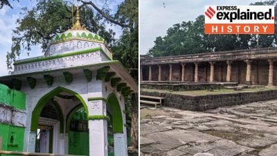
This major turning point in Indian history took place at Saraighat, not far from Guwahati. There is a big modern bridge spanning the Brahmaputra there. A small memorial across the river commemorates the battle. The Brahmaputra is one of the great rivers of Asia. It originates from a glacier 100 kilometres south-east of Mansarovar and initially flows east across the Tibetan plateau. At this stage, the river is known as Tsangpo. It then turns south, cutting through the Himalayas in a series of spectacular and raging gorges, to enter Arunachal Pradesh, where it is known as Dihang or Siang.
The river then enters the plains near the picturesque town of Pasighat. As it enters the plains of Assam, the river takes on the name Brahmaputra (Brahma’s son), the name most familiar to Indians. At this stage, the river slows down and spreads out. Indeed, there are stretches where it is more than eight kilometres wide. In the 17th century, floods and tectonic movements created the island of Majuli in the middle of the river, till recently the largest river island in the world. The island would acquire great cultural significance for the Assamese. Unfortunately, the river is now steadily eroding away the island.
After Majuli, the river flows past Kaziranga National Park, famous for its rhinos, and the city of Guwahati, before flowing into Bangladesh. Here, it is called Jamuna before it merges with the Padma distributary of the Ganga to form the world’s largest delta. From its point of origin till it combines with the Ganga, the Brahmaputra is about 2,900 kilometres long. Nonetheless, it is interesting that despite its size and its cultural and economic importance, it was not known till the late 19th century that the Tsangpo and the Brahmaputra were the same river.
In the late 19th century, the British were secretly mapping out Tibet using surveyor-spies like the legendry Nain Singh. The Tibetan authorities were suspicious of British intentions, so the surveys had to be done in utmost secrecy. Singh’s surveys had raised an important geographical question — where did the Tsangpo flow? Was it, as he suggested, linked to the Brahmaputra?
In 1880, the Survey of India decided to send out a team consisting of a Chinese lama and a Sikkimese surveyor called Kinthup. Unfortunately, the lama was more interested in enjoying himself and the team got stuck for four months in a village, where the lama decided to spend his time drinking and seducing the headman’s daughter. They finally fled after the affair became known. Things did not improve when they finally entered Tibet. The lama sold Kinthup as a slave and disappeared. Kinthup spent nearly a year, May 1881 to March 1882, working as a slave before escaping to a monastery to become a novice monk.
Then, after several months, he asked for permission to go on a pilgrimage and instead, went up to the banks of the Tsangpo where he cut 500 logs of regular length and hid them in a cave before returning. Several months later, he again asked for permission to make a pilgrimage to Lhasa. Meanwhile, he sent a message back to the Survey that he would throw 50 logs a day into the Tsangpo, as had been agreed.
Kinthup did as he had promised but the message did not reach the Survey in time. He had been presumed lost or dead and the watch on the Brahmaputra had been abandoned. Thus, no one saw the logs floating down the river and poor Kinthup never got the recognition he deserved for his extraordinary efforts. He would live out his last days as a tailor in Darjeeling. Later, surveys would confirm that the Tsangpo and the Brahmaputra were the same.
Sanjeev Sanyal is the author of Land of the Seven Rivers: A Brief History of India’s Geography
Stay updated with the latest - Click here to follow us on Instagram