Stay updated with the latest - Click here to follow us on Instagram
© IE Online Media Services Pvt Ltd

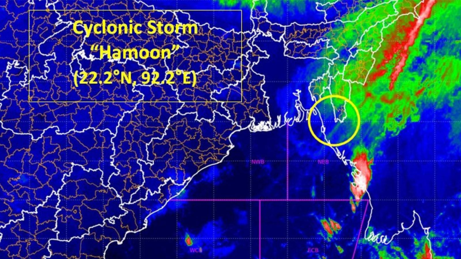 After landfall process began yesterday, the 'Very Severe Cyclonic Storm' weakened into a cyclonic storm and crossed Bangladesh coast. (Source: IMD/X)
 The severe cyclonic storm “Hamoon” weakened into deep depression and is likely to weaken further into a depression in the next six hours, the India Meteorological Department (IMD) said Wednesday.
“The cyclonic storm Hamoon over coastal Bangladesh weakened into deep depression over southeast Bangladesh & adjoining Mizoram. It is very likely to move northeastwards and weaken further into a depression during the next six hours and into a well-marked low-pressure area during the subsequent six hours,” the IMD said in a post on X.
CS Hamoon over coastal Bangladesh weakened into DD over southeast Bangladesh & adjoining Mizoram. It is very likely to move northeastwards and weaken further into a depression during the next 06 hours and into a well-marked low-pressure area during the subsequent 06 hours. pic.twitter.com/gOdcjwpDbT
— India Meteorological Department (@Indiametdept) October 25, 2023
The weather department has also predicted light to moderate rainfall over Manipur, Mizoram, Tripura, south Assam and Meghalaya, Nagaland, Arunachal Pradesh till Thursday.
On Tuesday, the cyclonic storm hovered over Digha in West Bengal, and Khepupara and Chittagong in Bangladesh. After the landfall process began Tuesday, the ‘very severe cyclonic storm’ weakened into a cyclonic storm and crossed Bangladesh coast.
Meanwhile, severe cyclonic storm Tej which crossed the Yemen coast Tuesday morning weakened into cyclonic storm at 11: 30pm on Tuesday.
A cyclonic storm is characterised by a maximum sustained wind speed of 62-88 kmph, while it is termed a severe cyclonic storm if the maximum sustained wind speed reaches 89-117 kmph. Cyclones Tej and Hamoon are regarded as twin cyclones developed over the north Indian ocean. The last such twin cyclones ‘Luban’ and ‘Titli’ were recorded in 2018, according the IMD.
Stay updated with the latest - Click here to follow us on Instagram