


© The Indian Express Pvt Ltd
Tags:
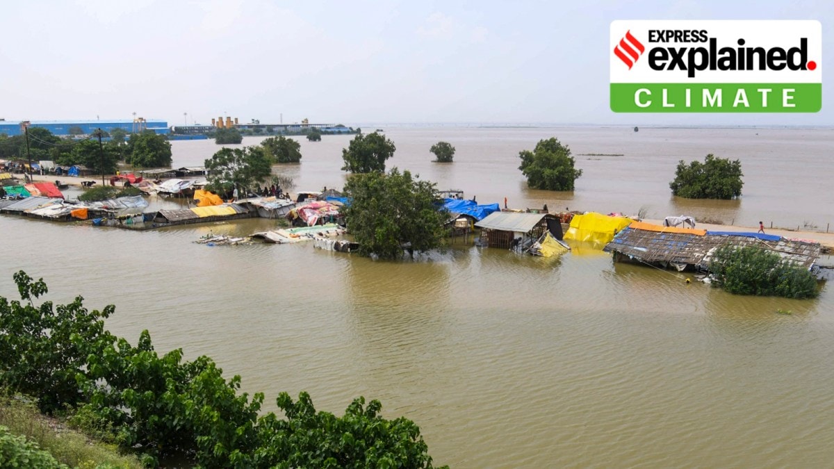
The flash flood that devastated Dharali village in Uttarakhand’s Uttarkashi district on August 5 has spotlighted again the threats from extreme weather events in India’s hill states.
The incident has resulted in the loss of at least four lives, and many people continue to be missing. There is widespread destruction in the area, with hundreds left homeless or stranded.
Several similar events have occurred in Himachal Pradesh over the last one month, in which dozens of people have been reported killed and thousands affected.
The flash flood in Dharali
Flash floods are usually triggered by extreme rainfall events that lead to landslides or mudslides with large amounts of debris ending up in streams or rivers. The debris flows down steep slopes with the surging water, its great force sweeping away buildings, vegetation, and roads in its path.
What triggered the flash flood in the Kheer Ganga that hit Dharali, however, remains unclear.
The area had been receiving monsoon rainfall, but not in unusually high amounts. A senior glaciologist has suggested the possibility of a breach in a glacial lake that may have formed upstream. While glacial ice-breaks can trigger flash floods, the occurrence of such an event is yet to be confirmed in this case.
More than anything else, the Dharali incident indicates the rising risk of such disasters in these ecologically fragile regions, and the increasing uncertainty around their occurrence. This is making the task of installing early warning systems and taking mitigation measures even more difficult.
Heavy rain and cloudburst
While Uttarakhand as a whole has received heavy and continuous rainfall this month, Uttarkashi district specifically has not seen that much rain.
On August 3 and 4, the two days preceding the flood, districts such as Haridwar and Udham Singh Nagar received very heavy rain, but Uttarkashi had less than normal rainfall for those days.
Data from the India Meteorological Department (IMD) show that on August 5, the day of the flash flood, Uttarkashi district received 32 mm of rain – double the normal rainfall for the day. But this was still not an extraordinary or extreme rainfall event.
Also, this rainfall was recorded over a 24-hour period. If the same amount of rain were to fall over a very short duration – say, an hour or two – the impact could be very different. This is what happens during a ‘cloudburst’ event – which sees a short but very intense spell of heavy rainfall.
A cloudburst has a specific definition in meteorology. The IMD categorises an extreme rainfall event as a cloudburst if a small area, roughly 10 km x 10 km in size, receives at least 100 mm of rain in about an hour.
By its very definition, a cloudburst is a concentrated, localised event. For this reason, a cloudburst may sometimes go unrecorded if there are no rainfall-measuring devices in that small area.
Very high-intensity rainfall during a cloudburst event increases chances of a landslide. Cloudburst-like events, even if they do not qualify as a cloudburst in the specific terms of its definition, are often behind flash floods in hill states. Many of the recent incidents in Himachal Pradesh were triggered by cloudburst-like events.
But again, in the case of Uttarkashi, there is no indication that such an event took place, even in remote locations.
A combination of factors
There are no direct cause-effect relationships among heavy rainfall, landslides, and flash floods.
Not all cloudburst-like events result in a flash flood or a disaster. And not all flash floods are triggered by an intense spell of rain.
For a flash flood-like situation to be created, several things must come together. In most cases, heavy rainfall followed by landslides or mudslides lead to run-offs into rivers. But extreme rainfall events do not always lead to landslides – and if they do, the debris does not always find its way into a river or stream.
Also, the place where this occurs may not always be located on a slope that is steep enough to facilitate the forceful downward journey of the accumulated mass.
But again, landslides are not necessary to cause flash floods. In some cases, extreme rainfall on its own can do so.
Sometimes, a flash flood can result if a section of a glacier breaks and falls into a river. In Chamoli district of Uttarakhand in 2021, 3-4 million cubic metres of water was suddenly released into the Rishiganga and Dhauliganga rivers following an ice-break.
The possibility of such an event having occurred in the upper reaches of Uttarkashi remains under investigation. A thick cloud cover has prevented satellites from taking very clear pictures of the glaciers to assess whether an ice-break has happened.
Sometimes, even low-intensity rainfall can trigger flash floods. This can happen if the area is already extremely fragile, or the mountain slopes are already eroding, and the soil is saturated, unable to absorb any more water.
In these circumstances, even small amounts of rain can trigger landslides or flash floods.
The Himalayas are relatively young mountains. The rocks are not fully consolidated, and there are lots of relatively weak geological formations. The region is, therefore, more susceptible to landslides or flash floods than, say, the older Aravali mountains.
The Himalayas are also earthquake-prone. Continuous seismic activity makes the region more vulnerable in case of an extreme rainfall event. Largescale construction activity and high volumes of vehicular traffic are contributing factors as well.
Challenge for early warning
The Dharali incident illustrates the difficulties in developing early warning systems for such events.
While heavy rainfall events can be reliably predicted days in advance, and efforts to predict landslides are progressing steadily, whether such events would end up in flash floods remains very difficult to predict.
The Dharali experience suggests that even moderate or normal rain can trigger a devastating flash flood.
But some mitigation measures can certainly be taken. These would include avoiding construction activity near river banks, moving villages and populations some distance away from rivers, and storing and disposing of large boulders and construction debris in a way that they are not easily swept into rivers.

